
Wilson County, Texas facts for kids
Quick facts for kids
Wilson County
|
|
|---|---|

The Wilson County Courthouse in Floresville. The courthouse was added to the National Register of Historic Places on May 5, 1978.
|
|

Location within the U.S. state of Texas
|
|
 Texas's location within the U.S. |
|
| Country | |
| State | |
| Founded | 1860 |
| Named for | James Charles Wilson |
| Seat | Floresville |
| Largest city | Floresville |
| Area | |
| • Total | 808 sq mi (2,090 km2) |
| • Land | 804 sq mi (2,080 km2) |
| • Water | 4.7 sq mi (12 km2) 0.6% |
| Population
(2020)
|
|
| • Total | 49,753 |
| • Density | 62/sq mi (24/km2) |
| Time zone | UTC−6 (Central) |
| • Summer (DST) | UTC−5 (CDT) |
| Congressional district | 15th |
Wilson County is a special area in the state of Texas, USA. It's called a county. In 2020, about 49,753 people lived here. The main town, or county seat, is Floresville.
The county is named after a person called James Charles Wilson. Wilson County is also part of a larger area around the cities of San Antonio and New Braunfels.
Contents
History of Wilson County
Early People and Explorers
Long ago, paleo-Indians lived in the Wilson County area. They were hunter-gatherers, meaning they hunted animals and gathered plants for food. Later, different Native American groups used the land for hunting. These groups included the Tonkawa, Karankawa, Tawakoni, Lipan Apache, and Comanche.
In the early 1700s, explorers from Spain traveled through this area. One explorer, Martín de Alarcón, passed through in 1718. Another, Pedro de Rivera y Villalón, explored the county in 1727. They were checking on Spain's lands in the New World.
Settlers Arrive and the County Forms
The first land grants in the area were given to Luis Menchaca and Andrés Hernández around 1832. They started ranches here. In the 1840s, people from other parts of the United States began to move in. Later, in the 1850s and 1860s, more settlers arrived. These included farmers from the Southern states and immigrants from German and Polish families.
Wilson County was officially created in 1860. It was formed from parts of Bexar County and Karnes County. The town of Sutherland Springs was chosen as the first county seat.
During the American Civil War, Wilson County supported the Southern states. Many local men joined the army. Life was hard during the war, and there was also a long drought.
After the Civil War, the county seat was moved to Floresville. The first courthouse there burned down. A new one was built in 1884, designed by a famous architect named Alfred Giles.
Fence Cutting Wars
From 1883 to 1888, there were conflicts in Texas called the "Fence Cutting Wars." This happened because farmers and ranchers needed land and water. Large ranches, like the 40,000-acre Houston and Dilworth ranch in Wilson County, started building fences. This made it hard for cowboys to move their cattle and find food.
Some cowboys began cutting fences. To stop this, Texas Governor John Ireland asked the state government to act. The government made fence-cutting a crime that could lead to prison time. They also made rules about building fences. After these new laws, the fence cutting mostly stopped.
Railroads Come to Wilson County
In 1886, the San Antonio and Aransas Pass Railway reached Floresville. This was a big deal because trains made it easier to transport goods and people. Later, in 1898, another railroad, the San Antonio and Gulf Railroad, was extended to Stockdale.
Geography
Wilson County covers a total area of about 808 square miles. Most of this area, 804 square miles, is land. The remaining 4.7 square miles is water, which is about 0.6% of the total area.
Main Roads
- U.S. Highway 87
- U.S. Highway 181
- State Highway 97


Neighboring Counties
Wilson County shares borders with these other counties:
- Guadalupe County (north)
- Gonzales County (northeast)
- Karnes County (southeast)
- Atascosa County (southwest)
- Bexar County (northwest)
Population and People
The number of people living in Wilson County has grown a lot over the years. In 1870, there were only 2,556 people. By 2020, the population had grown to 49,753.
| Historical population | |||
|---|---|---|---|
| Census | Pop. | %± | |
| 1870 | 2,556 | — | |
| 1880 | 7,118 | 178.5% | |
| 1890 | 10,655 | 49.7% | |
| 1900 | 13,961 | 31.0% | |
| 1910 | 17,066 | 22.2% | |
| 1920 | 17,289 | 1.3% | |
| 1930 | 17,606 | 1.8% | |
| 1940 | 17,066 | −3.1% | |
| 1950 | 14,672 | −14.0% | |
| 1960 | 13,267 | −9.6% | |
| 1970 | 13,041 | −1.7% | |
| 1980 | 16,756 | 28.5% | |
| 1990 | 22,650 | 35.2% | |
| 2000 | 32,408 | 43.1% | |
| 2010 | 42,918 | 32.4% | |
| 2020 | 49,753 | 15.9% | |
| U.S. Decennial Census> 1850–2010 2010 2020 |
|||
In 2000, there were 32,408 people living in the county. About 40% of the homes had children under 18. Most homes (66.5%) were married couples living together. The average age of people in the county was 36 years old.
Towns and Communities
Cities in Wilson County
- Elmendorf (partly in Bexar County)
- Floresville (the county seat)
- La Vernia
- Nixon (partly in Gonzales County)
- Stockdale
Towns in Wilson County
Small Communities (Unincorporated)
Former Towns (Ghost Towns)
Some towns that used to exist in Wilson County are now "ghost towns," meaning no one lives there anymore.
Education
Children in Wilson County attend schools in several different school districts:
- Falls City Independent School District
- Floresville Independent School District
- La Vernia Independent School District
- Nixon-Smiley Consolidated Independent School District
- Poth Independent School District
- Stockdale Independent School District
For older students, the entire county is served by the Alamo Community College District. This means students can go to community colleges in that district.
Famous People from Wilson County
- John Connally: He was a governor of Texas and also served as a secretary in the U.S. government.
- Merrill Connally: An actor and a judge in the county.
- Wayne Connally: He was a member of the Texas State Legislature.
- Frank Hamer: A famous Texas Ranger.
Images for kids
-
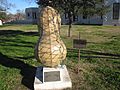
This "Peanut Marker" in Floresville honors Joe T. Sheehy. He started peanut farming in the area in 1916.
-
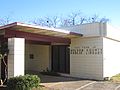
The Wilson County Public Library, a place for reading and learning.
-
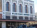
The Wilson County Hardware store in Floresville.


See also
 In Spanish: Condado de Wilson (Texas) para niños
