
Medina County, Texas facts for kids
Quick facts for kids
Medina County
|
|
|---|---|

The Medina County Courthouse in Hondo
|
|

Location within the U.S. state of Texas
|
|
 Texas's location within the U.S. |
|
| Country | |
| State | |
| Founded | 1848 |
| Named for | Medina River |
| Seat | Hondo |
| Largest city | Hondo |
| Area | |
| • Total | 1,335 sq mi (3,460 km2) |
| • Land | 1,325 sq mi (3,430 km2) |
| • Water | 9.2 sq mi (24 km2) 0.7% |
| Population
(2020)
|
|
| • Total | 50,748 |
| • Density | 38.013/sq mi (14.677/km2) |
| Time zone | UTC−6 (Central) |
| • Summer (DST) | UTC−5 (CDT) |
| Congressional district | 23rd |
Medina County is a place in the state of Texas, USA. It is called a county. In 2020, about 50,748 people lived there. The main town, or county seat, is Hondo.
The county gets its name from the Medina River. The northern part of the county is in the Edwards Plateau. This area is also known as the Texas Hill Country. The Medina Dam is a very important structure here. It was built in 1913 and was one of the biggest dams in the country back then. It helped create Medina Lake for watering farms. Medina County is also part of the larger San Antonio metropolitan area.
Contents
History of Medina County
The name "Medina" comes from the Medina River. A Spanish explorer named Alonso de Leon named the river in 1689. He named it after a Spanish mapmaker, Pedro de Medina. Pedro de Medina's family name came from an old city in Spain. That city's name came from an Arabic word meaning "city."
The state of Texas officially created Medina County on February 12, 1848. Later, on February 1, 1850, it became even bigger. Land was added from Bexar County.
The first county seat was Castroville. A courthouse was built there in 1854. But in 1892, the county seat moved to Hondo. A new courthouse was finished in Hondo in 1893.
Early Native American Tribes
Long ago, different Native American tribes lived in this area. These included the Lipan Apache, Coahuiltecan, and Tonkawa tribes.
Protecting the County from Raids
In the 1860s and 1870s, tribes like the Comanche and Kiowa often raided the county. For example, on June 11, 1873, Comanches attacked four settlers near Hondo. These raids made local people very afraid.
By 1875, the Comanche raids had mostly stopped. However, other tribes continued to raid the county. The very last Native American raid in the county happened on April 22, 1877. A 19-year-old named Joe Wilton was killed by Native Americans near Devine, Texas.
Geography of Medina County
Medina County covers a total area of about 1,335 square miles. Most of this area, about 1,325 square miles, is land. Only a small part, about 9.2 square miles, is water.
Main Roads in Medina County
Several important roads run through Medina County. These roads help people travel and connect different towns.
 Interstate 35
 U.S. Highway 90
 State Highway 16
 State Highway 132
 State Highway 173
Neighboring Counties
Medina County shares its borders with several other counties.
- Bandera County (to the north)
- Bexar County (to the east)
- Atascosa County (to the southeast)
- Frio County (to the south)
- Uvalde County (to the west)
Population Changes in Medina County
| Historical population | |||
|---|---|---|---|
| Census | Pop. | %± | |
| 1850 | 909 | — | |
| 1860 | 1,838 | 102.2% | |
| 1870 | 2,078 | 13.1% | |
| 1880 | 4,492 | 116.2% | |
| 1890 | 5,730 | 27.6% | |
| 1900 | 7,783 | 35.8% | |
| 1910 | 13,415 | 72.4% | |
| 1920 | 11,679 | −12.9% | |
| 1930 | 13,989 | 19.8% | |
| 1940 | 16,106 | 15.1% | |
| 1950 | 17,013 | 5.6% | |
| 1960 | 18,904 | 11.1% | |
| 1970 | 20,249 | 7.1% | |
| 1980 | 23,164 | 14.4% | |
| 1990 | 27,312 | 17.9% | |
| 2000 | 39,304 | 43.9% | |
| 2010 | 46,006 | 17.1% | |
| 2020 | 50,748 | 10.3% | |
| U.S. Decennial Census 1850–2010 2010 2020 |
|||
The population of Medina County has grown a lot over the years. In 1850, there were just over 900 people. By 2020, the population had grown to more than 50,000 people.
| Race / Ethnicity (NH = Non-Hispanic) | Pop 2000 | Pop 2010 | Pop 2020 | % 2000 | % 2010 | % 2020 |
|---|---|---|---|---|---|---|
| White alone (NH) | 19,919 | 21,408 | 22,324 | 50.68% | 46.53% | 43.99% |
| Black or African American alone (NH) | 801 | 913 | 1,252 | 2.04% | 1.98% | 2.47% |
| Native American or Alaska Native alone (NH) | 144 | 146 | 158 | 0.37% | 0.32% | 0.31% |
| Asian alone (NH) | 117 | 272 | 215 | 0.30% | 0.59% | 0.42% |
| Pacific Islander alone (NH) | 17 | 24 | 38 | 0.04% | 0.05% | 0.07% |
| Other race alone (NH) | 50 | 28 | 188 | 0.13% | 0.06% | 0.37% |
| Mixed race or Multiracial (NH) | 383 | 344 | 1,118 | 0.97% | 0.75% | 2.20% |
| Hispanic or Latino (any race) | 17,873 | 22,871 | 25,455 | 45.47% | 49.71% | 50.16% |
| Total | 39,304 | 46,006 | 50,748 | 100.00% | 100.00% | 100.00% |
In 2000, there were 39,304 people living in Medina County. About 45% of the people were Hispanic or Latino. The county had about 12,880 households. The average household had almost three people.
Communities in Medina County
Medina County has several towns and cities. It also has smaller communities.
Cities
- Castroville
- Devine
- Hondo (This is the county seat)
- LaCoste
- Lytle (Mostly in Atascosa County and a small part in Bexar County)
- Natalia
- San Antonio (Mostly in Bexar County and a small part in Comal County)
Census-Designated Places
These are areas that are like towns but are not officially incorporated as cities.
- D'Hanis
- Lake Medina Shores (Partly in Bandera County)
Unincorporated Communities
These are small communities that are not part of any city or census-designated place.
Ghost Towns
These are places where people used to live, but now they are mostly empty.
Education in Medina County
Students in Medina County go to schools in different school districts.
- D'Hanis Independent School District
- Devine Independent School District
- Hondo Independent School District
- Lytle Independent School District
- Medina Valley Independent School District
- Natalia Independent School District
- Northside Independent School District
- Utopia Independent School District
After high school, students can go to Southwest Texas Junior College.
Images for kids
-
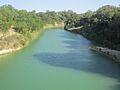
Hondo Creek is located south of Hondo.
-
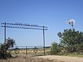
Entrance to Hondo Creek Ranch
-
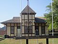
The Medina County Museum is located off U.S. Route 90 in Hondo.
-
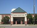
The Medina County Jail
-

Medina Electric Cooperative in Hondo
-
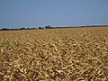
Scorched cornfield in Castroville
-
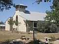
Medina Valley United Methodist Church in Castroville


See also
 In Spanish: Condado de Medina (Texas) para niños
