Greater San Antonio facts for kids
Quick facts for kids
Greater San Antonio
|
|
|---|---|
| San Antonio–New Braunfels, Texas Metropolitan Statistical Area |
|
 |
|
| Country | |
| State | |
| Principal cities | |
| Area | |
| • Urban | 597.1 sq mi (1,546 km2) |
| • MSA | 7,387 sq mi (19,130 km2) |
| Population
(2020)
|
|
| • Urban | 1,880,707 26th |
| • Urban density | 2,944.6/sq mi (1,136.9/km2) |
| • MSA | 2,558,143 (24th) |
| • MSA density | 302.42/sq mi (116.77/km2) |
| GDP | |
| • MSA | $163.1 billion (2022) |
| Time zone | UTC-6 (CST) |
| • Summer (DST) | UTC-5 (CDT) |
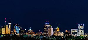
Greater San Antonio, also called San Antonio–New Braunfels, is a large area in Texas, USA. It includes eight different counties. This area is found where South Texas and Central Texas meet. It's also in the southwestern part of the Texas Triangle.
In 2020, over 2.5 million people lived here. This makes it the 24th largest metropolitan area in the United States. The cities of San Antonio and Austin are about 80 miles (129 km) apart. They are both along the Interstate 35 highway. Together, the San Antonio–Austin area has about 5 million people.
San Antonio–New Braunfels is the third biggest metro area in Texas. It is smaller than Dallas–Fort Worth–Arlington and Houston–The Woodlands–Sugar Land.
Contents
Counties in Greater San Antonio
Greater San Antonio is made up of eight counties. The main county in the middle is Bexar County.
| Census area | Estimated population as of 1 July 2022[update] | 2020 census | 2010 census | 2000 census | 1990 census |
|---|---|---|---|---|---|
| San Antonio–New Braunfels MSA | 2,665,342 | 2,558,143 | 2,142,508 | 1,711,703 | 1,407,745 |
| Atascosa | 50,864 | 48,981 | 44,911 | 38,628 | 30,533 |
| Bandera | 22,115 | 20,851 | 20,485 | 17,645 | 10,562 |
| Bexar | 2,059,530 | 2,009,324 | 1,714,773 | 1,392,931 | 1,185,394 |
| Comal | 184,642 | 161,501 | 108,472 | 78,021 | 51,832 |
| Guadalupe | 182,760 | 172,706 | 131,533 | 89,023 | 64,873 |
| Kendall | 48,973 | 44,279 | 33,410 | 23,743 | 14,589 |
| Medina | 53,723 | 50,748 | 46,006 | 39,204 | 27,312 |
| Wilson | 52,735 | 49,753 | 42,918 | 32,408 | 22,650 |
The entire area covers about 7,387 square miles. Most of this is land, with 47 square miles of water.
Cities and Towns in Greater San Antonio
Greater San Antonio has many communities. They are spread across different counties. The main city is San Antonio, which is the second largest city in Texas. It is also the seventh largest city in the USA. About 1.5 million people live in San Antonio.

[[File:St. Peter's Church, Alamo Heights, TX.jpg|thumb|right|Alamo Heights is a close-by suburb of San Antonio.
Cities with Over 1,000,000 People
- San Antonio (The main and central city) (1,532,233 people)
Cities with 100,000 to 1,000,000 People
- New Braunfels (Principal city) (104,707 people)
Cities with 25,000 to 100,000 People
- Cibolo (30,563 people)
- Converse (27,742 people)
- Schertz (41,057 people)
- Seguin (Principal city) (29,700 people)
- Timberwood Park (35,217 people)
Cities with 10,000 to 25,000 People
- Boerne
- Canyon Lake
- Leon Valley
- Live Oak
- Pleasanton
- Selma
- Universal City
- Uvalde
Cities with 5,000 to 10,000 People
Cities with 1,000 to 5,000 People
- Balcones Heights
- Castle Hills
- Castroville
- Charlotte
- China Grove
- Comfort
- Cross Mountain
- Devine
- Elmendorf
- Garden Ridge
- Hill Country Village
- Hollywood Park
- Jourdanton
- LaCoste
- La Vernia
- Lake Dunlap
- Lytle
- Marion
- McQueeney
- Natalia
- Nixon (partial)
- Olmos Park
- Poteet
- Poth
- Randolph AFB
- Redwood
- Sandy Oaks
- Scenic Oaks
- Shavano Park
- Somerset
- St. Hedwig
- Stockdale
- Von Ormy
- San Saba
Cities with Fewer than 1,000 People
Unincorporated Places
These are places that are not officially part of a city or town.
Population and People of Greater San Antonio
| Historical populations | |||
|---|---|---|---|
| Census | Pop. | %± | |
| 1910 | 119,676 | — | |
| 1920 | 202,096 | 68.9% | |
| 1930 | 292,533 | 44.7% | |
| 1940 | 338,176 | 15.6% | |
| 1950 | 500,460 | 48.0% | |
| 1960 | 687,151 | 37.3% | |
| 1970 | 864,014 | 25.7% | |
| 1980 | 1,071,954 | 24.1% | |
| 1990 | 1,302,099 | 21.5% | |
| 2000 | 1,592,383 | 22.3% | |
| 2010 | 2,142,508 | 34.5% | |
| 2020 | 2,558,143 | 19.4% | |
| 2023 (est.) | 2,703,999 | 26.2% | |
| U.S. Decennial Census 1790–1960 1900–1990 1990–2000 |
|||
Bexar County is a very populated county in the United States. It is the fourth most populated in Texas. Many people of Hispanic background live in Bexar County. There is also a growing African American population. In 2020, about 59.3% of the people in Bexar County were Hispanic. This makes it the most Hispanic-majority county in Texas.
In 2020, the entire San Antonio metropolitan area had over 2.5 million people. About half of the people were white (not Hispanic). About 6.5% were African American, and 2.7% were Asian. Over half of the population (54.3%) was Hispanic or Latino.
Economy and Jobs in San Antonio
The San Antonio–New Braunfels area is home to five very large companies. These are called Fortune 1000 companies. They include Valero Energy Corp, iHeartMedia, USAA, and NuStar Energy. These companies are all located in San Antonio. Another big company, Rush Enterprises, is in New Braunfels.
San Antonio is often called "Military City, USA." This is because many military bases are located here. It has one of the largest groups of military bases in the U.S. These bases include Lackland Air Force Base, Brooke Army Medical Center, Randolph Air Force Base, and Fort Sam Houston.
Culture and Fun in San Antonio
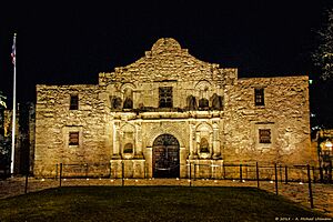
San Antonio is a very popular place for tourists to visit. It is known as the "Alamo City" because the famous Alamo is located downtown.
Other popular places to visit in San Antonio include:
- The River Walk, a beautiful path along the river.
- SeaWorld, a marine animal theme park.
- The San Antonio Zoo.
- The San Antonio Aquarium.
- Six Flags, a large amusement park.
New Braunfels has a very popular water park called Schlitterbahn. The town of Bandera, which is about 40 miles from San Antonio, hosts a "Cowboy Mardi Gras." This event brings over 15,000 people to the small town.
Sports Teams in San Antonio
San Antonio has a professional basketball team. It also has a major college football team.
| Club | Sport | League | Founded | Venue (capacity) | Attendance | Titles | Championship years |
|---|---|---|---|---|---|---|---|
 UTSA Roadrunners |
American football | NCAA Division I | 2011 | Alamodome (65,000) | 27,576 | 0 | |
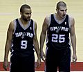 San Antonio Spurs |
Basketball | NBA | 1967 | AT&T Center (18,580) | 18,418 | 5 | |
 San Antonio Missions |
Baseball | Texas League | 1888 | Wolff Stadium (9,200) | 8,500 | 13 | |
 San Antonio FC |
Soccer | USL Championship | 2016 | Toyota Field (8,300) | 6,765 | 1 | 2022 |
| Crossmen Drum and Bugle Corps | Drum Corps | Drum Corps International | 1975 | Varies | 0 | ||
| San Antonio Soldados | Quidditch | Major League Quidditch | 2019 | Varies | 0 |
The city of San Antonio is home to the San Antonio Spurs. They are a professional basketball team in the NBA. The city's college football team is the UTSA Roadrunners. They play at the highest level of college football. San Antonio also has minor league teams like the San Antonio Missions (baseball) and San Antonio FC (soccer).
Education in San Antonio
The San Antonio area has many public schools and universities. The biggest university is the University of Texas at San Antonio (UTSA). Other public universities include the University of Texas Health Science Center at San Antonio and Texas A&M University–San Antonio. There are also five colleges that are part of the Alamo Community College District.
Many private universities are also in the city. These include Our Lady of the Lake University and St. Mary's University. Trinity University and the University of the Incarnate Word are in the Midtown area. The Culinary Institute of America has a campus downtown.
Outside of San Antonio, you can find Texas Lutheran University in Seguin. Howard Payne University at New Braunfels will soon have a campus in New Braunfels.
The San Antonio area has many public elementary and high schools. They are organized into different school districts:
| County | Independent School Districts (ISDs) |
|---|---|
| Atascosa | Charlotte, Jourdanton, Karnes City, Lytle, Pleasanton, Poteet, Somerset |
| Bandera | Bandera, Medina, Northside, Utopia |
| Bexar County/City of San Antonio | Alamo Heights, Boerne, Comal, East Central, Edgewood, Fort Sam Houston, Harlandale, Judson, Lackland, Medina Valley, North East, Northside, Randolph Field, San Antonio, Schertz-Cibolo-Universal City, South San Antonio, Southside, Southwest, Somerset |
| Comal | New Braunfels, Comal, Boerne |
| Guadalupe | Seguin, Navarro, Comal, New Braunfels, Schertz-Cibolo-Universal City, Marion, San Marcos Consolidated, Nixon-Smiley Consolidated, Prairie Lea, Luling, La Vernia |
| Kendall | Boerne, Comfort, Blanco, Comal |
| Medina | Devine, Hondo, Medina Valley, Natalia, Lytle |
| Wilson | Floresville, La Vernia, Stockdale, Nixon-Smiley Consolidated, Poth, East Central |
Transportation in San Antonio
The San Antonio International Airport (SAT) is in uptown San Antonio. It is about eight miles north of downtown. The airport has two terminals. It serves 21 airlines that fly to 44 different places. This includes six cities in Mexico and one in Canada.
VIA Metropolitan Transit is the public transportation system for the area. It serves all of San Antonio and many nearby towns in Bexar County.
The San Antonio Station is where you can catch an Amtrak train.
Major Highways
 Interstate 10 - Goes west to El Paso and east to Houston.
 Interstate 35 - Goes north to Austin and the Dallas/Fort Worth area. It goes south to Laredo.
 Interstate 37 - Goes south to Corpus Christi.
 Interstate 410 - This is a loop around San Antonio. It also goes through Castle Hills, Balcones Heights, and Leon Valley.
Other Important Roads
 U.S. Highway 87 - Goes south to Victoria and north to San Angelo.
 U.S. Highway 90 - Goes west to Uvalde.
 U.S. Highway 181 - Goes south to Beeville.
 U.S. Highway 281 - Goes north to Wichita Falls and south to McAllen.
 Loop 1604 - This is an outer loop around San Antonio.
See also
 In Spanish: Área metropolitana de San Antonio para niños
 | Stephanie Wilson |
 | Charles Bolden |
 | Ronald McNair |
 | Frederick D. Gregory |


