Kirby, Texas facts for kids
Quick facts for kids
Kirby, Texas
|
||
|---|---|---|
|
||
| Nickname(s):
Hobo Capital of Texas [1]
|
||

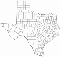
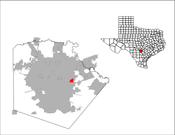
Location of Kirby, Texas
|
||
 |
||
| Country | ||
| State | ||
| County | Bexar | |
| Government | ||
| • Type | Council-Manager | |
| Area | ||
| • Total | 2.00 sq mi (5.18 km2) | |
| • Land | 2.00 sq mi (5.18 km2) | |
| • Water | 0.00 sq mi (0.00 km2) | |
| Elevation | 689 ft (210 m) | |
| Population
(2020)
|
||
| • Total | 8,142 | |
| • Density | 4,361.50/sq mi (1,683.85/km2) | |
| Time zone | UTC-6 (Central (CST)) | |
| • Summer (DST) | UTC-5 (CDT) | |
| ZIP code |
78219
|
|
| Area code(s) | 210, 726 (planned) | |
| FIPS code | 48-39448 | |
| GNIS feature ID | 1339154 | |
| Website | kirbytx.org | |
Kirby is a city in Bexar County, Texas, USA. In 2020, about 8,142 people lived there. It's like a small town completely surrounded by San Antonio. Kirby is also part of the larger San Antonio area. It started as a farming community near the Southern Pacific railroad. The city officially became a city in 1955. It is known as the "Hobo Capital of Texas."
Contents
Geography and Location
Kirby is located at 29.461032 degrees North and 98.388763 degrees West.
The city covers about 1.9 square miles (5.18 square kilometers) of land. Only a very small part, about 0.04 square miles (0.10 square kilometers), is covered by water.
People of Kirby
| Historical population | |||
|---|---|---|---|
| Census | Pop. | %± | |
| 1960 | 680 | — | |
| 1970 | 3,238 | 376.2% | |
| 1980 | 6,435 | 98.7% | |
| 1990 | 8,326 | 29.4% | |
| 2000 | 8,673 | 4.2% | |
| 2010 | 8,000 | −7.8% | |
| 2020 | 8,142 | 1.8% | |
| U.S. Decennial Census | |||
In 2020, there were 8,142 people living in Kirby. These people lived in 2,858 households, which are like homes or apartments. About 1,950 of these households were families.
The people living in Kirby come from many different backgrounds. Here's a look at the different groups that made up the population in 2020:
| Group | Number of People | Percentage |
|---|---|---|
| White (NH) | 1,889 | 23.2% |
| Black or African American (NH) | 1,095 | 13.45% |
| Native American or Alaska Native (NH) | 13 | 0.16% |
| Asian (NH) | 133 | 1.63% |
| Pacific Islander (NH) | 9 | 0.11% |
| Some other race (NH) | 22 | 0.27% |
| Mixed/multiracial (NH) | 221 | 2.71% |
| Hispanic or Latino | 4,760 | 58.46% |
| Total | 8,142 |
History of Kirby
Kirby was started in the early 1900s by German immigrants who were farmers. The city got its name from the Kirby yard of the Southern Pacific Railroad. This railroad line went right through the town. In 1920, only about 18 people lived there, mostly farmers. At that time, many people in Kirby spoke German.
In the 1950s, Kirby changed a lot. It went from being a farming town to a place where many military families lived. These families worked at Randolph AFB nearby. The population grew to 600 people, and fewer people spoke German. In 1955, Kirby officially became an incorporated city.
A long drought hit in 1957, which meant many farms failed. The farmers couldn't make money, so they sold their land to the city. New homes and roads were built on this land. This is how Kirby became the suburban area it is today.
The Hobo Festival
Because of the railroad and the many travelers who passed through, Kirby became known as the "Hobo Capital of Texas." City officials found out about this in 2007 and decided to start a "Hobo Festival."
The first festival was held in May 2008. It included a "hobo parade" and even crowned a hobo King and Queen. Over the years, famous musicians like Wade Hayes and Darrell McCall performed there. The festival happened every year until 2019. It was canceled because some residents didn't like the term "hobo." However, other residents want to bring the festival back. This has become an important topic for the city's leaders to discuss.
Education and Community
Students living in Kirby go to schools in the Judson Independent School District.
The schools they attend include:
- Hopkins Elementary School
- Kirby Middle School
- Karen Wagner High School
Parts of Kirby
Kirby has different areas, each with its own feel.
Northern Kirby
The northern part of Kirby includes the Kirby Manor and Old Town neighborhoods. This area has Kirby Middle School, Old Seguin Road, FM 78, Gibbs Sprawl Road, and the Southern Pacific railroad tracks.
Southern Kirby
The southern part of Kirby is home to Hopkins Elementary School. This school is named after a principal named Joseph Hopkins. This area has both older farming sections and newer homes. Ackerman Road is a main road here, leading to Interstate 10.
Community Services
Kirby is a suburban area of San Antonio. It has its own fire department and police department to keep residents safe. The City Hall, where city leaders work, is on Bauman Street. The Kirby Municipal Court is also located there. The Police Department and a new Fire Station are on Ackerman Road.
The city also has two parks on Binz Engleman Road, separated by Ackerman Road. The western part of the park has baseball fields. The eastern part has many other fun activities for everyone.
Natural Resources
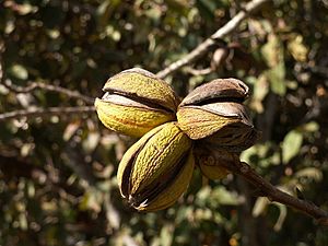
Kirby is known for its pecans, which are nuts that grow naturally in the soil. Pecans are usually ready to be picked between September and November. Sometimes, certain pecan trees don't produce nuts for a year, like in 1996, 2000, and 2004.
Rosillo Creek is the main stream in Kirby. In the past, it provided water for farmers to water their crops. The creek flows from under the railroad tracks on Gibbs Sprawl Road. Further downstream, it flows between Hopkins and Candlewood Elementary Schools before joining Salado Creek in southeastern Bexar County.
Neighborhoods
Kirby has several neighborhoods, including Kirby Manor, Old Town, Kirby Terrace, and Springfield Manor (also called the Astronaut Streets).
Kirby Manor
Kirby Manor is located between Old Seguin Road to the north, Ackerman Road to the east, and Binz Engleman Road to the south. The houses in this area were built in the 1950s and 1960s. People living here include original settlers and younger people moving in from other parts of San Antonio. This neighborhood is close to the police station on Ackerman Road, which helps keep crime rates low.
Old Town
Old Town is found between Old Seguin Road and FM 78. Its borders are Gibbs Sprawl Road to the east and Kirby Middle School to the west. This is where the first homes in Kirby were built. The Kirby City Hall, the old Kirby Post Office, and the old Kirby Fire Department were also located here. More young people are moving into this area, but there are still many older residents.
Springfield Manor
Springfield Manor is the westernmost part of Kirby. It's also known as the Astronaut Streets because its streets are named after famous astronauts. This is the newest and largest neighborhood in Kirby. It is bordered by FM 78 to the north, Swann Lane and Gordon Cooper Drive to the south, Springfield Road to the west, and Ackerman Road to the east.
Kirby Terrace
Kirby Terrace is a neighborhood located across from Hopkins Elementary School. It is bordered on one side by Ackerman Road.
See also
 In Spanish: Kirby (Texas) para niños
 | Mary Eliza Mahoney |
 | Susie King Taylor |
 | Ida Gray |
 | Eliza Ann Grier |


