El Tejar, Chimaltenango facts for kids
Quick facts for kids
El Tejar
|
|
|---|---|
|
Municipality and town
|
|
 |
|
| Country | |
| Department | |
| Area | |
| • Total | 5.2 sq mi (13.5 km2) |
| Population
(2018 census)
|
|
| • Total | 19,492 |
| • Density | 3,740/sq mi (1,444/km2) |
| Time zone | UTC+6 (Central Time) |
| Climate | Cwb |
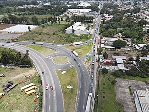
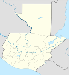
El Tejar is a small town and a municipality (like a local government area) in Guatemala. It's located in the Chimaltenango area. In 2018, about 15,639 people lived there.
What El Tejar is Known For
El Tejar got its name from something very special: tejas! These are traditional roof tiles made from clay. The town is famous all over Guatemala for making really good quality roof tiles, bricks, and other pottery items. This means making these clay products is a big part of the town's economy.
Climate in El Tejar
El Tejar has a special kind of weather called a subtropical highland climate. This means it's usually mild, not too hot and not too cold, because it's located high up in the mountains. It often has cool temperatures and a good amount of rain.
| Climate data for El Tejar | |||||||||||||
|---|---|---|---|---|---|---|---|---|---|---|---|---|---|
| Month | Jan | Feb | Mar | Apr | May | Jun | Jul | Aug | Sep | Oct | Nov | Dec | Year |
| Mean daily maximum °C (°F) | 22.2 (72.0) |
23.2 (73.8) |
24.9 (76.8) |
25.3 (77.5) |
25.1 (77.2) |
23.4 (74.1) |
23.6 (74.5) |
23.9 (75.0) |
23.3 (73.9) |
22.4 (72.3) |
22.5 (72.5) |
22.3 (72.1) |
23.5 (74.3) |
| Daily mean °C (°F) | 15.8 (60.4) |
16.5 (61.7) |
17.8 (64.0) |
19.0 (66.2) |
19.2 (66.6) |
18.7 (65.7) |
18.6 (65.5) |
18.5 (65.3) |
18.4 (65.1) |
17.5 (63.5) |
16.9 (62.4) |
15.9 (60.6) |
17.7 (63.9) |
| Mean daily minimum °C (°F) | 9.4 (48.9) |
9.8 (49.6) |
10.7 (51.3) |
12.7 (54.9) |
13.4 (56.1) |
14.1 (57.4) |
13.6 (56.5) |
13.2 (55.8) |
13.5 (56.3) |
12.6 (54.7) |
11.3 (52.3) |
9.6 (49.3) |
12.0 (53.6) |
| Average precipitation mm (inches) | 3 (0.1) |
3 (0.1) |
3 (0.1) |
37 (1.5) |
106 (4.2) |
251 (9.9) |
184 (7.2) |
174 (6.9) |
236 (9.3) |
127 (5.0) |
31 (1.2) |
7 (0.3) |
1,162 (45.8) |
| Source: Climate-Data.org | |||||||||||||
See also
 In Spanish: El Tejar (Guatemala) para niños
 | DeHart Hubbard |
 | Wilma Rudolph |
 | Jesse Owens |
 | Jackie Joyner-Kersee |
 | Major Taylor |


