
Empalme Olmos facts for kids
Quick facts for kids
Empalme Olmos
|
|
|---|---|
|
Village
|
|

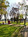
Train station at Empalme Olmos
|
|

Empalme Olmos
Location in Uruguay
|
|
| Country | |
| Department | Canelones Department |
| Population
(2011)
|
|
| • Total | 4,199 |
| Time zone | UTC -3 |
| Postal code |
91002
|
| Dial plan | +598 2 (+7 digits) |
Empalme Olmos is a small village located in the southern part of Uruguay. It's found in the Canelones Department. The name "Empalme Olmos" also refers to the larger area, called a municipality, that the village is part of.
Contents
Where is Empalme Olmos?
This village is easy to find on a map. It sits where three important roads meet. These roads are Route 8, Route 82, and Route 34. Empalme Olmos is about 6 kilometers (about 3.7 miles) northeast of a city called Pando.
A Look at History
Empalme Olmos officially became a "Pueblo," which means a village, on November 3, 1952. This change happened because of a special law, Ley Nº 11.877.
How Many People Live Here?
In 2011, about 4,199 people lived in Empalme Olmos. A few years earlier, in 2010, the local government of Canelones counted even more people. They recorded 5,497 residents for the whole municipality during an election.

The table below shows how the population of Empalme Olmos has grown over the years:
| Year | Population |
|---|---|
| 1963 | 1,973 |
| 1975 | 2,108 |
| 1985 | 3,144 |
| 1996 | 3,815 |
| 2004 | 3,978 |
| 2011 | 4,199 |
This information comes from the National Institute of Statistics of Uruguay.
Places to Worship
- St. Rose of Lima Parish Church (Roman Catholic)
Images for kids
-
Plaza 30 de noviembre near the train station at Empalme Olmos.

See also
 In Spanish: Empalme Olmos para niños
