Pando, Uruguay facts for kids
Quick facts for kids
Pando
|
|
|---|---|
|
City & Municipality
|
|

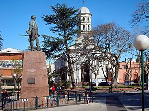
The central square of Pando with the Church of the Immaculate Conception in the background
|
|
| Country | |
| Department | |
| Founded | 1788 |
| Population
(2011 Census)
|
|
| • Total | 25,947 |
| Time zone | UTC -3 |
| Postal code |
91000
|
| Dial plan | +598 2 (+7 digits) |
Pando is a city located in the Canelones Department of Uruguay. It's a busy place known for its shops and factories. Pando has grown to become part of the larger Montevideo metropolitan area.
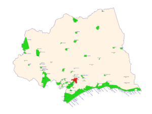
The name Pando also refers to the wider area around the city. This area includes smaller towns and countryside. It stretches from the Ciudad de la Costa in the south to Route 7 in the northwest.
Contents
Geography of Pando
The city of Pando is found along Route 8. It is about 29 kilometers (18 miles) northeast of Montevideo, Uruguay's capital city. The Arroyo Pando stream flows along the eastern edge of the city.
Pando's Climate
Pando has a climate with hot and humid summers. The winters are usually mild to cool. This type of weather is called a humid subtropical climate. On climate maps, it's often shown as "Cfa".
| Climate data for Pando, Uruguay | |||||||||||||
|---|---|---|---|---|---|---|---|---|---|---|---|---|---|
| Month | Jan | Feb | Mar | Apr | May | Jun | Jul | Aug | Sep | Oct | Nov | Dec | Year |
| Mean daily maximum °C (°F) | 28 (83) |
28 (82) |
26 (78) |
22 (71) |
18 (64) |
15 (59) |
14 (58) |
15 (59) |
17 (63) |
20 (68) |
23 (74) |
26 (79) |
21 (70) |
| Mean daily minimum °C (°F) | 17 (62) |
16 (61) |
15 (59) |
12 (53) |
9 (48) |
6 (43) |
6 (43) |
6 (43) |
8 (46) |
9 (49) |
12 (54) |
15 (59) |
11 (52) |
| Average precipitation mm (inches) | 74 (2.9) |
66 (2.6) |
99 (3.9) |
99 (3.9) |
84 (3.3) |
81 (3.2) |
74 (2.9) |
79 (3.1) |
76 (3) |
66 (2.6) |
74 (2.9) |
79 (3.1) |
950 (37.4) |
| Source: Weatherbase | |||||||||||||
History of Pando
Pando was officially founded on May 13, 1788. It got its name from one of the first people who settled there in 1730. The area was once home to the Guardia del Pando. This was a group that helped protect the region from Portuguese advances. Pando was already considered a "Pueblo" (village) before Uruguay became an independent country.
On March 11, 1863, Pando was given the status of "Villa" (town) by law (Ley Nº 759). Later, on August 5, 1920, its status was raised to "Ciudad" (city) by another law (Ley Nº 7.252). At that time, Pando was an important center for industries. It also had a track for airplanes, which became an airport in 1928. This airport was later moved to Carrasco in 1948. The Military Aeronautic School then took its place.
In 1969, a group called the Tupamaros was involved in an event known as the Taking of Pando (Spanish: Toma de Pando). During this time, they briefly took control of the city.
Places to Worship
- Parish Church of the Immaculate Conception (Roman Catholic)
Pando's Population
According to the 2011 census, Pando had a population of 25,947 people. In 2010, the Intendencia de Canelones (the local government of Canelones) estimated that the wider municipality had about 31,713 residents during elections.
| Year | Population |
|---|---|
| 1908 | 7,927 |
| 1963 | 12,876 |
| 1975 | 16,406 |
| 1985 | 19,795 |
| 1996 | 23,384 |
| 2004 | 24,004 |
| 2011 | 25,947 |
Source: Instituto Nacional de Estadística de Uruguay
See also
 In Spanish: Pando (Uruguay) para niños
 | Precious Adams |
 | Lauren Anderson |
 | Janet Collins |


