Englevale, North Dakota facts for kids
Quick facts for kids
Englevale, North Dakota
|
|
|---|---|

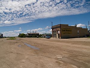
Buildings in Englevale
|
|
| Country | United States |
| State | North Dakota |
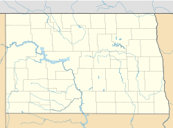
| County | Ransom |
| Area | |
| • Total | 1.49 sq mi (3.85 km2) |
| • Land | 1.49 sq mi (3.85 km2) |
| • Water | 0.00 sq mi (0.00 km2) |
| Elevation | 1,342 ft (409 m) |
| Population
(2020)
|
|
| • Total | 36 |
| • Density | 24.23/sq mi (9.35/km2) |
| Time zone | UTC-6 (Central (CST)) |
| • Summer (DST) | UTC-5 (CDT) |
| Area code(s) | 701 |
| GNIS feature ID | 2584342 |
Englevale is a small community in Ransom County, North Dakota, United States. It is known as a census-designated place (CDP) and an unincorporated community. This means it's an area that the government counts for population, but it doesn't have its own local city government.
History of Englevale's Name
The community was first called Marshall. It was named after Marshall T. Davis, who owned land there. Later, its name was changed to Englevale. This new name honored Mathias L. Engel, who helped promote and develop the community.
Englevale's Population
Englevale is a very small community. In the 2010 census, its population was 40 people. By the 2020 census, the population was 36 people. This information helps us understand how many people live in the area.
| Historical population | |||
|---|---|---|---|
| Census | Pop. | %± | |
| 2020 | 36 | — | |
| U.S. Decennial Census | |||
See also
 In Spanish: Englevale (Dakota del Norte) para niños
 | William L. Dawson |
 | W. E. B. Du Bois |
 | Harry Belafonte |


