Entraigues-sur-la-Sorgue facts for kids
Quick facts for kids
Entraigues-sur-la-Sorgue
|
||
|---|---|---|

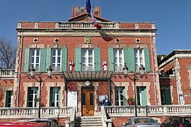
Town hall
|
||
|
||
| Country | France | |
| Region | Provence-Alpes-Côte d'Azur | |
| Department | Vaucluse | |
| Arrondissement | Avignon | |
| Canton | Monteux | |
| Intercommunality | CA Grand Avignon | |
| Area
1
|
16.57 km2 (6.40 sq mi) | |
| Population
(2006)
|
7,550 | |
| • Density | 455.6/km2 (1,180.1/sq mi) | |
| Time zone | UTC+01:00 (CET) | |
| • Summer (DST) | UTC+02:00 (CEST) | |
| INSEE/Postal code |
84043 /84320
|
|
| Elevation | 20–42 m (66–138 ft) (avg. 29 m or 95 ft) |
|
| 1 French Land Register data, which excludes lakes, ponds, glaciers > 1 km2 (0.386 sq mi or 247 acres) and river estuaries. | ||
Entraigues-sur-la-Sorgue is a charming commune in the south of France. A commune is like a local town or village area with its own government. In 2006, about 7,550 people lived there.
This commune is located in the Provence-Alpes-Côte d'Azur region. It is part of the Vaucluse department. The town is known for its connection to the Sorgue river, which is why "sur-la-Sorgue" is part of its name.
Contents
About Entraigues-sur-la-Sorgue
Entraigues-sur-la-Sorgue is a small but active community. It is situated in a beautiful part of France. The area is known for its sunny weather and lovely landscapes.
Where is Entraigues-sur-la-Sorgue?
The commune is found in the Avignon arrondissement. An arrondissement is a type of administrative division in France. It is also part of the Monteux canton. A canton is another way to divide up areas for local government.
The town's exact location can be described using coordinates. These are like an address on a map. The coordinates for Entraigues-sur-la-Sorgue are 44.0036 degrees north and 04.9272 degrees east.
How Big is the Town?
Entraigues-sur-la-Sorgue covers an area of 16.57 square kilometers. This is about 6.4 square miles. The town's elevation, or how high it is above sea level, varies. The lowest point is 20 meters (66 feet). The highest point is 42 meters (138 feet). The average elevation is 29 meters (95 feet).
Local Government and Services
Like all communes in France, Entraigues-sur-la-Sorgue has its own local government. This government helps manage the town's services. These services include things like roads, schools, and local events.
The mayor of Entraigues-sur-la-Sorgue is Guy Moureau. He was elected to serve from 2008 to 2014. The mayor is the head of the local government. He works to make decisions for the community.
The commune is also part of a larger group called the Communauté d'agglomération du Grand Avignon. This group helps different towns work together. They share resources and plan for the future of the whole area.
Life in Entraigues-sur-la-Sorgue
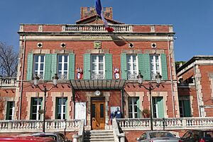
Life in Entraigues-sur-la-Sorgue offers a mix of quiet living and community spirit. The town hall, shown in the image, is an important building. It is where many local government activities take place.
The postal code for Entraigues-sur-la-Sorgue is 84320. This code helps mail get to the right place. The INSEE code is 84043. This is a special number used by the French government for statistics.
See also
 In Spanish: Entraigues-sur-la-Sorgue para niños
 | Calvin Brent |
 | Walter T. Bailey |
 | Martha Cassell Thompson |
 | Alberta Jeannette Cassell |


