Esgueva facts for kids
Quick facts for kids Esgueva |
|
|---|---|

Watershed of the Esgueva in Valladolid
|
|

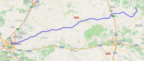
Course of the Esgueva.
|
|
| Country | Spain |
| Physical characteristics | |
| Main source | Peña Cervera Espinosa de Cervera, Sierra de la Demanda, Burgos Province, Castile and León, Spain 1,021 m (3,350 ft) |
| River mouth | Pisuerga Valladolid, Campiña del Pisuerga, Valladolid Province, Castile and León, Spain 692 m (2,270 ft) |
| Length | 116 km (72 mi) |
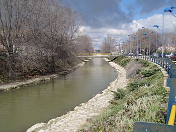
The Esgueva is a river in Spain. It flows through the Iberian Peninsula. This river starts in the Burgos Province and ends in the Valladolid Province. It is an important part of the local water system.
Contents
About the Esgueva River
The Esgueva River is one of the many rivers in Spain. It is known for its journey through different landscapes. The river helps to water the land around it. It also supports various plants and animals.
Where Does the Esgueva River Start?
The Esgueva River begins its journey high up in the mountains. Its source is near a place called Peña Cervera. This area is in the Burgos Province of Spain. The exact spot is in Espinosa de Cervera, which is part of the Sierra de la Demanda mountain range. The river starts at an elevation of about 1,021 meters (3,350 feet) above sea level.
How Long is the Esgueva River?
From its source to where it joins another river, the Esgueva River travels a long way. It is about 116 kilometers (72 miles) long. This makes it a medium-sized river in Spain. Along its path, it passes through different towns and villages.
Where Does the Esgueva River End?
The Esgueva River does not flow directly into the sea. Instead, it is a tributary of another, larger river. A tributary is a smaller river or stream that flows into a bigger one. The Esgueva flows into the Pisuerga River. This meeting point is in the city of Valladolid. The river joins the Pisuerga at an elevation of about 692 meters (2,270 feet).
The Esgueva River's Journey
As the Esgueva River flows, it goes through different areas. It starts in the mountains and then moves into flatter lands. The river helps to shape the land around it. It also provides water for farming and for the people living nearby. Over time, parts of the river have been changed by people. This includes building canals or moving sections of the river.
See also
 In Spanish: Río Esgueva para niños
 | Sharif Bey |
 | Hale Woodruff |
 | Richmond Barthé |
 | Purvis Young |

