Esmeraldo de Situ Orbis facts for kids
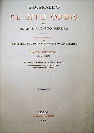
Esmeraldo de Situ Orbis is a very old and important book about geography and exploring the Atlantic Ocean. It was written by a Portuguese geographer and sailor named Duarte Pacheco Pereira.
This book was dedicated to King Manuel I of Portugal, who ruled from 1495 to 1521. It was divided into five parts with 59 chapters and about 200 pages. Written around 1506, the author himself said it was about "cosmography and seafaring." Cosmography means the study of the universe and Earth's features. Seafaring is about sailing and navigating the seas.
The book's unusual title, Esmeraldo de Situ Orbis, seems to be a mix of Portuguese and Latin words. It was written in Portuguese and included the exact geographical locations (coordinates) for all known ports at that time. The manuscript was likely finished by 1508.
Contents
What is Esmeraldo de Situ Orbis About?
Esmeraldo de Situ Orbis describes itself as a "book of cosmography and navigation". It explains that besides Europe, Africa, and Asia, there was a "fourth part" of the world: America. According to the book, America included both North and South America.
When Duarte Pacheco Pereira wrote Esmeraldo, he knew about other important books. These included De sphaera mundi by Johannes de Sacrobosco and Natural History by Pliny. These older books helped him understand the world and write his own work.
How the Book is Organized
The book is divided into four main parts, all put together in one volume:
- Prologue (an introduction)
- First Book: This part talks about the discoveries made during the time of Henry the Navigator. It has 33 chapters.
- Second Book: This section covers discoveries from the reign of Afonso V of Portugal. It has 11 chapters.
- Third Book: This part describes discoveries made when John I of Portugal was king. It has 9 chapters.
- Fourth Book: This section focuses on discoveries during the rule of Manuel I of Portugal. It has 6 chapters.
Duarte Pacheco Pereira mentioned some maps in his book, but these maps have unfortunately disappeared over time. It's also not clear if the Esmeraldo was ever fully finished. The book mentions a fifth part, but only a small part of the fourth book seems complete in the copies we have today.
Why the Book Was a Secret
A Portuguese historian named Jorge Couto, from the University of Lisbon, studied Esmeraldo de Situ Orbis. He found that the book was lost for about 400 years. This was because its information was considered very secret.
The title "Esmeraldo" is thought to be a clever mix of letters from the names of King Manuel (Emmanuel in Latin) and Duarte (Eduardus in Latin). De Situ Orbis means "on the Geography of the Globe (the Earth)". This part of the title came from an old book by Pomponius Mela, a Roman geographer who inspired Duarte Pacheco Pereira.
King Manuel I thought the sailing, geography, and economic information in the book were so valuable that he never let anyone outside the royal court see it. The book gave detailed accounts of voyages to Brazil and the coast of Africa. These areas were very important for Portugal's profitable trade in the 1400s.
The Discovery of Brazil
The book also gives important information about the Discovery of Brazil. In the second chapter of the first part, it says:
"As in the third year of your reign in the year of Our Lord one thousand four hundred and ninety-eight, whence your Highness sent to discover the western part, passing beyond the greatness of the Ocean sea, where such a great land is found and navigated, with many large islands adjacent to it and is heavily populated. Its grandeur expands so much and runs with great length, that one art or the other has not been seen, nor its end and end known. It is found in it very fine Brazil with many other things that ships in these Kingdoms are heavily populated."
This is the first Portuguese document that mentions the coast of Brazil. It also talks about how much brazilwood (a valuable tree used for dye) was found there at the time.
In the South Atlantic, the book lists several islands with their locations:
- A ilha de Sam Lourenço (which is Fernando de Noronha)
- A ilha d'Acensam (which is Trindade Island)
- A ilha de S. Crara (which is Santana Island, near Macaé)
- O Cabo Frio (a cape in Brazil)
However, the book does not mention other important islands in the South Atlantic, like Saint Helena and what is now called Ascension Island.
A Hidden Manuscript
The Esmeraldo de Situ Orbis manuscript was so rare and secret that in 1573, a copy was secretly sent to Philip II of Spain. This was done by an Italian spy named Giovanni Gesio, who worked for the Spanish ambassador in Lisbon. For his mission, Gesio was given a copy of the book as payment. This copy is now kept in the library of El Escorial Monastery in Spain.
Even though Esmeraldo de Situ Orbis was written between 1505 and 1508, it was not published until the 1800s. Several versions have been printed in Portuguese, French, and English. These versions are based on two copies from the 1700s: one at the Biblioteca Nacional de Portugal and another at the Public Library of Évora. The original manuscript has never been found.
Experts like Joaquim Barradas de Carvalho believe that Esmeraldo de Situ Orbis was more than just a travel book. It was a detailed collection of all the knowledge gained from Portuguese sea voyages in the late 1400s and early 1500s.
See also
 In Spanish: Esmeraldo de situ orbis para niños
 | Claudette Colvin |
 | Myrlie Evers-Williams |
 | Alberta Odell Jones |


