
Esperance (village), New York facts for kids
Quick facts for kids
Esperance, New York
|
|
|---|---|
|
Village
|
|
.jpg)
The corner of Main Street and Charleston Street in the village of Esperance, New York.
|
|

Esperance (village), New York
Location in New York
|
|
| Country | United States |
| State | New York |
| County | Schoharie |
| Area | |
| • Total | 0.52 sq mi (1.35 km2) |
| • Land | 0.49 sq mi (1.27 km2) |
| • Water | 0.03 sq mi (0.08 km2) |
| Elevation | 581 ft (177 m) |
| Population
(2020)
|
|
| • Total | 346 |
| • Density | 707.57/sq mi (273.00/km2) |
| Time zone | UTC-5 (Eastern (EST)) |
| • Summer (DST) | UTC-4 (EDT) |
| FIPS code | 36-24713 |
| GNIS feature ID | 0949711 |
Esperance is a small village located in Schoharie County, New York, in the United States. In 2010, about 345 people lived there. The village got its name from a French word that means "hope."
The Village of Esperance is found in the eastern part of the larger Town of Esperance. It is located west of the city of Schenectady.
Contents
History of Esperance
The area where Esperance is now was first settled around 1793. This happened because of a land grant, which is like a special permission to own land, given in 1769. It was called the Ten Eyck Patent.
The village officially became a village in 1818. This means it got its own local government. At that time, a fire department was also created to help keep people safe. Esperance is the oldest village in Schoharie County to be officially recognized. Later, in 1846, the larger area around it, called the Town of Esperance, was formed and named after the village.
Geography and Location
Esperance is located at coordinates 42°45′44″N 74°15′33″W.
The United States Census Bureau says the village covers a total area of about 0.5 square miles (1.3 square kilometers). Most of this area is land, and a small part, about 0.04 square miles (0.1 square kilometers), is water.
The village is right next to the Schoharie Creek, which is a waterway. It is also located on U.S. Route 20, which is an important road. Other local roads, County Roads 28 and 44, also meet there.
Population Over Time
| Historical population | |||
|---|---|---|---|
| Census | Pop. | %± | |
| 1880 | 341 | — | |
| 1890 | 274 | −19.6% | |
| 1900 | 290 | 5.8% | |
| 1910 | 263 | −9.3% | |
| 1920 | 219 | −16.7% | |
| 1930 | 233 | 6.4% | |
| 1940 | 219 | −6.0% | |
| 1950 | 322 | 47.0% | |
| 1960 | 314 | −2.5% | |
| 1970 | 408 | 29.9% | |
| 1980 | 374 | −8.3% | |
| 1990 | 324 | −13.4% | |
| 2000 | 380 | 17.3% | |
| 2010 | 345 | −9.2% | |
| 2020 | 346 | 0.3% | |
| U.S. Decennial Census | |||
In 2000, there were 380 people living in Esperance. These people lived in 149 households, and 106 of these were families. The village had about 757 people per square mile.
About 35% of the households had children under 18 living with them. Most households (56%) were married couples. The average household had about 2.55 people.
The population included people of different ages. About 24.5% were under 18 years old, and 13.2% were 65 years or older. The average age in the village was 40 years.
Fun Places to Visit
- The George Landis Arboretum is a cool place to visit. It's located just north of the village. An arboretum is like a botanical garden, but it focuses on trees and shrubs.
See also
 In Spanish: Esperance (villa) para niños
Images for kids
-
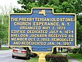
Presbyterian Church Historical Marker

