Eye Water facts for kids
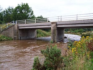
The Eye Water is a river in the Scottish Borders area of Scotland. It starts in the Lammermuir Hills and flows southeast. After about 35 kilometers (22 miles), it reaches the sea at Eyemouth. This is where the river meets the ocean, forming an estuary.
The Journey of the Eye Water
The Eye Water begins high up on the eastern side of Wester Dod, about 375 meters (1,230 feet) above sea level. It flows southeast for 10 kilometers (6 miles). Then, it turns northeast for 3 kilometers (2 miles) until it reaches the village of Grantshouse.
The river flows along the southern edge of Grantshouse. It then turns southeast again. It runs through a valley between Horseley Hill and Dalks Law. The river flows next to the A1 road and the East Coast Main Line railway.
The Eye Water stays on the southwest side of the A1 road. It passes through the villages of Reston and Ayton. In Ayton, it flows through a lovely wooded valley on the Ayton Castle estate. When the current castle was built in 1851, many trees were planted. Some of these old trees still stand along the riverbanks today.
In the past, the river from Ayton onwards had some pollution issues. This was due to wastewater from Ayton and Eyemouth. However, in 2005, Scottish Water completed important work. They collected the wastewater from the villages and sent it to a treatment plant in Eyemouth. This helped to clean up the river.
At Ayton, the Eye Water turns north-northeast for its final 5 kilometers (3 miles) to the sea. It flows under the A1 road through a wooded gorge. Here, it meets its largest branch, called the Ale Water. The Ale Water starts on Coldingham Moor, about 10 kilometers (6 miles) to the northwest.
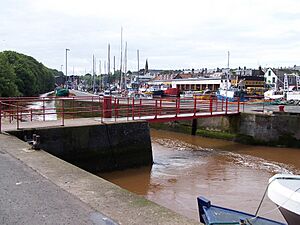
The Eye Water then enters Eyemouth. It flows on the east side of the harbor. A stone wall keeps it separate from the main harbor. The river eventually flows into the harbor closer to the lifeboat station.
The Big Flood of 1948
On August 12, 1948, the Berwickshire area had a huge flood. About one-third of the usual yearly rainfall fell in just six days. This caused water to rush off the Lammermuir Hills. The Eye Water and other rivers in the area overflowed, causing a lot of damage.
The low-lying farmland around Ayton turned into a big lake. The 18-meter (59-foot) high railway embankment of the East Coast Main Line acted like a dam. People worried that the embankment would break and flood Eyemouth. Luckily, the embankment held strong.
Even so, Eyemouth still suffered some damage. Reports said that strong winds and the overflowing Eye Water hit the town with the "impact of a hurricane." The flood also closed the local Eyemouth Railway from August 13, 1948, until June 29 of the next year.
Between Reston and Granthouse, seven railway bridges were washed away. Military bridges were quickly put in place on the East Coast Main Line. This allowed goods trains to run again on October 25 and passenger trains on November 1, 1948. The temporary bridges were finally replaced with permanent ones on May 21, 1950.
 | Jessica Watkins |
 | Robert Henry Lawrence Jr. |
 | Mae Jemison |
 | Sian Proctor |
 | Guion Bluford |


