Fail Loch facts for kids
Quick facts for kids Fail Loch |
|
|---|---|

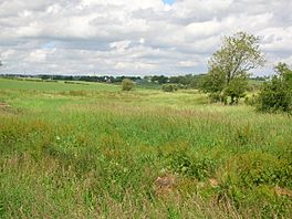
The site of Fail Loch
|
|
| Lua error in Module:Location_map at line 420: attempt to index field 'wikibase' (a nil value). | |
| Location | Tarbolton, South Ayrshire, Scotland |
| Type | Drained freshwater loch |
| Primary inflows | Townend Burn and the Mill Burn |
| Primary outflows | Water of Fail |
| Basin countries | Scotland |
| Islands | One |
| Settlements | Tarbolton |
Fail Loch was once a freshwater loch (a Scottish word for lake) located in a low-lying area. It was near the old Fail Abbey in Tarbolton, South Ayrshire, Scotland. Another old loch, Lochlea Loch, is nearby. Its waters still flow into the area where Fail Loch used to be, through a stream called the Mill Burn.
Contents
History of Fail Loch
The loch has had different names over time. In 1307, it was called 'Valle'. By the 17th century, it was known as 'Feil'. Other names like 'Feill' (1732) and 'Faill' or 'Ffele' were also used.
Some historical records suggest that the loch once surrounded Fail Abbey. This would have made the abbey sit on an island. Today, a small part of the loch remains. It fills with water only during certain seasons and is located north of the old abbey site.
In 1504, people used turf and earth from land near the Fail Abbey. They used these materials to fix a break in Fail Loch and its water channel. This repair was needed where the loch met the lands of the Abbot of Melrose.
In the 1950s, a writer named Shaw noted that Fail Loch, Lochlea, and Tarbolton Loch were not as full of water as they used to be. They once supplied water for mills and were great for ice skating and curling in winter. By then, much of their water had been drained away. However, they were still home to birds like snipe, geese, ducks, and swans.
Fail Mill and Water Use
In the mid-1800s, the Duke of Portland ended a system called thirlage. This system forced local farmers to use a specific mill to grind their grain. When thirlage ended, mills like Millburn Mill became less important. This also made the water sources for these mills, like Lochlea and Fail Loch, less needed.
Around 1840, people actively started draining both Fail Loch and Lochlea. This led to their disappearance as large bodies of water. Most of the land that was once Fail Loch became farm fields. These fields belonged to nearby farms like Mosside, Lilylaw, Adamhill, and Boghead. However, some parts of the area still flood seasonally.
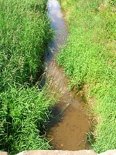
The Townend Burn and Mill Burn still flow towards where the old Fail Mill stood. From this point, the stream is known as the Water of Fail. The mill itself was still in use into the 20th century. Much of the land around this area originally belonged to the monks from Fail Abbey. An old path called the Monk's Road forms a boundary on the east side of the former loch.
William Muir was the person who rented the Mill of Fail when the famous poet Robert Burns lived nearby. Old maps from the Ordnance Survey (OS) show that there was a dam and a mill pond. These features would have helped control the water for the mill.
In 1840, three ancient burial urns were found at Fail Mill. These urns were donated to the Mechanics Museum in Ayr by a Mr. Andrew from Fail Mill.
Why Fail Loch Was Drained
The draining of Fail Loch likely started in the 1700s. At that time, wealthy landowners like Alexander Montgomerie, the 10th Earl of Eglinton, were improving their farms. Other landowners followed their example.
More drainage work might have happened in the 1740s. This was part of efforts to create jobs for Irish workers during the potato famines. Many drainage projects also took place after World War I. This was when many soldiers returned home and needed work.
What Maps Show
Old maps help us understand how Fail Loch changed over time.
- Blaeu's map (1654): This map, based on a survey from around 1604, clearly shows and names Fail Loch. It also suggests that Fail Loch was larger than Lochlea Loch at that time.
- Roy's map (1747): This map does not show Fail Loch. This suggests that by 1747, the loch might have already been drained or was much smaller.
- Thomson's map (1832): This map also does not show Fail Loch. However, it does mark other nearby lochs like Loch Brown and Lochlea Loch.
Maps from the 19th century Ordnance Survey (OS) show the area as 'Fail Loch'. These maps note that the area was prone to flooding. They also mention that the drainage was not good and that marsh plants grew there. A historian named Paterson recorded in the 1860s that a part of Fail Loch still remained.
Interesting Facts About Fail Loch
The area where Fail Loch used to be is now a site for counting wildfowl (water birds). This is part of a Wetland Bird Survey (WEBS). Fail Loch is also a special site recognized by the Scottish Wildlife Trust. It is important as a wetland area, with over 125 different plant species recorded there.
The Tarbolton Curling Club used Fail Loch in the 1800s. This shows that the area still froze over in winter, allowing for curling games.
 | Sharif Bey |
 | Hale Woodruff |
 | Richmond Barthé |
 | Purvis Young |


