South Ayrshire facts for kids
Quick facts for kids
South Ayrshire
Sooth Ayrshire
Siorrachd Àir a Deas |
|||
|---|---|---|---|
 |
|||
|
|||
| Sovereign state | United Kingdom | ||
| Constituent country | Scotland | ||
| Lieutenancy area | Ayrshire and Arran | ||
| Administrative headquarters | County Buildings, Ayr | ||
| Government | |||
| • Body | South Ayrshire Council | ||
| Area | |||
| • Total | 472 sq mi (1,222 km2) | ||
| Area rank | Ranked 15th | ||
| Population
(2020)
|
|||
| • Total | 112,550 | ||
| • Rank | Ranked 19th | ||
| • Density | 238.55/sq mi (92.10/km2) | ||
| ONS code | S12000028 | ||
| ISO 3166 code | GB-SAY | ||
| Website | South Ayrshire Council | ||
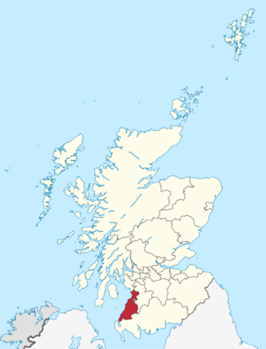
South Ayrshire is one of 32 areas in Scotland that are managed by a local council. It covers the southern part of a larger region called Ayrshire. South Ayrshire shares its borders with Dumfries and Galloway, East Ayrshire, and North Ayrshire. In 2021, about 112,450 people lived here. This makes it the 19th largest area in Scotland by population. It covers an area of 472 square miles (about 1,222 square kilometers), ranking it as the 15th largest area in Scotland by size.
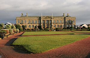
The main office for South Ayrshire's local government is in its biggest town, Ayr. The building where the South Ayrshire Council meets is called the County Buildings, located in Wellington Square. Ayr used to be the main town for the historic Ayrshire county.
Contents
History of South Ayrshire
South Ayrshire was created in 1996. This happened because of a new law that changed how local government worked in Scotland. Before 1996, Scotland had larger regions and smaller districts. The new law created "unitary council areas." This means each council area, like South Ayrshire, now handles all local government services by itself.
South Ayrshire covers the same area that used to be called the Kyle and Carrick district. It also took over tasks from the Strathclyde Regional Council that used to manage this area. The name "South Ayrshire" shows its place within the historic area of Ayrshire.
In 2021, South Ayrshire tried to become a city. This was part of the celebrations for Queen Elizabeth II's Platinum Jubilee in 2022. The bid highlighted the area's long history and connections to royalty. Many local groups and businesses supported this idea. However, South Ayrshire was not chosen. Eight other places, including Dunfermline in Scotland, were given city status instead.
Geography and Climate
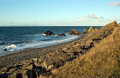
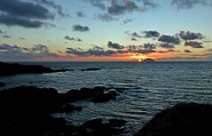
South Ayrshire is located on the western coast of Scotland. It shares borders with East Ayrshire, Dumfries and Galloway, and North Ayrshire. The weather here is milder than in eastern Scotland. This is because winds usually blow from the sea, and the warm Gulf Stream also affects the area.
Along the coast, like in Ayr and Troon, the average yearly temperature is about 9.5 to 9.9 degrees Celsius (49 to 50 degrees Fahrenheit). The sea is coldest in February or early March. So, February is often the coldest month in coastal parts of South Ayrshire. Inland, where the sea has less effect, January is usually the coldest month.
The amount of sunshine in South Ayrshire depends on the time of year and how cloudy it is. December is usually the cloudiest month, while May or June are the sunniest. Places at higher altitudes or far from the coast get less sunshine. In the past, pollution from factories reduced sunshine. But now, with less heavy industry, especially in Ayr, the area gets more sunshine, especially in winter.
The amount of rain each year changes across the area. Coastal areas of Ayrshire usually get less than 1,000 millimeters (39 inches) of rain. However, higher parts of the west Highlands can get over 3,500 millimeters (138 inches) of rain.
Towns and Villages
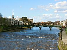
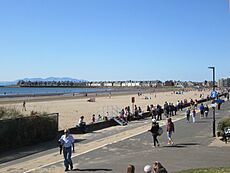
Most of the people in South Ayrshire live in the coastal towns of Ayr, Prestwick, and Troon. These towns are located in the northwest part of the area. About 68% of the total population lives here, with a combined population of 76,846 people, based on the 2011 census. Other important towns include Maybole and Girvan, which are located in the southern part of the area.
Largest Settlements by Population
Here are the largest settlements in South Ayrshire based on their population:
| Settlement | Population (2020) |
|---|---|
| Ayr | 46260 |
| Troon | 14950 |
| Prestwick | 14880 |
| Girvan | 6330 |
| Maybole | 4580 |
| Dundonald | 2570 |
| Coylton | 2160 |
| Mossblown | 2100 |
| Tarbolton | 1860 |
| Symington | 1510 |
Main Towns
Ayr is the main administrative center for the South Ayrshire Council. It is also the historic county town of Ayrshire. With about 46,982 people, Ayr is the 15th largest settlement in Scotland. It is also the second largest town in Ayrshire. Ayr is very close to the smaller town of Prestwick to its north. Ayr was made a Royal Burgh in 1205. This means it was a special town with royal rights. It was a central market and harbor during the Middle Ages.
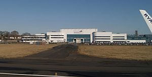
Troon is the second largest town in South Ayrshire. It is about eight miles (13 km) north of Ayr. It is also about three miles (5 km) northwest of Glasgow Prestwick Airport. Troon has a port with ferry and freight services. It also has a yacht marina. Since March 2024, a ferry service to Brodick on the Isle of Arran has been running from Troon. In 2024, the population of Troon was just over 15,000 people.
South Ayrshire has five main towns:
Villages and Hamlets
- Alloway (a neighborhood of Ayr)
- Annbank
- Ballantrae
- Barassie (a neighborhood of Troon)
- Barr
- Barrhill
- Colmonell
- Coodham
- Coylton
- Craigie
- Crosshill
- Dailly
- Dundonald
- Dunure
- Failford
- Joppa (a neighborhood of Coylton)
- Kirkmichael
- Kirkoswald
- Lendalfoot
- Loans
- Maidens
- Monkton
- Mossblown
- Minishant
- Old Dailly
- Pinmore
- Pinwherry
- Straiton
- Symington
- Tarbolton
- Turnberry
Economy and Jobs
The economy of South Ayrshire, like many other places, was affected by the global financial crisis between 2009 and 2012. Despite this, the total value of goods and services produced in South Ayrshire has grown steadily. In 2015, it reached £2.4 billion. By 2022, this value, known as Gross Domestic Product (GDP), was estimated at £2.710 million.
The largest number of people in South Ayrshire work in public services. This includes jobs in government, education, and health. More people work in these areas in South Ayrshire than in Scotland as a whole. However, fewer people work in banking, finance, and insurance here. Even though it's a coastal area, the fewest jobs are in farming and fishing.
Working Together for Economic Growth
The South Ayrshire Council works with its neighbors, East Ayrshire and North Ayrshire. They form the Ayrshire Regional Economic Partnership. This group works together to help the economy grow. They get help from the Scottish and UK governments, as well as private businesses.
Job Trends in South Ayrshire
In 2023, about 47,500 people in South Ayrshire were working or looking for work. Out of these, 44,700 people had jobs. This included 36,800 people who worked for businesses or organizations. Another 7,500 people were self-employed. During the same time, 1,700 people in South Ayrshire were unemployed. This means the unemployment rate was 3.7%, which is a little higher than the Scottish average of 3.5%.
Many people in South Ayrshire work in professional jobs. About 8,900 people (20%) have these kinds of jobs. Other large job areas include associate professional jobs (13.1%), care, leisure, and social care (10.2%), and management and director roles (9.1%).
In 2023, the average weekly salary for a full-time worker in South Ayrshire was £753.40. This was higher than the average Scottish weekly salary of £702.40.
Tourism and Attractions
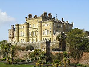
Tourism is very important to the economy of South Ayrshire. The area has many popular attractions. These include Burns Cottage and the Robert Burns Birthplace Museum, which celebrate the famous poet Robert Burns. Other attractions are Turnberry Castle and Culzean Castle.
The Royal Troon Golf Club is a famous golf course that hosts the Open Championship. The most recent Open Championship held there was in 2024. The Turnberry Golf Course has also hosted the Open Championship, last in 2009.
Other interesting places to visit in South Ayrshire include:
- Ailsa Craig (an island)
- Bachelor's Club, Tarbolton
- Bargany Gardens
- Blairquhan
- Burns Cottage
- Robert Burns Birthplace Museum
- Carrick Forest
- Crossraguel Abbey
- Culzean Castle
- Electric Brae (a place where things seem to roll uphill)
- Penkill Castle
- Souter Johnnie's Cottage
- Royal Troon Golf Club
- Turnberry Hotel and Golf Course
Education in South Ayrshire
South Ayrshire offers education through many schools. There are eight secondary schools and 41 primary schools. There are also two schools for children with special needs. Five Early Years Centres are available for younger children. Some primary schools also have Early Years Centres attached to them. There are also private nurseries that work with the South Ayrshire Council.
From 2023 to 2024, about 6,596 students attended secondary schools in South Ayrshire. Belmont Academy in Ayr is the largest secondary school, with 1,225 students. In contrast, Carrick Academy has the fewest students, with 391. During the same period, 7,441 children were in primary schools. Forehill Primary School had the most students, with 458 children. Straiton Primary School had the fewest, with only 18 children in 2024.
The South Ayrshire Council also runs Dolphin House. This is an outdoor learning program for older primary school students. It is located within the beautiful grounds of Culzean Country Park.
As of 2024, there are eight secondary schools in South Ayrshire:
- Ayr Academy (non-religious, in Ayr)
- Belmont Academy (non-religious, in Ayr)
- Carrick Academy (non-religious, in Maybole)
- Girvan Academy (non-religious, in Girvan)
- Kyle Academy (non-religious, in Ayr)
- Marr College (non-religious, in Troon)
- Queen Margaret Academy (Roman Catholic, in Ayr)
- Prestwick Academy (non-religious, in Prestwick)
Besides these council-run schools, Ayr is also home to Wellington School. This is a private school that teaches children from ages 3 to 18.
Local Government and Representation
South Ayrshire is governed by the South Ayrshire Council. Since 2003, no single political party has had full control of the council. This means different groups have worked together to run things. After the election in 2022, the council is led by a group of Conservative members. They have support from two independent councillors. The next election for the council will be in 2027.
The main civic leader of the council is called the provost. This role is mostly ceremonial. The provost leads council meetings and acts as the main representative for the area. Even though the provost is an elected councillor, they are expected to be fair and not take sides in politics. The actual political leadership comes from the leader of the council.
Representation in Parliament
South Ayrshire is represented in both the UK Parliament and the Scottish Parliament.
UK Parliament Members
South Ayrshire is part of two areas for the UK Parliament. These areas are called constituencies.
| Constituency | Member | Party | |
|---|---|---|---|
| Ayr, Carrick and Cumnock | Elaine Stewart | Scottish Labour Party | |
| Central Ayrshire | Alan Gemmell | Scottish Labour Party | |
Scottish Parliament Members (MSPs)
South Ayrshire is also part of two areas for the Scottish Parliament. These are called constituency seats.
Constituency MSPs
| Constituency | Member of Scottish Parliament | Extent of constituency | |||
|---|---|---|---|---|---|
| Ayr | Siobhian Brown | SNP | Covers Ayr, Prestwick, and Troon. | ||
| Carrick, Cumnock and Doon Valley | Elena Whitham | SNP | Covers Kyle and Carrick (outside Ayr, Prestwick, and Troon). It also includes Ballochmyle, Cumnock, and Doon Valley in East Ayrshire. | ||
Regional List MSPs South Ayrshire is part of the South Scotland electoral region. This region elects 7 additional MSPs. These MSPs represent the entire South Scotland region.
| Constituency | Member | Party | |
|---|---|---|---|
| South Scotland | Sharon Dowey | Conservative | |
| Emma Harper | Scottish National | ||
| Carol Mochan | Labour | ||
| Craig Hoy | Conservative | ||
| Brian Whittle | Conservative | ||
| Martin Whitfield | Labour | ||
| Colin Smyth | Labour | ||
See also
 In Spanish: South Ayrshire para niños
 | George Robert Carruthers |
 | Patricia Bath |
 | Jan Ernst Matzeliger |
 | Alexander Miles |


