
Ayr facts for kids
Quick facts for kids Ayr
|
|
|---|---|
| Administrative centre and town | |
|
Skyline of Ayr town centre
Ayr Town Hall
Pavilion building and Place De Saint-Germain-en-Laye fountain
Wellington Square Gardens
Coat of Arms |
|
 Coat of arms of Ayr |
|

Ayr
|
|
| Population | 46,260 (2020) |
| Urban | 62270 |
| OS grid reference | NS 33853 21445 |
| • Edinburgh | 66 mi (106 km) |
| • London | 330 mi (530 km) |
| Council area | |
| Lieutenancy area |
|
| Country | Scotland |
| Sovereign state | United Kingdom |
| Post town | AYR |
| Postcode district | KA6-KA8 |
| Dialling code | 01292 |
| EU Parliament | Scotland |
| UK Parliament |
|
| Scottish Parliament |
|
_-_Ayr_river_bridges_and_Town_Hall_spire.jpg)
_(cropped).jpg)


Ayr (pronounced "AIR") is a town on the southwest coast of Scotland. It used to be a special kind of town called a royal burgh. Today, it's the main office town for South Ayrshire Council. It's also the historic county town of Ayrshire.
Ayr has about 47,000 people, making it one of the biggest towns in Scotland. It's right next to a smaller town called Prestwick. Ayr tried to become a city a few times but didn't succeed.
The town of Ayr was officially started in 1205. For a long time, it was a busy market and port. In the 1600s, Oliver Cromwell's soldiers built a fort there. South of the town is Alloway, where the famous Scottish poet Robert Burns was born. Ayr has been a popular place for tourists since 1840 because of its nice beach and links to golf and Robert Burns.
Ayr is a big shopping area in the south of Scotland. It's also known for hosting the Scottish Grand National horse race and the Scottish International Airshow.
Contents
What's in a Name?
The name Ayr comes from a very old word that means "watercourse" or "strong river." This name was used for the River Ayr even before the modern calendar existed. The town was once called "Inverair" or "Inverayr," which means "mouth of the River Ayr." This was later shortened to "Ayr." You can still see the full name in the Scottish Gaelic name for Ayr, which is Inbhir Àir.
Ayr's Story


Ayr was founded as a market town in 1205 by King William the Lion. It was first called 'Inverair' or 'Inverayr', meaning "mouth of the River Ayr", but this was later shortened to 'Ayr'.
Since 1261, the town has held yearly fairs. Back then, about 1,500 people lived there, and it was a very important port on the west coast. English forces took over Ayr from 1301 to 1312 during the Wars of Scottish Independence.
On April 26, 1315, Robert The Bruce held a Scottish Parliament meeting in Ayr at St. John's Tower. Later, in 1652, Oliver Cromwell's soldiers used the town as a base. Cromwell built a large fort near the mouth of the River Ayr. Many of the walls from this fort are still there today. St John's Tower, which was part of a church, was used for military training. Today, a group called "Friends Of Saint Johns Tower" (FROST) helps protect it.
Who Runs Ayr?
People in Parliament


Ayr is part of two important areas for government. For the UK Parliament in London, Ayr is in the Ayr, Carrick and Cumnock area. This area also includes other towns like Carrick and Cumnock. The person who represents this area in the UK Parliament is called an MP (Member of Parliament). Currently, Allan Dorans from the Scottish National Party is the MP.
For the Scottish Parliament in Edinburgh, Ayr is in the Ayr area. This area also includes Prestwick and Troon. The person who represents this area in the Scottish Parliament is called an MSP (Member of the Scottish Parliament). Siobhian Brown from the Scottish National Party has been the MSP for Ayr since 2021.
South Ayrshire Council

Ayr is also looked after by South Ayrshire Council, which is the local government. There are 11 elected people called councillors who represent Ayr on this council. Five of them are from the Scottish Conservatives, four are from the Scottish National Party, and two are from Scottish Labour.
The Provost of Ayr
Ayr used to be a "Royal Burgh," which meant it had its own special leader called a Provost. The Provost is like the mayor of the town. Today, the Provost is the head of South Ayrshire Council. This role is not about politics anymore. The Provost chairs council meetings and represents the council at events.
The Provost wears a special chain and robes for official duties. The chain was given to the town in 1897. Since 1923, the council has provided the robes. Also, special lamp posts with the town's coat of arms are put outside the Provost's home.
When a new Provost is chosen, they write their name in a special Bible at a church service. The current Provost is Helen Moonie.
Where is Ayr?
Ayr is a town on the coast, located where the River Ayr meets the sea. The river then flows into the bigger Firth of Clyde estuary. From the coast, you can see the Isle of Arran, and on a very clear day, even the northern part of Northern Ireland.
The land around Ayr is mostly flat and low, often used for farming dairy cows. However, south of Ayr, the land gets higher, like the Brown Carrick Hill. Ayr is about 35 miles (56 km) southwest of Glasgow.
The area that includes Ayr and Prestwick together is considered one large urban area.
Places Near Ayr
 |
Firth of Clyde | Prestwick, Troon | Kilmarnock, Glasgow | |
| Firth of Clyde | Auchinleck, Cumnock | |||
| Maybole, Girvan, Stranraer | Newton Stewart | Dalmellington, Castle Douglas |
Parts of Ayr
Ayr is made up of several smaller areas, including:
- Alloway
- Belmont
- Castlehill
- Craigie
- Dalmilling
- Doonfoot
- Forehill
- Fort
- Heathfield
- Holmston
- Kincaidston
- Newton-On-Ayr
- Old Belmont
- Seafield
- Wallacetown
- Whitletts
People of Ayr
In 2011, Ayr had a population of about 46,849 people. This was a small increase from 2001. Most people in Ayr are white (98.6%). About 16% of the population is under 16 years old, and about 21.9% are over 65.
When it comes to religion, in 2011, about 57.9% of people in Ayr said they were Christian. About 35% said they had no religion.
Ayr's Economy
.jpg)
The northern part of Ayr Harbour is still a working port, mainly shipping out coal. There are also many railway tracks leading to it.
Ayr became a major shopping area in southwest Scotland after its first department store, Hourstons, opened in 1896. New shops and shopping centres, like the Kyle Centre (1988) and Ayr Central Shopping Centre (2006), helped the local economy grow. In 2014, Ayr's High Street was even named the second healthiest in the UK, meaning it had many services that help people's well-being.
Ayr became a popular holiday spot in the 1800s because of its nice sandy beach and the railway line to Glasgow, which opened in 1840.

Just north of Ayr is Prestwick, known for golf and its airport, Glasgow Prestwick Airport. This airport is a key base for the airline Ryanair and is important for fixing and maintaining aircraft. Companies like GE Caledonian and Spirit AeroSystems work there. Prestwick Airport is also planning to become a spaceport for launching small satellites into space.
Only 5 miles (8 km) north of Ayr is Troon, another golf and seaside town that often hosts the Open Championship. Ayr itself has three golf courses. The area is famous as a seaside resort, with holiday parks like Craig Tara to the south. The village of Alloway is well-known because of its connection to the poet Robert Burns.
Ayr has hosted the Scottish Grand National horse race every year since 1966 and the Scottish International Airshow since 2014.
Faith in Ayr
The 2022 Scottish Census found that 51% of people in Ayr said they had no religion. About 28% belonged to the Church of Scotland, and 9% were Roman Catholic.
The Church of Scotland is the largest Christian group in Ayr, with nine churches. The Roman Catholic Church has two churches, including the Cathedral Church of St Margaret. There are also other churches like the Scottish Episcopal Church, Free Church of Scotland, and a Baptist Church.
Learning in Ayr


Ayr has two nursery schools and many nursery classes within primary schools.
There are fifteen primary schools in Ayr, including:
- Alloway Primary School
- Annbank Primary School
- Braehead Primary School
- Dalmilling Primary School
- Doonfoot Primary School
- Forehill Primary School
- Grammar Primary School
- Heathfield Primary School
- Holmston Primary School
- Kincaidston Primary School
- Newton Primary School
- St. John's Primary School (a Catholic school)
Ayr also has one school for students with special needs, called Southcraig Campus.
There are four secondary schools in Ayr:
- Ayr Academy
- Belmont Academy
- Kyle Academy
- Queen Margaret Academy (a Catholic school)
Prestwick Academy in the nearby town of Prestwick also teaches some students from Ayr.
Ayr has one independent school, Wellington School, which teaches both primary and secondary students.
For further education, Ayr has four places:
- Ayrshire College
- University of the West of Scotland
- Scotland's Rural College
- Adult Learning Centre
Public Services and Getting Around

The main hospital in Ayr is University Hospital Ayr, which opened in 1991. It has an accident and emergency department. There is also Ailsa Hospital for mental health and a private hospital called The Abbey Carrick Glen Hospital.
Ayr has two community centres: Heathfield Community Centre and Lochside Community Centre.

Ayr is connected by several main roads:
- The A77 is a bypass around Ayr, connecting Glasgow and Stranraer.
- The A79 runs through Ayr and links it to Prestwick and its airport.
- The A70 goes east from Ayr to Edinburgh.
Local bus services run by Stagecoach West Scotland serve Ayr and Prestwick. You can also get express buses to Glasgow and even to Belfast in Northern Ireland (via a ferry from Stranraer).
Ayr railway station has regular train services to Glasgow Central, Edinburgh Waverley, Stranraer, and Kilmarnock. All these services are run by ScotRail.
The town is served by Glasgow Prestwick International Airport, which is only 2 miles (3 km) north of Ayr. It has flights to places in Europe and the British Isles. For more destinations, you can go to Glasgow Airport, which is about 35 miles (56 km) away.
Sports in Ayr

Ayr Racecourse is a famous horse racing track in Scotland. It hosts big events like the Scottish Grand National in April and the Ayr Gold Cup in September.
Ayr has two main football clubs. Ayr United plays at Somerset Park in the Scottish Championship. The club was formed in 1910. Whitletts Victoria is another club based in Ayr.

Ayr used to have a professional ice hockey team called the Ayr Scottish Eagles. The town's rugby union team, Ayr RFC, plays at Millbrae and has won Scottish championships.
Ayr also has a curling club, a cricket team, and a leisure centre called Citadel Leisure Centre. This centre has a swimming pool and courts for various sports. Ayr has a sandy beach and a nice walkway (esplanade) that is popular for walking and jogging.
Culture and Fun

Ayr is home to the Gaiety Theatre, which was built in 1902. It has been rebuilt a few times after fires. It's a place where you can watch plays and shows.
The local radio station, West FM, used to be based in Ayr. The Ayrshire Post and Ayr Advertiser newspapers are still based in Ayr. The Ayr Advertiser is Scotland's oldest weekly newspaper.

Ayr has three libraries, plus a mobile library that visits different areas. These are:
- Alloway Library
- Carnegie Library (the main one)
- Forehill Library
Twin Towns
Ayr is twinned with:
 Saint-Germain-en-Laye, France (since 1984). This means the towns have a special friendship and often share cultural exchanges.
Freedom of the Burgh
The "Freedom of the Burgh" is a special honour given to people or military groups who have done great things for Ayr. It's like being given the key to the city.
- Sir Winston Churchill: 1947.
- The Royal Scots Fusiliers: 15 June 1946.
Famous People from Ayr

Many notable people have come from Ayr, including:
- Robert Burns (1759–1796), Scotland's national poet, born in Alloway.
- John Loudon McAdam (1756–1836), who invented the Tarmacadam road surface.
- Drew McIntyre (born 1985), a professional wrestler.
- Neil Oliver (born 1967), a BBC presenter.
- Mike Scott (born 1958), lead singer of The Waterboys.
- Robert Shankland (1887–1968), who won the Victoria Cross for bravery in 1917.
- Simon Alexander Neil (born 1979), lead singer and songwriter for Biffy Clyro.
Images for kids
-
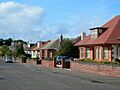
Bungalows in Old Belmont

See also
 In Spanish: Ayr para niños
