River Ayr facts for kids
Quick facts for kids River Ayr |
|
|---|---|

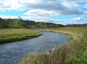
The River Ayr Looking towards Alder Glen, from the River Ayr Way.
|
|
| Native name | Uisge Àir |
| Country | Scotland |
| Counties | Ayrshire |
| Settlements | Ayr, Catrine, Muirkirk |
| Physical characteristics | |
| Main source | Glenbuck Loch Muirkirk, Scotland |
| River mouth | Ayr Harbour, Firth of Clyde Ayr, Scotland |
| Length | 65 km (40 mi) |
| Discharge (location 2) |
|
| Basin features | |
| Tributaries |
|
The River Ayr (pronounced like air) is a river in Ayrshire, Scotland. In Gaelic, its name is Uisge Àir. It flows for about 65 km (40 mi), making it the longest river in the Ayrshire region.
Long ago, before Christianity, people living near the River Ayr thought it was a very special and holy place. They even performed ceremonies along its banks. Archaeologists have found ancient burial sites for horses near the town of Ayr, which suggests these animals were important in their rituals.
Contents
What Does the Name "Ayr" Mean?
The name Ayr might come from a very old word, even older than Celtic, that simply meant "watercourse" or "river". Another idea is that it comes from a Brittonic word, *ar, which was used for rivers and meant something that moves horizontally.
The town of Ayr used to be called Inver Ayr. The word "Inver" means "mouth of the river" (like where a river meets the sea). So, Inver Ayr meant "mouth of the River Ayr". Over time, the name was shortened to just Ayr.
Where Does the River Ayr Flow?
The River Ayr collects water from a large area of land called a watershed. This area covers about 574 km2 (222 sq mi).
The river starts its journey at a place called Glenbuck Loch in East Ayrshire. This is close to the border with Lanarkshire. From there, it twists and turns through East Ayrshire and South Ayrshire. Finally, it reaches its mouth at the town of Ayr, where it flows into the Firth of Clyde and then into the ocean.
Along its path, the River Ayr passes through several villages. These include Muirkirk, Sorn, Catrine, Failford, Stair, and Annbank. It also flows past the ruins of the old Ayr Castle. The biggest towns and villages along the river are Ayr, Cumnock, Catrine, Ochiltree, Muirkirk, and Sorn.
The land around the river is used for many things. People use it for farming, growing trees (forestry), and even mining. It's also a place for fun activities like leisure and recreation, and many towns and cities have grown up along its banks.
Smaller Rivers Joining the Ayr
Many smaller rivers and streams flow into the River Ayr, adding to its water. These are called tributaries. Some of the main ones are:
- Greenock Water
- Lugar Water
- Water of Fail
- Water of Coyle
Exploring the River Ayr Way
If you enjoy walking, you might be interested in the River Ayr Way. This is a special walking path that follows the river for most of its length, over 90%! Sometimes, the path has to leave the river for a short time because of land disputes or damage from bad weather.
The walk begins in the former village of Glenbuck. This village is now mostly gone due to open-pit mining and industries closing down. The path starts right at the river's source, Glenbuck Loch. It then follows the river all the way to the coastal town of Ayr, where the river meets the Firth of Clyde. Most people complete this long walk in two or three separate trips.
 | Charles R. Drew |
 | Benjamin Banneker |
 | Jane C. Wright |
 | Roger Arliner Young |

