Fairford River facts for kids
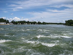
The Fairford River is a river located in Manitoba, Canada. It starts at the northern end of Lake Manitoba. From there, it flows into Lake Pineimuta and then into Lake St. Martin. Eventually, its waters reach Lake Winnipeg through the Dauphin River.
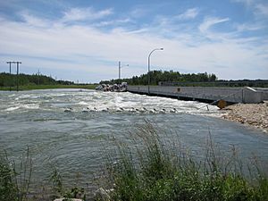
For many years, people have worked to manage the water levels of Lake Manitoba. This effort started way back in the late 1890s. A big step was taken in 1961 when the Fairford River Water Control Structure (FRWCS) was finished. This structure is like a special dam that helps control how much water flows out of Lake Manitoba.
Controlling the Water Flow
The Fairford River Water Control Structure is very important for managing water. When it was built in 1961, the river channel was made wider and deeper. This was especially true for the part of the river between Lake Manitoba and the dam. These changes made it possible for much more water to flow through. The river's capacity more than tripled when Lake Manitoba was at a level of about 248 metres (813 ft) above sea level.
How the Dam Works
The Fairford Dam helps keep Lake Manitoba's water levels steady. When there isn't much water in Lake Manitoba, the dam reduces the flow into the Fairford River. This helps to keep enough water in the lake.
But when Lake Manitoba has a lot of water, the dam's gates are opened. This allows extra water to flow down the Fairford River. The water then moves into Lake Pineimuta and Lake St. Martin. This process helps prevent flooding around Lake Manitoba.
Target Water Levels
The goal is to keep Lake Manitoba's water levels between 247.0 metres (810.5 ft) and 247.7 metres (812.5 ft) above sea level. The Fairford Dam is used to achieve this balance.
Between 1972 and 2001, a huge amount of water flowed out of Lake Manitoba into the Fairford River each year. On average, this was about 2.502979 cubic kilometres (2,029,198 acre⋅ft) of water.
The 2011 Flood
In 2011, there was a very big flood called the 2011 Assiniboine River flood. During the worst part of this flood, the Fairford River handled a record amount of water. About 620 cubic metres per second (22,000 cu ft/s) of water flowed through the river at its peak. This shows how important the Fairford River and its control structure are for managing water during extreme weather events.
 | Mary Eliza Mahoney |
 | Susie King Taylor |
 | Ida Gray |
 | Eliza Ann Grier |


