
Lake Manitoba facts for kids
Quick facts for kids Lake Manitoba |
|
|---|---|
 |
|
| Location | Manitoba |
| Coordinates | 51°00′N 98°50′W / 51.000°N 98.833°W |
| Lake type | Glacial |
| Primary inflows | Waterhen River Whitemud River |
| Primary outflows | Fairford River |
| Catchment area | 54,630 km2 (21,090 sq mi) |
| Basin countries | Canada |
| Max. length | 200 km (120 mi) |
| Max. width | 45 km (28 mi) |
| Surface area | 4,624 km2 (1,785 sq mi) |
| Max. depth | 7 m (23 ft) |
| Water volume | 14.1 km3 (3.4 cu mi) |
| Residence time | North basin: 2 years; South basin: 28 years |
| Salinity | 3.5‰ (hyposaline) |
| Surface elevation | 812 ft (247 m) |
| Settlements | Fairford, Steep Rock, St. Laurent, Sandy Bay |
Lake Manitoba is a large lake in the Canadian province of Manitoba. It is the 14th largest lake in Canada and the 33rd largest lake in the world! The lake covers an area of about 4,624 square kilometres (1,785 sq mi). You can find it about 75 kilometres (47 mi) northwest of Winnipeg, the capital city of Manitoba.
Contents
History of Lake Manitoba
Lake Manitoba has a long and interesting history. Long ago, the shores of the lake were home to the Assiniboine and Cree Indigenous peoples.
Who Discovered Lake Manitoba?
European explorers learned about Lake Manitoba in the mid-1730s. This was thanks to Pierre Gaultier de Varennes, sieur de La Vérendrye. He and his sons traveled through the lake to explore the Saskatchewan River. The lake also became an important part of the fur trade route to Hudson Bay.
What Does "Manitoba" Mean?
The name "Manitoba" comes from the Cree language word manitou-wapow or the Ojibwe language word manidoobaa. Both of these words mean "straits of Manitou, the Great Spirit." This name refers to an area in the middle of the lake called The Narrows. People believed that the spirit could be heard there. What exactly was heard remains a mystery! Early French explorers called the lake Lac des Prairies, which means "Lake of the Prairies."
The short-lived Republic of Manitobah and the later province of Manitoba both got their names from this lake.
Is There a Monster in Lake Manitoba?
For many years, people have claimed that a mysterious creature lives in Lake Manitoba. It's similar to the famous Loch Ness Monster in Scotland! This creature has been named Manipogo. People have reported seeing this serpent-like lake monster since around 1908.
Geography of Lake Manitoba

Lake Manitoba has an unusual shape and is about 200 kilometres (120 mi) long. It is the smallest of three large lakes in the area. The other two are Lake Winnipeg (the biggest) and Lake Winnipegosis. These lakes sit on the bottom of a huge ancient lake called Glacial Lake Agassiz.
Lake Manitoba is divided into two parts: a smaller, irregular northern section and a much larger southern section. The lake is part of the Nelson River watershed, which eventually flows into Hudson Bay.
The southern tip of the lake, near Portage la Prairie, is home to the Delta Marsh. This marsh is a very important place for migrating birds to stop and rest.
Some of the communities located on the lake include Fairford, Steep Rock, St. Laurent, and Sandy Bay.
Where Does Lake Manitoba's Water Come From?
Lake Manitoba gets most of its water from Lake Winnipegosis to the northwest, through the Waterhen River. Other rivers like the Whitemud River also flow into it. A lot of water also comes directly from rain falling on the lake's surface.
The water from Lake Manitoba flows northeast into Lake Winnipeg. It does this through the Fairford River, then into Lake St. Martin, and finally into the Dauphin River. About half of the water that leaves the lake does so through evaporation, which means it turns into vapor and goes into the air. This is why the lake has a slightly salty taste, making it a hyposaline lake.
How is Lake Manitoba's Water Level Controlled?
To help control flooding around the lake, a special channel was dug between 1899 and 1901. Later, in 1933, a concrete dam was built across the Fairford River. A new dam was built in 1961. This dam helps to keep the lake's water levels between 810.5 and 812.5 feet (247.0 and 247.7 m) above sea level.
What Happened During the 2011 Flood?
In 2011, Lake Manitoba experienced a major flood. There was a lot of snow during the winter and heavy rain in the spring. This caused the lake's water level to rise very high, reaching 817.2 feet (249.1 m) above sea level on July 21.
On May 31, 2011, when the lake was already high, strong winds of up to 90 kilometres per hour (56 mph) caused even more problems. These winds pushed the water, leading to significant damage to beaches and communities along the southern part of the lake. Places like Twin Lakes Beach, St. Laurent, and Delta Beach were badly affected.
When Have There Been Other Floods?
Unlike rivers that can rise and fall quickly, large lakes like Lake Manitoba take months or even years for their water levels to change. Here are some of the years when Lake Manitoba experienced high flood levels:
| Year(s) | Peak Lake Level (ft. ASL) |
|---|---|
| 2011-12 | 817.2 (2011) |
| 1881-82 | > 817 (1882) |
| 1954-57 | 816.6 (1955) |
| 1913 | > 816 |
| 2014 | 814.7 |
| 1924 | 814.2 |
| 1925 | 814.2 |
Fishing in Lake Manitoba
Lake Manitoba is one of the three most important lakes for Manitoba's commercial fishing industry. This industry is worth about $30 million each year!
In the past, whitefish were the main fish caught in Lake Manitoba. Today, the most popular fish for sale are walleye, sauger, and yellow perch. There has also been an increase in fish like carp. While Tullibee are caught often, they are not usually sold commercially.
The total amount of fish caught by commercial fishers in the winter has gone down. For example, it dropped from 15 million pounds (6.8 kt) per year in the late 1940s to less than 4.5 million pounds (2.0 kt) in 2002.
Gallery
-
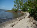
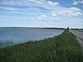
Delta Beach
-
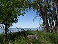
Lake Manitoba From Delta Marsh Field Station
-
Lake Manitoba From Delta Marsh Field Station
-
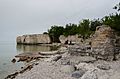
Limestone cliffs near Steep Rock
-
Lake Manitoba Narrows
-
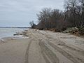
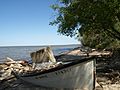
Twin Lakes Beach
-
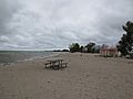
St. Ambroise Provincial Park Beach
-
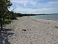
Watchorn Provincial Park Beach
.JPG)
.JPG)
.JPG)


See also
 In Spanish: Lago Manitoba para niños
