
Far Ings National Nature Reserve facts for kids
Quick facts for kids Far Ings |
|
|---|---|
 |
|
| Lua error in Module:Location_map at line 420: attempt to index field 'wikibase' (a nil value). | |
| OS grid | TA017233 |
| Area | 59 hectares (150 acres) |
| Managed by | Lincolnshire Wildlife Trust |
| Designated: | 28 July 1994 |
| Reference #: | 663 |
Far Ings is a special nature reserve in North Lincolnshire, England. It covers a large area of over 64 hectares (that's about 158 acres!) right by the Humber Estuary. This amazing place is just west of the town of Barton-upon-Humber.
Far Ings is super important for wildlife. Because of this, it has many special protections. It's not just a national nature reserve; it's also part of a Ramsar site, a Site of Special Scientific Interest, a Special Area of Conservation, and a Special Protection Area. These titles mean it's a really valuable spot for plants and animals!
A Look Back at Far Ings
For many years, Far Ings was a busy industrial area. From 1850 to 1959, people dug for clay here to make tiles and cement. When the clay ran out, the factories closed down.
Over time, the big holes left by digging filled with water. Reeds and other plants started to grow, turning the old clay pits into beautiful wetlands. This made it a perfect home for many different kinds of wildlife.
In 1983, the Lincolnshire Wildlife Trust took over the land. They opened it as a nature reserve in the same year, so everyone could enjoy its natural beauty. In April 2005, Far Ings was officially named a national nature reserve, showing how important it is for nature in the UK.
In December 2013, a big flood hit the area. This was caused by a storm called Cyclone Xaver. The flood damaged parts of the reserve, but the visitor centre was fixed and opened again in August 2014.
-
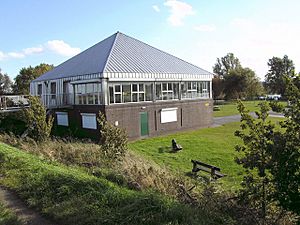
The visitor centre in 2008
-
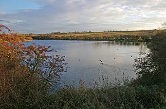
A peaceful lake at Far Ings
_-_geograph.org.uk_-_1028660.jpg)

Amazing Wildlife at Far Ings
Far Ings is a fantastic place to see all sorts of creatures! It's home to a huge variety of life.
You can find more than 250 different kinds of moths here. There are also over 230 types of wildflowers, making the reserve a colourful place. If you love butterflies, you'll be happy to know there are at least 19 different species fluttering around.
Birds are a big part of Far Ings too. In 2000, Eurasian bitterns were seen breeding here. This was very exciting because it was the first time in over 30 years that these shy birds had bred in Lincolnshire! In June 2020, a rare Blyth's reed warbler was also spotted at the reserve.
-
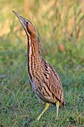
A Eurasian Bittern at Far Ings in 2013
-
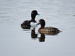
Tufted ducks swimming
-
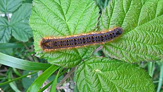
A drinker moth larva
-
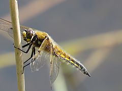
A colourful dragonfly


.jpg)
.jpg)

