Fern Rock, Philadelphia facts for kids
Quick facts for kids
Fern Rock
|
|
|---|---|

Fern Rock Transportation Center
|
|
| Country | |
| State | Pennsylvania |
| County | Philadelphia |
| City | Philadelphia |
| Area code(s) | 215, 267 and 445 |
Fern Rock is a neighborhood in the northern part of Philadelphia, Pennsylvania. It's a busy area with homes, shops, and important transportation links. Fern Rock is located near other neighborhoods like Olney, Ogontz, Logan, and East Oak Lane. You can find it roughly between Broad Street, Tabor Road, 7th Street, Godfrey Avenue, and Fisher Park.
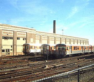
A major subway station, the Fern Rock Transportation Center, is here. It's the last stop for the Broad Street Line subway. Also, three SEPTA Regional Rail train lines pass through this station. This makes it easy for people to travel around the city and beyond. The Pennsylvania College of Optometry is also located in Fern Rock.
Contents
What is Fern Rock Named After?
The name Fern Rock comes from an old family estate. This estate belonged to Elisha Kent Kane. He was a famous explorer of the Arctic. He was also a naval surgeon from Philadelphia.
Who Lives in Fern Rock?
Fern Rock is a very stable neighborhood. Most of the people living here are Black-American.
Learning and Education in Fern Rock
Fern Rock has some great places for learning. The Pennsylvania College of Optometry is located here. It's known for its Eye Institute. The Community College of Philadelphia also has a center in Fern Rock.
There are other colleges close by too. These include La Salle University in Logan. Salus University is in Elkins Park. Gratz College is in Melrose Park.
Homes and Shops in Fern Rock
Fern Rock has a mix of different types of homes. Many are "row homes" built in the 1920s. These are houses joined together in a row. There are also some taller apartment buildings. You can find these near York and Chelten streets. Some older "twin" homes and single houses are also present. These are especially near 13th and Spencer streets.
The neighborhood also has many places to shop. You can find stores along Broad Street. There are also shops on Olney Avenue. More shops are located on the 5700-5900 block of Old York Road.
 | Frances Mary Albrier |
 | Whitney Young |
 | Muhammad Ali |

