List of Philadelphia neighborhoods facts for kids
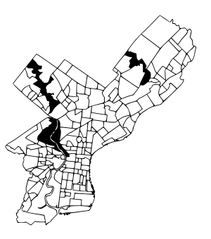
Philadelphia, Pennsylvania, is a big city in the United States. Like many large cities, it's made up of many smaller areas called neighborhoods and districts. This article will help you explore some of these cool places!
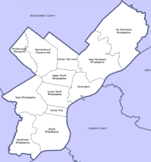
Sometimes, the names people use for neighborhoods don't exactly match the "official" maps used by the city. This means some areas might overlap, and people might not always agree on where one neighborhood ends and another begins. Philadelphia also has 41 ZIP codes, which are often used to study different areas.
Long ago, many neighborhoods were separate towns or boroughs before they became part of Philadelphia in 1854. Today, local groups like community organizations help define and name these areas. For planning, the city divides itself into 18 main sections.
Contents
- Center City: The Heart of Philadelphia
- South Philadelphia: History and Sports
- Southwest Philadelphia: Near the Airport
- West Philadelphia: "West Philly"
- North Philadelphia: Two Main Sections
- Roxborough-Manayunk: Northwest Charm
- Germantown-Chestnut Hill: Historic "Uptown"
- Olney-Oak Lane: North of Upper North
- River Wards: Along the Delaware River
- Northeast Philadelphia: Two Large Sections
Center City: The Heart of Philadelphia
Center City is the main downtown area of Philadelphia. It stretches from South Street in the south to Vine Street in the north. On the east, it reaches the Delaware River, and on the west, it goes to the Schuylkill River. This area is full of important buildings, shops, and cultural spots.
Some of the neighborhoods you'll find here include:
- Avenue of the Arts
- Callowhill
- Chinatown
- Elfreth's Alley
- French Quarter
- Logan Square
- Naval Square
- Jewelers' Row
- Market East
- Old City
- Museum District
- Penn Center
- Rittenhouse Square
- Fitler Square
- Penn's Landing
- Society Hill
- South Street
- Washington Square West: This area is west of Washington Square. It's also sometimes called Midtown Village.
South Philadelphia: History and Sports
South Philadelphia is located south of Center City. It's bordered by South Street to the north and the Delaware and Schuylkill Rivers. This part of the city is known for its rich history, diverse communities, and famous sports stadiums.
Here are some neighborhoods in South Philadelphia:
- Bella Vista
- Central South Philadelphia
- Christian Street Historic District
- Devil's Pocket
- Dickinson Square West
- East Passyunk Crossing
- Franklin Delano Roosevelt Park
- Girard Estate
- Greenwich
- Grays Ferry
- Hawthorne
- Italian Market: A famous outdoor market along 9th Street.
- Little Saigon
- Lower Moyamensing
- Marconi Plaza
- Moyamensing
- Packer Park
- Passyunk Square
- Pennsport: Often called "Two Street," this area has a strong Irish-American heritage.
- Point Breeze
- Queen Village
- Schuylkill
- Sports Complex: Home to Philadelphia's major sports teams.
- Tasker
- Wharton
- Whitman
- Wilson Park
- West Passyunk
- Southwark
- Graduate Hospital
Southwest Philadelphia: Near the Airport
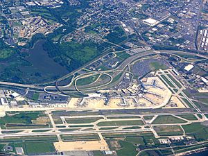
Southwest Philadelphia is located west of the Schuylkill River. Its borders extend to the city line. This area includes the Philadelphia International Airport.
Some neighborhoods in Southwest Philadelphia are:
- Angora
- Bartram Village
- Clearview
- Kingsessing
- Eastwick
- Elmwood Park
- Hedgerow
- Mount Moriah
- Paschall
- Philadelphia International Airport
- Penrose
- Southwest Schuylkill
- Hog Island: This island used to have a big shipyard and is now where the airport is.
West Philadelphia: "West Philly"
West Philadelphia, often called "West Philly," is a well-known part of the city. It stretches from the western side of the Schuylkill River to the city line.
Here are some of the neighborhoods in West Philadelphia:
- Belmont District (no longer exists)
- Belmont Village
- Carroll Park
- Cathedral Park
- Cedar Park
- Centennial District
- Dunlap
- Garden Court
- Haddington
- Haverford North
- Mantua
- Mill Creek
- Overbrook
- Overbrook Park
- Overbrook Farms
- Parkside
- Powelton Village
- Saunders Park
- Spruce Hill
- Squirrel Hill
- University City
- Walnut Hill
- Woodland Terrace
- Wynnefield Heights
- Cobbs Creek
- Wynnefield
North Philadelphia: Two Main Sections
North Philadelphia is divided into two main parts: Lower North and Upper North.
Lower North Philadelphia
Lower North Philadelphia is just north of Center City. It was once part of a special program to help overcome poverty. This area is bordered by Spring Garden Street to the south and Fairmount Park to the west.
Neighborhoods in Lower North Philadelphia include:
Upper North Philadelphia
Upper North Philadelphia is just north of Lower North Philadelphia. This area has a large and growing Puerto Rican population. Its borders are York Street to the south and Fairmount Park to the west.
Some communities in Upper North Philadelphia are:
Roxborough-Manayunk: Northwest Charm
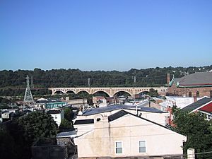
The Roxborough-Manayunk section is an official planning district in Philadelphia. It's located northwest of Center City. This area includes the well-known neighborhoods of Roxborough and Manayunk.
Neighborhoods here include:
Germantown-Chestnut Hill: Historic "Uptown"
This section, sometimes called "Uptown," is about 7-8 miles northwest of the city center. The neighborhood of Germantown is full of historic sites from the colonial era. Chestnut Hill was part of an old German township.
This area was a popular summer vacation spot long ago because of its higher elevation and cooler temperatures. Chestnut Hill is still known as one of Philadelphia's more well-off areas.
Neighborhoods in this section are:
Olney-Oak Lane: North of Upper North
The Olney-Oak Lane section is an official planning area in Philadelphia. It's located just north of Upper North Philadelphia and south of Cheltenham. This area was once a separate township called "Bristol Township." People sometimes call it "Uptown" along with the Germantown-Chestnut Hill section.
This section includes neighborhoods in the center-north of the city:
- East Oak Lane
- Feltonville
- Fern Rock
- Koreatown
- Logan
- Melrose Park
- Ogontz
- Olney
- West Oak Lane
River Wards: Along the Delaware River
The River Wards section of Philadelphia is located northeast of Center City, right along the Delaware River.
Neighborhoods within the River Wards include:
- Bridesburg
- Fishtown
- Harrowgate
- Kensington
- Port Richmond
- Olde Richmond
Northeast Philadelphia: Two Large Sections
Northeast Philadelphia is a very large part of the city, often divided into "Near Northeast" and "Far Northeast." Together, these areas have a big percentage of Philadelphia's population. Since the 1980s, many families have moved to the suburbs, but new people have moved in. The Northeast is now very diverse, with many Hispanic, African American, and Asian residents.
Near Northeast Philadelphia
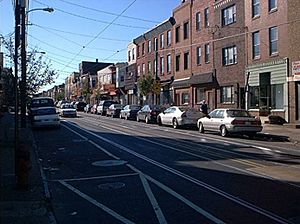
This is one of the two main sections of Northeast Philadelphia.
Here are some neighborhoods in Near Northeast Philadelphia:
Far Northeast Philadelphia
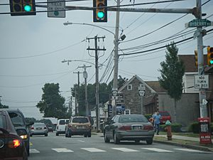
Far Northeast Philadelphia is an official planning section located north of the Near Northeast section.
Neighborhoods in Far Northeast Philadelphia include:
- Academy Gardens
- Ashton-Woodenbridge
- Bustleton
- Byberry
- Crestmont Farms
- Krewstown
- Millbrook
- Modena Park
- Morrell Park
- Normandy
- Parkwood
- Pennypack
- Somerton
- Torresdale
- Upper Holmesburg
- Winchester Park
 | Janet Taylor Pickett |
 | Synthia Saint James |
 | Howardena Pindell |
 | Faith Ringgold |


