Ffridd Faldwyn, Montgomery facts for kids
Quick facts for kids Ffridd Faldwyn, Montgomery |
|
|---|---|
| Powys, Wales | |

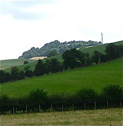
Fridd Faldwyn Iron Age Hillfort on the skyline, as viewed from Llandyssil
|
|
|
Location in Wales Powys
|
|
| Coordinates | 52°34′N 3°10′W / 52.56°N 3.16°W |
Ffridd Faldwyn is an ancient hillfort from the Iron Age in Powys, Wales. It sits on a tall hill near Montgomery. This amazing site is higher than Montgomery Castle and looks out over the River Severn. Ffridd Faldwyn is one of the biggest hillforts in all of Wales. It's a fantastic place to learn about how people lived long ago!
Contents
Discovering Ffridd Faldwyn's Past
People have been interested in Ffridd Faldwyn for a long time. In 1776, a visitor named Thomas Pennant explored the area. He wrote about the "stupendous British post" (meaning a huge ancient fort). He noticed how the fort was protected by many ditches and steep slopes.
What the Fort Looked Like
Ffridd Faldwyn is known as a multivallate contour fort. This means it had many defensive walls or ditches that followed the shape of the hill. Imagine several rings of protection around the main fort! Today, the site is covered with trees, but you can still follow a path through it.
In 1909, experts from the Royal Commission on the Ancient and Historical Monuments of Wales studied the hillfort. Later, in 1932, Dr. Willoughby Gardner published a detailed report. This led to important digs, or excavations, being carried out.
Digging Up the Past: The 1937-1939 Excavations
From 1937 to 1939, an archaeologist named B. H. St. John O’Neill led major excavations at Ffridd Faldwyn. He was the Inspector of Ancient Monuments in Wales. O'Neill used the latest methods, similar to those used at the famous Maiden Castle hillfort.
Early Discoveries
O'Neill's team found that the very first fort was smaller. It measured about 170 meters by 80 meters. This early fort had a gate to the south. It was defended by two rows of wooden palisades, which are like strong fences made of pointed logs. This first fort was on the highest part of the hill. Inside, there was a small mound. This mound might have been a Bronze Age burial site, called a round barrow.
Even older evidence was found under the southern gate. This showed that people lived here even earlier, during the Neolithic (New Stone Age) period!
How the Fort Grew
The first fort was later changed. It got a stronger wooden rampart (a defensive wall). It also grew bigger towards the north-west. A special entrance area, called a barbican, was added to the south gate.
Inside the fort, archaeologists found rectangular structures. These are now thought to be supports for wooden granaries. Granaries were buildings used to store grain, like wheat or barley. This tells us that people were farming and storing food here.
The Big Expansion
The hillfort then became much larger. It grew to about 300 meters by 200 meters, covering a huge area. The new defenses included timber-laced ramparts. These were walls made of earth and wood woven together. Even today, some of these banks are still very tall, up to 8 meters high!
A large extra area was added near the south-west gate. This might have been another barbican or a place to keep animals. Over time, the defenses of this big hillfort started to fall apart. But later, perhaps when the Romans arrived in Britain, the defenses were fixed up with a simple earthen bank.
 | Percy Lavon Julian |
 | Katherine Johnson |
 | George Washington Carver |
 | Annie Easley |


