Flat Iron, Indiana facts for kids
Quick facts for kids
Flat Iron, Indiana
|
|
|---|---|

Flat Iron from the air
|
|

Vermillion County's location in Indiana
|
|
| Country | United States |
| State | Indiana |
| County | Vermillion |
| Township | Highland |
| Elevation | 617 ft (188 m) |
| Time zone | UTC-5 (Eastern (EST)) |
| • Summer (DST) | UTC-4 (EDT) |
| ZIP code |
47974
|
| Area code(s) | 765 |
| GNIS feature ID | 434564 |
Flat Iron is a small, quiet place in Indiana. It's not a city or a town with its own government. Instead, it's called an "unincorporated community." This means it's part of a larger area, like Highland Township in Vermillion County.
Where is Flat Iron?
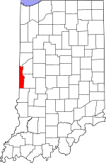
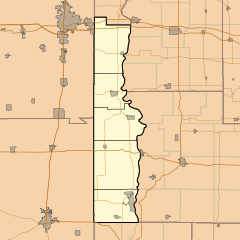
Flat Iron is located in Vermillion County, Indiana. You can find it at these coordinates: 40°3′11″N 87°29′21″W / 40.05306°N 87.48917°W. It sits about 617 feet (188 meters) above sea level.
How Flat Iron Got Its Name
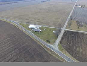
The name "Flat Iron" comes from how the land looks. Three roads meet there: State Road 32, County Road 100W (also called "Flat Iron Road"), and County Road 1150N. These roads come together to form a flat, triangular shape. This shape reminds people of an old-fashioned clothes iron. That's how this unique spot got its name!
What You'll Find There
Today, Flat Iron is a very small place. It has a house and a large barn. There's even a sign that says, "Flat Iron, population 1." In the past, it was a bit busier. It used to have another house and a general store. At one time, six people lived there.
Just north and east of Flat Iron, there used to be an airport called Highland Airport. It closed down in the late 1980s.
Nearby Places
The closest town with its own government is Perrysville. It's about three miles (about 5 kilometers) to the east. Another small, unincorporated community called Gessie is about two miles (about 3 kilometers) north of Flat Iron.
 | Claudette Colvin |
 | Myrlie Evers-Williams |
 | Alberta Odell Jones |


