Fleming Island, Florida facts for kids
Quick facts for kids
Fleming Island, Florida
|
|
|---|---|
| Country | United States |
| State | Florida |
| County | Clay |
| Area | |
| • Total | 23.12 sq mi (59.89 km2) |
| • Land | 15.84 sq mi (41.02 km2) |
| • Water | 7.29 sq mi (18.87 km2) |
| Population
(2020)
|
|
| • Total | 29,142 |
| • Density | 1,840.01/sq mi (710.42/km2) |
| Time zone | UTC-5 (Eastern (EST)) |
| • Summer (DST) | UTC-4 (EDT) |
| ZIP codes |
32003
|
| FIPS code | 12-22660 |
Fleming Island is a special kind of community in Clay County, Florida, United States. It's called an "unincorporated community" and a "census-designated place" (CDP). This means it's a recognized area with a population, but it doesn't have its own city government.
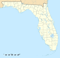
Fleming Island is located about 21 miles (34 km) southwest of downtown Jacksonville. It sits on the western side of the St. Johns River. In 2020, about 29,142 people lived here. Its special ZIP code, 32003, was created in 2004. This makes it different from nearby Orange Park.
Contents
History of Fleming Island
Early Settlement and Plantations
Fleming Island was first settled by an Irish immigrant named George Fleming (1760-1821). He received a large piece of land, about 1,000 acres, from the Spanish governor of East Florida. This was a reward for his service in the military.
In 1790, George Fleming built a large farm called a plantation. He named it Hibernia Plantation. This name came from "Hibernia," which is the Latin word for Ireland. When George Fleming passed away in 1821, his son, Lewis Michael Fleming, took over the plantation.
During World War II, in 1942, the U.S. Navy built an airfield on Fleming Island. This area was mostly undeveloped back then. The airfield was called NOLF Fleming Island. It was an auxiliary (extra) airfield for Naval Air Station Jacksonville.
The Navy stopped using this airfield in the 1960s. Its runways were too short for the new jet planes. These jets were being used at nearby Naval Air Station Jacksonville and NAS Cecil Field. In the late 1990s, the old runways were removed. This made way for the homes and neighborhoods you see there today.
Community Life on Fleming Island
A Place to Live and Grow
Today, Fleming Island is mainly a "bedroom community" for Jacksonville. This means many people who live here travel to Jacksonville for work. Some of the big neighborhoods include Eagle Harbor, Pace Island, and Fleming Island Plantation.
Fleming Island High School opened in 2003. It is the only high school on the island. Fleming Island is known as one of the wealthiest areas in the Jacksonville region. It was ranked very high in a 2013 business journal article. In 2021, it was even ranked number one in the Jacksonville metro area by Stacker.
Parks and Recreation
The Clay County Public Library headquarters is located on Fleming Island. The Clay County Soccer Club also has its fields here. There is a wide sidewalk, about 8 feet (2.4 meters) wide, that runs the entire length of Fleming Island. This path is about 7 miles (11 km) long. It's perfect for walking, jogging, and biking.
Black Creek Park is on the south end of Fleming Island. It is next to Black Creek. This park offers nature trails for bikers and hikers. On the north end of the island, you'll find a park for children at Moccasin Slough. Moccasin Slough also has a canal. You can use a canoe or small boat to travel almost all the way to Doctors Lake. Fleming Island is known for having very low crime rates. It consistently ranks high as a great place to live.
Geography of Fleming Island
Location and Surroundings
Fleming Island is located in the northeastern part of Clay County. Its northern border touches the southern edge of Orange Park. To the northwest, you'll find the community of Lakeside.
To the northeast is a part of the city of Jacksonville. Directly to the east, across the St. Johns River, is Fruit Cove in St. Johns County.
Land and Water Features
Fleming Island covers a total area of about 23.1 square miles (59.9 square kilometers). About 15.8 square miles (41.0 square kilometers) of this is land. The remaining 7.3 square miles (18.9 square kilometers), or about 31.56%, is water.
Fleming Island is surrounded by water or wetlands on all sides. The St. Johns River is to the east. Doctors Lake is to the north. Black Creek is to the south. Swimming Pen Creek is to the west. There are also wetlands between Swimming Pen Creek and Black Creek. These wetlands are not easy to travel through by boat.
Population of Fleming Island
| Historical population | |||
|---|---|---|---|
| Census | Pop. | %± | |
| 2010 | 27,126 | — | |
| 2020 | 29,142 | 7.4% | |
| U.S. Decennial Census | |||
In 2010, about 27,126 people lived in Fleming Island. By 2020, this number grew to 29,142 people.
About 27.3% of the people living here are under 18 years old. About 11.3% are 65 years or older. The average age of people in Fleming Island is about 40.4 years old.
Schools in Fleming Island
The Clay County School District manages the public schools in Fleming Island.
- Fleming Island High School
- Thunderbolt Elementary School
- Fleming Island Elementary School
- Paterson Elementary School
There is also a K-12 Florida Charter School called St. Johns Classical Academy.
See also
 In Spanish: Fleming Island para niños
 | Claudette Colvin |
 | Myrlie Evers-Williams |
 | Alberta Odell Jones |


