Fletcher, Ohio facts for kids
Quick facts for kids
Fletcher, Ohio
|
|
|---|---|
|
Village
|
|

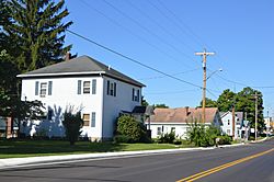
Houses on Main Street
|
|

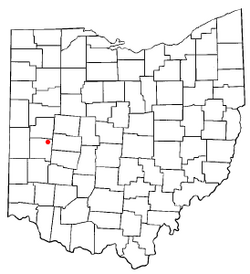
Location of Fletcher, Ohio
|
|

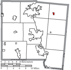
Location of Fletcher in Miami County
|
|
| Country | United States |
| State | Ohio |
| County | Miami |
| Township | Brown |
| Government | |
| • Type | Mayor with 6 Council Members |
| Area | |
| • Total | 0.31 sq mi (0.80 km2) |
| • Land | 0.31 sq mi (0.80 km2) |
| • Water | 0.00 sq mi (0.00 km2) |
| Elevation | 1,053 ft (321 m) |
| Population
(2020)
|
|
| • Total | 458 |
| • Estimate
(2023)
|
458 |
| • Density | 1,450.16/sq mi (560.32/km2) |
| Time zone | UTC-5 (Eastern (EST)) |
| • Summer (DST) | UTC-4 (EDT) |
| ZIP code |
45326
|
| Area code(s) | 937, 326 |
| FIPS code | 39-27412 |
| GNIS feature ID | 2398885 |
| Website | https://fletcherohio.us/ |
Fletcher is a small village located in Miami County, Ohio, United States. It is part of the larger Dayton area. In 2020, about 451 people lived there.
Contents
History of Fletcher
Fletcher was officially planned and laid out in 1830. The village was named after Samuel Fletcher. He was a local store owner. A post office opened in Fletcher in 1831. However, this post office closed its doors in 2010.
Geography and Location
According to the United States Census Bureau, Fletcher covers about 0.31 square miles (0.80 square kilometers). All of this area is land. Two small streams, East Branch Lost Creek and West Branch Lost Creek, flow through the village.
The village is also crossed by two important roads. These are U.S. Route 36 and State Route 589.
Population and People
| Historical population | |||
|---|---|---|---|
| Census | Pop. | %± | |
| 1850 | 246 | — | |
| 1860 | 298 | 21.1% | |
| 1870 | 306 | 2.7% | |
| 1880 | 384 | 25.5% | |
| 1900 | 375 | — | |
| 1910 | 376 | 0.3% | |
| 1920 | 369 | −1.9% | |
| 1930 | 407 | 10.3% | |
| 1940 | 436 | 7.1% | |
| 1950 | 515 | 18.1% | |
| 1960 | 569 | 10.5% | |
| 1970 | 539 | −5.3% | |
| 1980 | 498 | −7.6% | |
| 1990 | 545 | 9.4% | |
| 2000 | 510 | −6.4% | |
| 2010 | 473 | −7.3% | |
| 2020 | 451 | −4.7% | |
| 2023 (est.) | 458 | −3.2% | |
| U.S. Decennial Census | |||
2010 Census Information
In 2010, the census showed that 473 people lived in Fletcher. There were 175 households, and 133 of these were families. The village had about 1525.8 people per square mile. Most residents were White (97.0%). About 0.8% of the population was Hispanic or Latino.
Many households (40.6%) had children under 18 living with them. The average household had 2.70 people. The average family had 3.06 people. The median age in the village was 36 years old. About 27.7% of residents were under 18. About 12.9% were 65 or older.
Economy and Jobs
A factory owned by Systemax was located just east of Fletcher. This factory closed on December 31, 2012.
Agriculture is still a very important part of life in Fletcher. The local grain elevator, which used to be owned by Shepard Grain Company, is now owned by Champaign Landmark Inc. This shows that farming and related businesses are key to the area.
An old AT&T microwave radio relay tower is still standing near the village. This tower once provided jobs for people living nearby. It was used to send phone signals and data. Ohio Bell operated it before AT&T changed its business in the 1980s. The tower is now empty because new technologies like fiber-optic cables and satellites replaced its use.
Notable People from Fletcher
- Thomas Charles Munger, a well-known judge.
See also
 In Spanish: Fletcher (Ohio) para niños
 | Jessica Watkins |
 | Robert Henry Lawrence Jr. |
 | Mae Jemison |
 | Sian Proctor |
 | Guion Bluford |

