Flora, Louisiana facts for kids
Quick facts for kids
Flora
|
|
|---|---|
| Country | United States |
| State | Louisiana |
| Parish | Natchitoches |
| Elevation | 115 ft (35 m) |
| Time zone | UTC-6 (Central (CST)) |
| • Summer (DST) | UTC-5 (CDT) |
| ZIP code |
71428
|
| GNIS feature ID | 547366 |
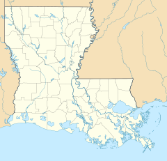
Flora is a small, unincorporated community located in Natchitoches Parish, Louisiana, United States. Being "unincorporated" means it's not an official city or town with its own local government. Instead, it's part of the larger parish area. Flora is known for its quiet, rural setting.
This community is situated near where Louisiana Highway 120 and Louisiana Highway 478 meet. It's just south of the larger city of Natchitoches. Flora is also close to a historic area called Isle Brevelle and the famous El Camino Real de los Tejas National Historic Trail.
What is Flora, Louisiana?
Flora is a small place where people live, but it doesn't have its own city government. It's part of Natchitoches Parish, which is like a county in other states. This community is a peaceful spot in the central part of Louisiana.
Where is Flora located?
Flora is found in the state of Louisiana, in the southern United States. It's in Natchitoches Parish, which is one of Louisiana's oldest areas. The community sits near two important roads, Louisiana Highway 120 and Highway 478.
How far is Flora from Natchitoches?
Flora is located to the south of the city of Natchitoches. Natchitoches is a much larger and older city, known for its history and charm. Flora is close enough to Natchitoches for residents to easily visit for shopping or services.
What waterways are near Flora?
Flora is surrounded by several natural waterways. These include Old River, Bayou Brevelle, and Kisatchie Bayou. Bayous are slow-moving streams or rivers found in flat, low-lying areas, often in the southern United States. They are important for the local environment.
What is the Natchitoches Micropolitan Statistical Area?
Flora is part of something called the Natchitoches Micropolitan Statistical Area. This is a special term used by the government to describe a small city or town and the nearby areas that are closely connected to it. It helps show how different communities are linked together for things like jobs and daily life.
Exploring Flora's Surroundings
Flora is located in a region rich with history and natural beauty. Its proximity to significant landmarks makes it an interesting place to learn about.
What is the El Camino Real de los Tejas National Historic Trail?
One of the most exciting features near Flora is the El Camino Real de los Tejas National Historic Trail. This trail is a very old route that was used for hundreds of years. It was a major pathway for explorers, missionaries, and traders. They traveled between Mexico and Louisiana, long before the United States was formed.
Why is the El Camino Real important?
The El Camino Real de los Tejas National Historic Trail is important because it tells a story of early American history. It shows how different cultures, like Spanish and Native American, interacted. The trail helped shape the development of the region, including parts of Louisiana and Texas.
What is Isle Brevelle?
Isle Brevelle is another historic area near Flora. It's a unique community known for its strong cultural heritage. The people of Isle Brevelle have a rich history, often connected to French and African American traditions. It's a place where history and culture are deeply preserved.
 | Aaron Henry |
 | T. R. M. Howard |
 | Jesse Jackson |


