Fort-Coulonge facts for kids
Quick facts for kids
Fort-Coulonge
|
|
|---|---|
|
Village municipality
|
|

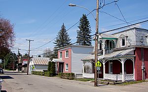
Rue Principale in Fort-Coulonge
|
|

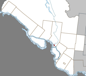
Location within Pontiac RCM
|
|
| Country | Canada |
| Province | Quebec |
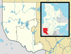
| Region | Outaouais |
| RCM | Pontiac |
| Constituted | December 15, 1888 |
| Area | |
| • Total | 3.17 km2 (1.22 sq mi) |
| • Land | 2.96 km2 (1.14 sq mi) |
| Population
(2021)
|
|
| • Total | 1,312 |
| • Density | 443.9/km2 (1,150/sq mi) |
| • Pop (2016-21) | |
| • Dwellings | 605 |
| Time zone | UTC−05:00 (EST) |
| • Summer (DST) | UTC−04:00 (EDT) |
| Postal code(s) |
J0X 1V0
|
| Area code(s) | 819 |
Fort-Coulonge is a small village in western Quebec, Canada. It is located where the Coulonge River meets the larger Ottawa River. This village is a special place in the Pontiac Regional County Municipality because most people here speak French. In fact, about 79.6% of its residents speak French as their first language.
Fort-Coulonge is also famous for being close to the Félix-Gabriel-Marchand Bridge. This bridge is Quebec's longest covered bridge, and it's actually in the nearby area of Mansfield-et-Pontefract.
Contents
History of Fort-Coulonge
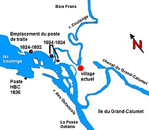
The area where Fort-Coulonge is located has a long history. It was first settled by members of the d'Ailleboust family in the late 1600s. They used "sieur de Coulonge" as a special title. Some records say Nicholas d'Ailleboust de Manthet stayed here in 1694. Others suggest the d'Ailleboust family founded a settlement as early as 1650. After New France was taken over, the settlement was left empty for a while.
The Trading Post Era
In 1784, the area became active again. The North West Company built a fort here, which they called Fort Coulonge. This fort was a trading post. Trading posts were places where European traders exchanged goods with Indigenous peoples.
When the Hudson's Bay Company took over in 1821, they continued to use Fort Coulonge. It was an important trading hub on the Ottawa River until 1828. People at the post traded with the local Ojibwe and Algonquins. They also did some farming.
After 1830, more settlers arrived in the area. The trading post slowly changed into a general store. The large farm connected to the post was sold in 1844. In 1855, the store was sold to Thomas Taylor, who was its last clerk. The original buildings were still there in 1873, but they burned down by 1892.
Birth of the Village
The village of Fort-Coulonge grew a few kilometers downriver from the old trading post. This happened because of the lumber industry. In 1843, George Bryson Sr. built the first sawmill in the region. This sawmill brought more people to the area, leading to a permanent settlement.
Two years later, in 1845, the Saint-Pierre-de-Fort-Coulonge mission was started. This was a religious community. Then, in 1863, the Presbyterian church of St. Andrews was established. The village also got its own post office in 1853. By the mid-1860s, about 500 people lived in Fort-Coulonge.
Growth and Development
A wooden church was built in 1873, but it later burned down. A new brick church was built in its place in 1884. In 1886, the Pontiac Pacific Junction Railway reached Fort-Coulonge, connecting it to other towns by train.
Fort-Coulonge officially became a municipality in 1888. This means it became its own local government. It separated from the larger Township Municipality of Mansfield. John Bryson, who was George Bryson's son, became the first mayor.
The lumber industry continued to be very important for Fort-Coulonge. In the 1890s and early 1900s, many logging camps in the Ottawa Valley needed places for workers to stay. Because of this, Fort-Coulonge had at least five hotels by the 1890s. The town's mills produced a lot of cut lumber and wood pulp.
Passenger train service to Fort-Coulonge stopped in 1958. Cargo train service ended in 1977.
Population Information
In 2021, the population of Fort-Coulonge was 1,312 people. This means there were 1,312 people living in the village. This number was a bit lower than in 2016, when the population was 1,433.
The village has a land area of about 2.96 square kilometers. This means that in 2021, there were about 443.9 people living in each square kilometer.
 | Victor J. Glover |
 | Yvonne Cagle |
 | Jeanette Epps |
 | Bernard A. Harris Jr. |


