Coulonge River facts for kids
Quick facts for kids Coulonge River |
|
|---|---|

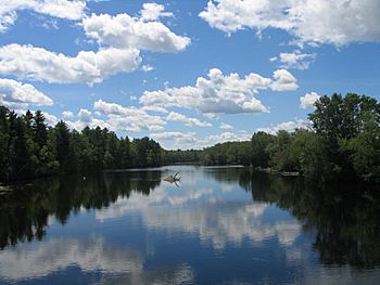
Coulonge River near Pont Davidson
|
|
| Native name | Rivière Coulonge |
| Country | Canada |
| State | Quebec |
| Region | Outaouais |
| Physical characteristics | |
| Main source | Lac au Barrage Lac-Pythonga, Quebec 47°12′30″N 76°53′30″W / 47.20833°N 76.89167°W |
| River mouth | Ottawa River Fort-Coulonge, Quebec 45°51′44″N 76°45′54″W / 45.86222°N 76.76500°W |
| Length | 240 km (150 mi) |
| Depth |
|
| Basin features | |
| Progression | Ottawa River→ Saint Lawrence River→ Gulf of Saint Lawrence |
| River system | Ottawa River drainage basin |
| Basin size | 5,060 km2 (1,950 sq mi) |
| Tributaries |
|
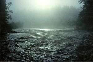
The Coulonge River is a wild and beautiful river in western Quebec, Canada. It is one of many important rivers that flow into the Ottawa River. The Coulonge River is about 240 kilometers (149 miles) long. Its water comes from a large area of 5,060 square kilometers (1,954 square miles).
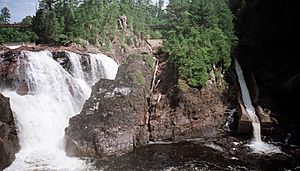
The river flows mostly southeast from its start at Lac au Barrage. This lake is found in the La Vérendrye Wildlife Reserve. The river ends when it joins the Ottawa River at Fort-Coulonge. Along its path, the river drops about 260 meters (853 feet). A big part of this drop, 48 meters (157 feet), happens at the amazing Grandes or Coulonge Chutes. These chutes are about 15 kilometers (9 miles) upstream from where the river meets the Ottawa River.
The Coulonge River is very popular for whitewater canoeing. People who love adventure often group it with the Dumoine and Noire Rivers. These three rivers are in the same area and have similar exciting whitewater sections. All three rivers flow into the Ottawa River within 105 kilometers (65 miles) of each other.
You can find the historic Félix-Gabriel-Marchand Bridge crossing the Coulonge River near Fort-Coulonge. This bridge was built in 1898. It is 148.66 meters (487.7 feet) long. It is also the longest covered bridge in all of Quebec.
Exploring the Coulonge River's Past
The Coulonge River got its name from Nicholas d'Ailleboust de Manthet. He was a French explorer from the late 1600s. He spent a winter nearby on Allumettes Island in 1694-1695.
Long ago, Native North Americans used the Coulonge River as a travel route. Later, French-Canadian traders called coureurs des bois used it. They traveled the river to trade furs. In 1784, a company called the North West Company built a trading post. It was at the mouth of the river and was named Fort Coulonge. In 1821, this post became part of the Hudson's Bay Company.
In 1835, a Scottish businessman named George Bryson bought rights to cut timber. He owned thousands of acres of forest in the area. This included the land around the Grandes Chutes. In 1843, Bryson built a sawmill near the river's mouth. This led to people settling there and forming the village of Fort-Coulonge.
To move cut timber safely past the big waterfalls, Bryson built a special slide. It was a wooden chute filled with water. This slide was 915 meters (3,002 feet) long. It helped logs get past the falls and a 750-meter (2,461-foot) gorge below. In 1923, a new concrete chute replaced the old wooden one.
For nearly 150 years, people cut down trees around the Coulonge River in winter. When spring came, the ice melted. This allowed for huge log drives. These log drives were very important for the economy of the Ottawa Valley. They helped the region grow from the early 1800s to the mid-1900s.
The very last spring log drive in Canada happened on the Coulonge River. This was in 1982. Today, timber from smaller logging operations is moved by trucks. They use a network of dirt roads throughout the Coulonge River valley.
In 1994, a new hydro-electric dam and power station were built. This was at the top of the Grandes Chutes. This means the Dumoine River is now the last major river in the area that still flows freely.
 | George Robert Carruthers |
 | Patricia Bath |
 | Jan Ernst Matzeliger |
 | Alexander Miles |


