Fostoria, Kansas facts for kids
Quick facts for kids
Fostoria, Kansas
|
|
|---|---|

|
|
| Country | United States |
| State | Kansas |
| County | Pottawatomie |
| Elevation | 1,473 ft (449 m) |
| Time zone | UTC-6 (CST) |
| • Summer (DST) | UTC-5 (CDT) |
| ZIP code |
66426
|
| Area code | 785 |
| FIPS code | 20-24050 |
| GNIS ID | 476080 |
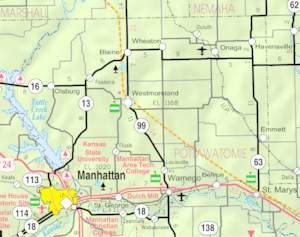
Fostoria is a small, quiet place in Pottawatomie County, Kansas, in the United States. It's not a city or town with its own government, but rather an unincorporated community. You can find Fostoria about 6 miles (10 km) east of a place called Olsburg. Even though it's small, Fostoria has its own post office with the ZIP code 66426.
A Look at Fostoria's Past
Fostoria has a simple history. One of the first important things to happen there was the opening of its post office. This happened way back in 1884. The post office helped connect the community with the rest of the world.
Weather in Fostoria
The weather in Fostoria changes with the seasons. Summers are usually hot and humid, meaning the air can feel sticky. Winters are generally mild, not too cold, but sometimes they can be cool. This type of weather is known as a humid subtropical climate. On climate maps, you might see it labeled as "Cfa."
Learning and Schools
The students in Fostoria attend schools that are part of the Blue Valley USD 384 public school district. This district helps make sure kids in the area get a good education.
 | Jackie Robinson |
 | Jack Johnson |
 | Althea Gibson |
 | Arthur Ashe |
 | Muhammad Ali |


