
Galrigs Loch (South Ayrshire) facts for kids
Quick facts for kids Galrigs Loch |
|
|---|---|

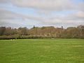
The site of the loch looking towards Dundonald and the castle
|
|
| Lua error in Module:Location_map at line 420: attempt to index field 'wikibase' (a nil value). | |
| Location | Dundonald, South Ayrshire, Scotland |
| Type | Old freshwater loch |
| Primary inflows | Broomhill Burn |
| Primary outflows | Dundonald Burn |
| Basin countries | Scotland |
| Max. length | 800 yards (730 m) |
| Max. width | 600 yards (550 m) |
| Average depth | Shallow |
| Islands | None |
The Galrigs Loch was a large freshwater lake in South Ayrshire, Scotland. It was located between Newfield and Dundonald. People drained it in the early 1700s.
Contents
History of Galrigs Loch
The Galrigs Loch was a natural lake. It formed in a 'Kettle Hole' after glaciers melted. The lake was fed mostly by the Broomhill Burn, rain, and water from nearby fields.
Today, the Broomhill Burn no longer flows into the old loch site. The area is now covered in rushes and is not good for grazing animals. The land still floods during winter. You can also see old rig and furrow marks, which show where the land was once farmed.
Land Ownership and Names
The land around the loch had different names over time, like 'Gariggis' and 'Galriggis'. In 1578, William Wallace owned these lands. Later, the Craufurd family took over. By the 1860s, the Finnie family, who were important in the coal industry, owned the land.
The names of places like Lochend, Lochside, and Mosside still remind us of the old loch.
How People Used the Loch Area

It seems no watermills were built near Galrigs Loch. Maps from the mid-1800s show only a farm called Lochend or Lochside near the old lake site. A lane with hedges on both sides led to it from Newfield Mains.
The loch might have been used for curling. However, Newfield House had its own curling pond, which opened in 1856. A curling competition called the 'Finnie Kettle' also took place at Newfield. The prize was a "tea kettle shaped like a curling stone." This competition still happens today at an indoor rink.
Near where Newfield House used to be, you can still find parts of a stone dam and a sluice. These were used to control water.
Old Maps and the Loch's Disappearance
Blaeu's map from 1654 is based on a survey from around 1604. It shows the loch as a large body of water. It shows one stream flowing out of the loch, which went into the Dundonald Burn and then into the River Irvine. The map also shows a farm called Mosside on the loch's edge.
This 1654 map is the last one to show the loch. This means the lake was likely drained in the early 1700s. Roy's map from 1747 does not show a clear loch, but it does show a place called 'Lochend'. Later maps from the Ordnance Survey call the farm 'Lochside'.
Why the Loch Was Drained
The draining of Galrigs Loch might have started in the 1700s. At that time, people like Alexander Montgomerie, 10th Earl of Eglinton, were working to improve their farmlands. Other landowners followed their lead.
More draining work might have happened in the 1740s. This was done to give jobs to Irish workers during the Irish potato famines. Many drainage projects also took place after World War I. This was when many soldiers came home and needed work.
Interesting Facts About the Area
The land and big house of Galrigs were renamed 'Newfield' around 1723. This was done by Captain Lawrence Nugent. He had fought in a battle called Neufeldt (Newfield) in Germany. However, Galrigside Farm kept its old name. So, the draining of Galrigs Loch does not seem to be linked to the name 'New Field'.
Lochside Farm is now just ruins, but maps show it was still standing in the 1980s.
Images for kids
-
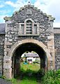
Pend and dovecot at Newfield Mains Farm.
-
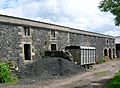
The south range of nearby Newfield Mains Farm.
-
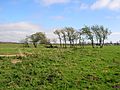
The site of Lochside Farm.
-
The old lane leading to Newfield Mains.
-
A view of Newfield Mains from the loch site.
-
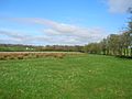
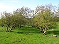
The eastern shoreline of the old loch.


