
River Irvine facts for kids
Quick facts for kids Irvine |
|
|---|---|

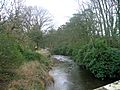
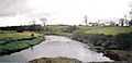
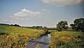
The Irvine near Drybridge
|
|
| Country | Scotland |
| Physical characteristics | |
| Main source | near Loudoun Hill, Drumclog, Lanarkshire, Scotland 810 ft (250 m) |
| River mouth | Firth of Clyde |
| Length | 42 km (26 mi) |
| Basin features | |
| Basin size | 380 km2 (150 sq mi) |
The River Irvine (Scottish Gaelic: Irbhinn) is a river that flows through southwest Scotland. It starts high up on the border of Lanarkshire and Ayrshire, near Loudoun Hill and Drumclog. This starting point is about 810 feet (250 m) above sea level. The river flows westward for about 29+1⁄2 mi (47.5 km). It acts as a natural border between the old areas of Cunninghame and Kyle. Eventually, the River Irvine reaches the sea at Irvine Harbour, joining the Firth of Clyde and flowing into Irvine Bay near the town of Irvine. Many smaller streams, called tributaries, flow into the River Irvine. Some of these streams even mark the boundaries between different parishes and districts.
Contents
River Irvine: Where It Starts and Flows
The River Irvine actually begins from two main streams. One starts in a wet, marshy area called a moss at Meadow-head. This is on the eastern edge of the Loudoun parish in Ayrshire. The other stream begins about a mile east in the Avondale parish of Lanarkshire, close to the historic Drumclog battlefield.

About 2.75 miles (4.43 km) after entering Ayrshire, the Glen Water joins the Irvine from the north. The Glen Water is actually the longer and bigger of the two starting streams. It begins at Crosshill in Renfrewshire, about 1 mile (1.6 km) north of the East Ayrshire border. It flows 6 miles (9.7 km) south, picking up five smaller streams along the way, before meeting the Irvine.
After the Glen Water joins, the Irvine flows past the town of Darvel on its right. Then, about 1.75 miles (2.82 km) further, it passes Newmilns. Another 2.25 miles (3.62 km) downstream, it flows past Galston on its left. The Hagg Burn joins the river before Galston, flowing past the old ruined Arclowden Castle. The Burnanne also joins the Irvine at Galston.
About 1.25 miles (2.01 km) below Galston, the Polbaith Burn joins from the north. A little further, the Cessnock Water joins from the south. About 3 miles (4.8 km) later, the river passes Kilmarnock and Riccarton on opposite sides. Here, the Kilmarnock (or Marnock) Water flows into the Irvine from the right.
About 4 miles (6.4 km) downstream, the Carmel Water joins from the right. Then, 2.5 miles (4.0 km) further, the Annick Water also joins from the right. The river then flows 1.5 miles (2.4 km) northwest, passing through the town of Irvine. It then suddenly turns south and widens into a basin about 0.75 miles (1.21 km) wide. The Garnock River joins at the northwest end of this basin. The Irvine then connects to the Firth of Clyde through a narrow opening.
Historical records show that the River Irvine's path changed in 1758. This change affected where the Annick Water joined the Irvine. The Irvine is affected by tides as far upstream as the Shewalton nature reserve, which is about 0.5 miles (800 m) past where the Annick Water joins.
The main rivers and streams that flow into the Irvine are the Glen Water, Polbaith Burn, Cessnock Water, Kilmarnock Water, Carmel Water, Annick Water, and the Garnock.
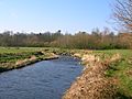
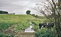
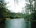
River Views in 2007
-
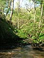
The River Irvine and the view of the viaduct near Laigh Milton Mill.
-
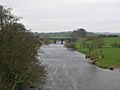
Looking upriver from Laigh Milton viaduct.
-
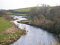
Old Rome from Gatehead's bridge over the Irvine.
-
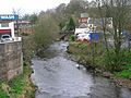
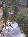
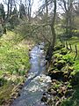
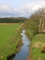
Near the old Shewalton house and estate, Drybridge.
-
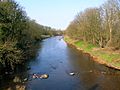
Near the old Shewalton house and estate, Drybridge.
-
Girtrig mill weir at Drybridge.
-
Near the site of Maid Morville's mound at Holmford, Dreghorn.
-
Near the site of Maid Morville's mound at Holmford, Dreghorn.
-
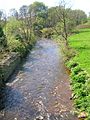
The river at Newmilns.
-
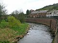
The river at Newmilns.
-
The river from the Muckle Brig in Galston.
-
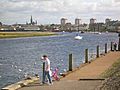
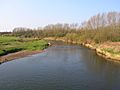
The River Irvine at the harbour with the town in the background.


How Rivers Change Course
Rivers often change their paths over time. For example, the Kilmarnock Water used to flow slightly more to the west through Howard Park in Kilmarnock. The old river bank can still be seen. It's said that a local lord, Lord Boyd, deliberately moved the river to gain more land, as the river marked the boundary of his property.
An old story says that St. Winnan of Kilwinning made the River Garnock change its course. The river supposedly failed to provide fish for one of the saint's friends!
Historically, the Garnock, Annick, and Irvine rivers did not join in the same way they do now. Maps from the early 1600s and mid-1700s show the Garnock flowing directly into the sea, about 2 miles (3.2 km) from the Irvine's mouth. The Annick did not flow into the Garnock back then, and the Ardeer peninsula was an island. Later, the sea came right up to Irvine town, with ships loading at Seagate, which is now 0.5 miles (0.80 km) from the sea.
The Earl of Eglinton also changed the path of the Lugton Water where it flowed through what is now Eglinton Country Park.
Country Estates and the River
Many large country estates were built along the River Irvine and its tributaries. These estates often changed the river's path through landscaping and engineering. For example, weirs (small dams) were built, and riverbanks were strengthened. Some of these estates include Loudoun Castle (now a ruin), Cessnock House, Lanfine House, and Craig House. Other estates like Craufurdland and Dean Castle were on the tributaries.
Ancient Sites Near the River


A large stone called the 'Carlin's Stone' is located near the Carlin Burn in East Ayrshire. 'Carlin' is an old word for an 'old hag' or witch. This stone is also known as the Witch's or Hag's Stone. It was once a popular place to visit, with a footbridge leading to it.
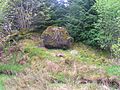
The Grannie Stane is another ancient boulder near Irvine. It's thought to be either a rock left behind by the Ice Age or the last stone from a stone circle. Other stones were removed after the Irvine weir was built in 1895, but protests saved this one. The Grannie Stane can be seen when the water level is low.
The River at Work
Many weirs, dams, and fords (shallow places to cross) were built on natural stone dikes in the rivers. These dikes naturally raised the water level.
In 1880, in Kilmarnock, Glencairn Mill stood near Riccarton, using water from a long channel called a lade. Richardland Brewery also used the river's water. A slaughterhouse, a foundry, a forge, and an engine works were all located by the river or its tributaries, using the water for their operations.

Many mills once operated along the Annick Water. Only Cunninghamhead Mill still stands today (2006). The Corsehill Mills in Stewarton were powered by the Corsehill Burn. Scroaggy or Fairliecrevoch Mill was a waulk mill for preparing cloth, operating until the 1960s. Downstream from Cunninghamhead, there was a sawmill and a corn mill in Perceton.

At Galston, the Burnanne joins the Irvine. This tributary was known for its beautiful jasper pebbles, which are semi-precious stones. These stones were collected, cut, and polished to make jewelry.
The gravel from riverbeds was also an important source of income. It was sold for various uses, like filling drainage ditches, surfacing driveways, and for gardening.
In 1656, a report to Oliver Cromwell said that the port of Irvine was "clogged up and almost choked with sand." By 1760, Irvine was the third most important port in Scotland.
The River at Play
The River Irvine and its tributaries are used for many fun activities, like sailing, swimming, and fishing. There are also lovely walks along the riverbanks. Irvine Harbour is no longer a commercial port. It now hosts private pleasure boats and is home to part of the Scottish Maritime Museum, where you can see old ships.
Fishing is very popular. Angling clubs work to maintain the river, monitor fish, report pollution, and help with conservation. In the early 1600s, it was noted that salmon were plentiful in the River Irvine. Today, the river has brown trout, sea trout, salmon, eels, minnows, and sticklebacks.
Rivers have always been places for swimming. A favorite swimming spot called the 'Toad Hole' is on the Annick Water near Ramstane. Other spots include the 'Auld dam' and the 'Munt' on the Corsehill Burn at Stewarton.
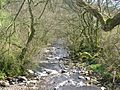
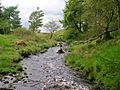
Tributaries of the Irvine – 2007
-
The Annick Water looking upstream from Chapeltoun Bridge.
-
The path near Anderson's Plantation with the Annick Water to the right.
-
The Annick Water from Bourtreehill.
-
A view of the Brackenburn at Little Alton, with Hillhead Wood in the background.
-
A view of the Burnanne near its confluence with the Irvine at Galston.
-
A view of the Burnanne at Bank Wood Bridge.
-
A view near the site of St Anne's Holy Well.
-
The Carlin Burn at Hareshawmuir Water, below Cameron's Moss, East Ayrshire.
-
The Carlin Stone beside the Carlin Burn.
-
The Carmel Water in Kilmaurs at the inflow of the Mack Well (see the rings in the water) near the 1824 Auld Brig.
-
The Chapel Burn near its confluence with the Annick Water.
-
The Clerkland Burn at Clerkland West farm, looking towards Dunlop.
-
The Clerkland Burn at Clerkland House, looking towards Stewarton.
-
The Cowlinn Burn from Clonbeith joining the Lugton Water at Montgreenan Castle.
-
A view of the old Glazert ford at Haysmuir, with the Bonshaw woodlands in the background.
-
The Glazert Rivulet and the Annick Water at Water Meetings with Rashillhouse Farm on the Horizon.
-
A view of the Glazert at Gallowayford.
-
The River Garnock downstream from Dalgarven Mill.
-
A view of the Glen Water at Law Bridge in Darvel.
-

The Hag Burn at Jocklan Bridge near Galston.
-
The Hareshawmuir Water near the confluence with the Carlin Burn. Note the iron support for the old footbridge across to the Carlin Stone.
-
The Lugton Water at Lugton overlooking the old Caldwell estate.
-
The Lugton Water at Caven Bridge, Montgreenan, North Ayrshire.
-
The Templeton Burn in the Armsheugh Plantation near Crookedholm.


Holy Waters and Mineral Springs
The Burnanne, or Burnawn, joins the Irvine at Galston. It is named after St Anne, who is said to be the mother of the Virgin Mary. The St Anne's holy well is marked on maps and flows into the Burn Anne. Maria's well is on the Byrebank Burn, within the Loudoun Castle grounds, and flows into the Irvine.
A mineral spring called the Bloak Well was found near Stewarton, North Ayrshire. It was discovered because pigeons from nearby areas flocked there to drink. In 1833, Mr. Cunningham of Lainshaw built a house over the well, as its mineral water was considered valuable. The water from this well flows into the Glazert, which then joins the Annick Water.

The Chapel Burn starts near the Anderson Plantation and is marked as a chalybeate (iron-rich) or mineral spring. People believed that mineral water could cure various illnesses. The main spring here has been covered, and its water is piped into the burn, which flows into the Annick Water at Chapeltoun Bridge.
In the woods of Chapeltoun House, there is a Monk's Well (also called a fountain or spring). It looks like a Victorian or Edwardian decoration, with a large stone that has a cross carved into it. The spring water used to flow through a spout into a metal bowl. It's believed to be connected to an old chapel.

The Monk's or Mack's or Maaks Well at Kilmaurs flows into the Carmel Water. Legend says that when a local lord tried to stop people from using the well, it dried up until he changed his mind. It has flowed continuously ever since.
Near the Kilmaurs-Glencairn church in Kilmaurs, there is a wooded area that was once an orchard. The Tour streamlet joins the Carmel nearby. Before it joins, you can find an old, arched well called the Lady's Well. Its water is always cool and refreshing.

Saint Inans well is close to the River Irvine, on a path next to the Old Irvine Parish churchyard. It has the date 839 AD carved on it.

A religious settlement and chapel dedicated to Saint Mary once stood at the Thurgartstone near Dunlop's Chapel Crags. This Christian site was built to replace older pagan traditions. Although the monastic cells, chapel, and graveyard are now gone, the name 'St. Marys' is still used for nearby modern homes. The Holy Well still exists, with nearby houses pumping water from its source. In 1856, water for baptisms in Dunlop Kirk was still taken from this Holy Well.
St Winnans Well flows into the Garnock at Kilwinning, and people believe its holy waters have healing powers.
Waterfalls and Weirs

Many waterfalls are found on the higher parts of the rivers. Some are named, like Lizzie's Linn on the Lugton Water. The Cessnock Water has several waterfalls as it flows through the Carnell estate. Many waterfalls are formed by natural dykes, which are harder rocks that resist erosion. Other notable waterfalls are on the Polbaith Burn, Fenwick Water, Glen Water, and Burn Anne.

Weirs were often built to raise the water level and direct water to power mills. A unique use of a weir was at Lainshaw House. Two weirs and a change in the Annick Water's path created a large area of water for waterfowl, hunting, and simply for its beauty.
Witches and the River
It is said that a deep pool in the River Irvine at Irvine was called the 'Witches Plumb'. People believed it was used to test suspected witches. They would be thrown into the water to see if the Devil would save them. This pool was near the old Gallows Knowe.
Crossing the River
Stilts
Sometimes, people used stilts to cross the river. For example, Thomas Raeburn of Holmhead regularly crossed the River Irvine on stilts to get to his job as a gardener. At nearby Barleith, stilt races across the river were sometimes part of Mayday celebrations, leading to much laughter as people fell into the water.
Ferries and Carries

Rivers are natural barriers. At Irvine port, ferry boats carried passengers across to Ardeer. Further upstream, fords (shallow crossings) and stepping stones were common. These could be dangerous, quickly becoming deadly if heavy rain fell upstream.
In the past, people were sometimes carried across rivers, usually at fords, for a fee. One story tells of a rich farmer who had his servant girl carry him across the river to church every Sunday. He eventually married her. She carried him to their wedding, but refused to carry him back, and never did again!
In the 1930s, a leisure boat service was set up at Irvine, but it didn't last long.
Stepping Stones
Many stepping stones are shown on old maps, such as near Shawhill Farm, crossing to Templetonburn. Stepping stones were also located downstream from the Chapeltoun bridge over the Annick Water. The owner of Chapeltoun Mains later had these removed. Stepping stones also existed near Waterside Farm on the Irvine at Galston.
At Kaimshill House near Crookedholme, there were stepping stones and a ford called 'Struthers Steps'. These crossed the River Irvine below Struther's Farm. By 1931, the Struthers stepping stones had disappeared, but some at Haining on the Cessnock Water still remained.
The name 'Puddle ford' at Irvine might come from 'holy steps' ('pas de Dieu'). This refers to the stepping stones used by Carmelite Priory monks to reach their church. Some of these stones might have come from an old stone circle, of which the Grannie stone is the last remaining piece. In 1836, horses were not allowed to use the Puddleford to protect access to the Puddly Well, a public water source.
Fords


Toll road authorities often disliked fords because people could cross for free, unlike bridges where a toll was charged. To prevent this, they sometimes deepened the fords to force people to use the toll bridges. Because of this, very few fords remain in Ayrshire. Even the Dean Ford on the Kilmarnock Water no longer exists, as a bridge was built over it around 2016. Further up the Fenwick Water, the Bringan Ford still survives. Many fords eventually had wooden footbridges built alongside them. The 'suspension bridge' footbridge at the Dean Ford was famous for collapsing on its opening day due to too many sightseers! It was replaced with a stronger one, but has since been removed.

A ford called 'Romford' or 'Rome Ford' was located where the modern road bridge crosses the Irvine at Gatehead. This name might come from an old Scots word meaning 'to rumble violently'. Another idea is that 'Room' or 'Rome' meant a small farm. The current bridge was built around 1870, replacing an older one.
The Hurling Ford was at Shewalton, crossing the river to the Warrix Holm.
Pedestrian and Road Bridges
Bridges were built where they were most needed or where funds were available. Many older bridges were built by local landowners. For example, Chapeltoun Bridge over the Annick Water was built in the 1850s to replace an older ford.


In 1875, it was noted that the old bridge connecting Kilmarnock and Riccarton over the Irvine was built in 1726. The stones for this bridge were carried in the first wheeled carts used in Ayrshire, as sledges were used before then due to poor roads. A new bridge was built here around 1845.
The pedestrian 'Auld Brig' (Old Bridge) across the Carmel Water in Kilmaurs was built in 1824 to replace stepping stones. It has been the site of two deaths.

Murdock's iron bridge over the Carmel Water near Kilmaurs-Glencairn church was believed to be the oldest iron bridge in Scotland. It was built with money collected from people across Ayrshire. The council replaced it with a wooden bridge around the year 2000.
The bridge over the Craufurdland Water at Craufurdland was built using parts from the old battlements of Cessnock Castle.
In 1931, a bridge at Haining over the Cessnock was made of two wires, one above the other. People crossed by holding the top wire and walking on the lower one, one person at a time.
Railway Bridges
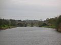
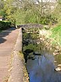
Railways came to this part of Scotland very early. One of the first was the stone viaduct over the Irvine at Laigh Milton, part of the Kilmarnock and Troon Railway. It has four arches and, although not used since 1846, it was restored in 1996. This railway carried steam locomotives nine years before the famous Stockton and Darlington Railway. It is thought to be the world's first passenger steam railway. The viaduct itself, built in 1811, is the oldest surviving railway viaduct in Scotland and one of the oldest in the world.
Many railways that crossed the river were mineral lines, used for transporting coal or other materials. These lines often had a busy but short life. The bridges built for these lines are still visible today.
Taming the River
To prevent floods, the Kilmarnock Water has been changed where it flows through Kilmarnock. Its banks have been raised, and there are gates that close automatically. The Irvine itself has a large flood prevention system at east Holmes Wetlands near Galston. Here, when the water level rises too high, the river is directed into its old floodplains, protecting Kilmarnock. A similar project on the River Cessnock was underway in 2007. Many parts of the other rivers have also been straightened or have raised banks to stop them from flooding.
River Wildlife

Meadow Plants
Many of the wet meadows along the river are rich in pignut, a plant related to parsley. Children used to dig up its small, potato-like roots for a snack. Hemlock water dropwort grows in wet areas, but it's best to avoid it as it's poisonous. Large butterbur leaves are also found; in the past, they were used to wrap butter for market.
Water ragwort is a plant that was brought to Scotland and grows in tall stands along the Garnock. Himalayan balsam and giant hogweed are other introduced plants. Giant hogweed should never be touched, as its sap can cause severe skin blistering and scarring.
The Stewarton Flower, or pink purslane, is common in wet areas. It has white or pink flowers. It seems the white variety was first introduced in the Stewarton area, and the common pink variety spread later.
The alder trees along the riverside are sometimes cut back, even by accident by anglers. Alders grow well in wet soil and have special root nodules that help enrich the soil.
The trees near the rivers were not just for looks; they were crops. Their wood was used for building and fencing. Millers needed strong wood like beech or hornbeam for the gears in their mill machinery. It's interesting to know that a few hundred years ago, the Ayrshire landscape looked very different, with very few trees or hedges.
Birds, Fish, and Other Animals
The river and its banks are home to many animals. You might see kingfishers, owls, herons, moorhens, and mallard ducks. Other birds include ravens, rooks, treecreepers, and buzzards. Mammals like roe deer, mink, moles, shrews, grey squirrels, hares, hedgehogs, foxes, badgers, and otters also live here. Migrating Canada and Graylag Geese often visit the nearby fields in winter.
The river's water quality is generally good now. This is shown by the presence of freshwater limpets, shrimps, leeches, caddisfly larvae, and water snails. In the early 1600s, salmon were very common in the River Irvine. Today, the river system has brown trout, sea trout, salmon, eels, minnows, lampreys, and sticklebacks. The brown color of the Irvine in places like Darvel and Newmilns is not from pollution. It's simply organic material washed out of the peat bogs where the river starts. Freshwater mussels, which were once hunted for their pearls, can be found in parts of the Glazert and Garnock.
Micro History
In the early 1600s, it was said that the area around Stewarton and along the Irvine's banks was so densely populated that "well travelled men" had never seen so many houses so close together, even in walled cities. It was so populous that if a bell rang for a few hours at night, 3,000 strong, well-armed men could gather.
Shewalton Sand Pits is a Scottish Wildlife Trust nature reserve located on the River Irvine.
A lot of effort has gone into building walls along the banks of many rivers and streams to prevent erosion. At Chapeltoun on the Annick Water, even the Chapel Burn's bed is paved with stones. This drystone walling was important for keeping the riverbanks stable.


The Brackenburn near Kilmaurs has been incorrectly named the Garrier on maps since the 1860s. Usually, when streams join, the larger one gives its name to the river downstream. However, sometimes the name changes completely, like the Kilmarnock Water forming from the Fenwick and Craufurdland Waters. Sometimes, a river's flow is reduced due to changes upstream. For example, the Garrier used to drain Buiston Loch. After the loch was drained for farming, the Garrier became seasonal, even though it kept its name when joined by other year-round streams.
Being a miller in the past wasn't always easy. Some people believed it was wrong to use water artificially, thinking that changing a river's course was against God's plan. They thought old mills were built where they could work naturally, without sinful changes to the water flow.
New farm drainage work in the 18th and 19th centuries had a big impact on water courses. Millers often complained that they no longer had enough water to turn their waterwheels.
The weir at Dalgarven on the River Garnock is made of carefully placed boulders. These create a natural millpond to provide enough water for the mill wheel. The monks of Kilwinning Abbey chose this site for Dalgarven Mill because of this natural feature.
The Automatic tide signalling apparatus at Irvine harbour is unique. It was invented and patented by Martin Boyd, the Irvine harbour master, in 1905 and opened in 1906.
In February 2009, the Lochrig or Lochridge Burn was badly polluted by diesel oil from a train that derailed near Peacockbank farm, Stewarton. Despite efforts to contain it, the pollution eventually reached the River Irvine.
Images for kids
-
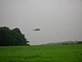
A Royal Navy search and rescue helicopter searching the Annick Water at Lambroughton in 2007.

