
Chapeltoun facts for kids
Chapeltoun is a historic estate located by the Annick Water river in East Ayrshire, Scotland. This area is known for its farms, especially for producing milk and Dunlop cheese, and for the special Ayrshire cows.
Contents
Chapeltoun: A Historic Scottish Estate
Chapeltoun has a long and interesting history, stretching back hundreds of years. The name itself tells a story, changing from "Templeton" to "Chapelton" over time. This area was once connected to powerful groups like the Knights Templar and later the Knights Hospitaller, who were famous for their military and charitable work.
Knights Templar and Chapelton's Past
Long ago, land was often given out by powerful lords to their followers in exchange for military help. This system was called feudalism. The word "ton" meant a small settlement or farm with a fence or wall around it. The name "Templeton" likely came from land given to the Knights Templar, a famous group of warrior monks.
In 1312, the Knights Templar were disbanded, and their lands in Scotland were given to the Knights of St. John. Today, the Knights of St. John are known for running the St John Ambulance service. These "temple-lands" were special because they didn't have to pay taxes to the local church, making them very valuable.
Maps from the 1600s, like Pont's Map of 1604, show a place called "Templeton" in this area. By 1775, maps started showing "Chapel" or "Chapelton." This name change probably happened after the temple-lands were no longer officially owned by the Knights of St. John, or when the land was divided up.
There was a chapel here, possibly dedicated to the Virgin Mary. After the Scottish Reformation, when Scotland became Protestant, this chapel was left to fall into ruins.
The Mysterious Chapel Hill

People believe there were two chapels in the area, but it's more likely there was just one, located at Chapelton. In 1846, foundations of an old chapel were found on a farm called Chapelton (now Chapeltoun Mains). No clear records of this chapel have survived.
The chapel was probably small and was abandoned during the Protestant Reformation led by John Knox (1514-1572). It wasn't marked as a ruin on old maps, but sometimes as a small house, suggesting a "Chapel House" existed nearby.
The "Chapel Hill" is a circular, artificial hill. Around 1850, a Mr. J. McAlister made it taller by moving earth onto the top. While doing this, he found human bones near the bottom, suggesting it was once a burial ground. Some stones found looked like they had been exposed to fire, leading some to think the old chapel might have been destroyed by fire.
This mound is also known as the "Jockey's Cap" because its shape looks like a jockey's hat, and horse races used to be held in the field below. Another name for it is the "Monk's Graveyard," which supports the idea that it was a burial site. Experts believe it's one of the best-preserved Bronze Age burial mounds in Ayrshire.
A "Moot Hill of Chapelton" is mentioned in old records. A moot hill was a place where local meetings or justice courts were held. This suggests the Chapel Hill might have had a second use as a meeting place, or that a separate moot hill existed nearby.
Old Farms and Houses of Chapeltoun
The area around Chapeltoun has several old farms and properties, each with its own history.
Chapeltoun Mains Farm
The farm now known as Chapeltoun Mains was once simply called Chapelton. It changed its name when a new, grander house was built at Laigh Chapelton, which then took the name Chapelton. The field in front of the farm is called "Black Sawneys Park," possibly referring to its dark, rich soil from river floods.
Wattshode: A Lost Property
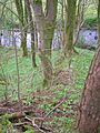
A small property called Wattshode or Wattshod is mentioned in old legal papers from 1723. It was located on about 4 acres of land. Today, only a shelter belt of trees and some nettle growth (which often grows where old buildings stood) suggest its former location.
Mosshead and Bogflat Farms
A farm originally called Chapelton Moss Head is now just "Mosshead." All traces of its buildings have disappeared. Bogside cottage, another old property, is also gone, with only building debris left.
Bogflat Farm was rebuilt around 2004. In 1941, during World War II, a bomb fell nearby, creating a crater that filled with water. A pipe was laid from this crater to the well at Bogflat, providing water. An old stone from Bogflat, now in the Stewarton Museum, shows that a dwelling existed there as early as 1711.
Parkside and Cankerton Hollow
Parkside, also known as Windwaird, was a house on the road to Stewarton. It's no longer there. A "park" in old times meant an enclosed area of land.
Cankerton or Cankerton Hollow was another farm. The name "canker" usually refers to a plant disease, but its meaning here is unclear.
High Chapeltoun Farm
High Chapeltoun first appears on maps in 1829. It had a limekiln, used to burn limestone for building materials or to improve farm fields. The Wilson family farmed here in the 1700s.
Building the New Chapeltoun House
.jpg)
The old Chapelton House was likely demolished around 1908, possibly after a fire. Some of its old stones were used to build the new house and garden walls.
The current Chapeltoun House was designed in 1908 by architect Alexander Cullen for Hugh Neilson, who owned the Summerlee Iron Company. The family moved in around 1910. The house was built with a special type of plaster called "harling," which was originally left unpainted.
Hugh Neilson enjoyed playing the bagpipes, and his music could be heard drifting from the estate gardens. He also loved curling, a sport played on ice, and would invite locals to play on his curling pond.
The Chapeltoun Estate was never very large, including Chapeltoun Mains, High Chapeltoun, and a few other farms and cottages. After being a private home, the mansion house was used as an insurance company headquarters and a hotel before becoming a family home again around 2004.
Gardens and Nature at Chapeltoun
The gardens of Chapeltoun House have interesting features. A decorative stone piece, called a finial, from the old house or a well, is now used as a garden ornament. Finials were sometimes believed to deter witches! An old stone lintel (a beam over a doorway) from the garden has the initials "S.M. 1740," possibly from the Miller family.
The Monks' Well

In the woods of Chapeltoun House is the Monks' Well, a spring or fountain. It looks like a Victorian or Edwardian garden feature, with a large stone that has a cross carved on it. Water used to flow from a spout into a metal bowl. It's thought that this well was connected to the old chapel.
The Curling Pond and Ha-Ha
The curling pond was built by the Neilsons on the site of the old driveway to the original house. It's said to have been built where the old stables once stood.
Near the river, there are remains of a footbridge that once crossed the Annick Water. On the other side of the river, there's a large wall with a wide ditch in front of it. This is a "ha-ha," a type of sunken fence. It's designed to create a boundary without blocking the view, making it look like the garden extends into the surrounding landscape. Ha-has were common in grand country estates to keep animals out of formal gardens without needing visible fences.
Chapeltoun Bridge
The Chapeltoun Bridge crosses the Annick Water and is a well-designed sandstone bridge. Old maps show "stepping stones" just downstream from here. The Annick Water's name might come from a Gaelic word meaning "little water."
Old Roads and Milestones
In the past, roads were just tracks, and people used sledges or pack animals because wheeled vehicles were rare. The Stewarton to Torranyard road was a "turnpike," meaning it was a toll road where people had to pay to use it. You can still see signs of this in farm names like Crossgates and Gateside.
"Turnpike" comes from the wooden bars used as gates, which looked like the "pikes" used as weapons. These roads helped standardize the length of a mile, which used to vary greatly. Tolls on roads were abolished in 1878.
During the Second World War, many milestones (stones marking distances along roads) were buried to prevent them from being used by invading troops. This happened all over Scotland, and the milestones near Chapeltoun are still missing, presumed buried.
Local History and Interesting Facts
Mineral Springs and Healing Waters
There are several mineral springs in the area. One, called the Bloak Well, was discovered around 1800 because pigeons flocked there to drink. Mr. Cunningham of Lainshaw built a house over the well in 1833, as the water was believed to have healing properties.
The Chapel Burn also rises from a chalybeate (iron-rich) spring. In the past, mineral water was popular for its supposed health benefits, believed to cure various ailments. Another mineral well, called Saltwell, is located nearby.
The March Dyke Dispute
An interesting historical record tells of a dispute between James Wilson of High Chapelton and John Miller of Laigh Chapelton in 1820. They went to court over a "march dyke" (a boundary wall or fence) built between their lands. The document shows that such boundaries were new and sometimes caused arguments. John Miller's father had reluctantly agreed to the dyke, but didn't pay for it. Later, John sued James for cutting down trees from the dyke. This shows how important land boundaries were, even leading to family disagreements!
Images for kids
-
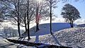
The Chapel Hill, Chapeltoun
-
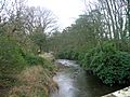
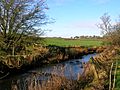
The Annick Water looking upstream from Chapeltoun Bridge.
-
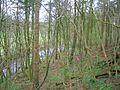
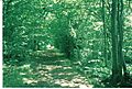
The Bonnie wood o' Lambroughton.
-
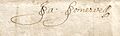
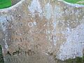
Signature of John Somervell of Kennox, 1728.
-
Signature of James Miller who inherited Chapelton, then called Laigh Chapelton, in 1775.
-
Signature of John Miller who inherited Chapelton, then called Laigh Chapelton, from his father James in 1789.
-
Signature of Col. Charles Somerville McAlester Esq. who purchased Chapelton on 6 February 1827.
-
Signature of James Somerville McAlester Esq. of Kennox who inherited Laigh Chapelton from his father Charles on 25 April 1848.
-
Signature of John Cunningham, Ironmaster of Barrhead who purchased the Chapelton estate from James McAlester Esq. in May 1874.
-
Signature of John Archibald Brownlie of Monkcastle purchased the Chapelton estate on 21 November 1888 from John Cunningham, Ironmaster, Barrhead.
-
Signature of John Faulds who lived at Mosshead in 1728.
-
1848 Signature on vellum of William Cuninghame Esq. of Lainshaw, superior of the Barony of Lainshaw.
-
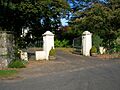
The gates and remains of the old lodges at Kennox House in 2007.
-
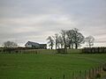
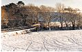
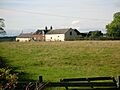
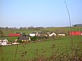
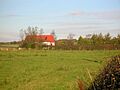
Chapeltoun Mains farm with 'Black Sawney's Park' in front, taken from near Chapeltoun Bridge.
-
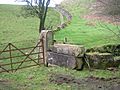
The shelter belt and site of Wattshode.
-
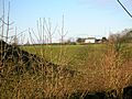
Bottoms point Crevoch Farm.
-
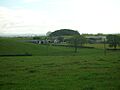
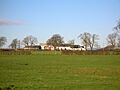
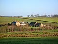
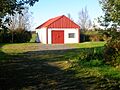
Bogflat Farm.
-

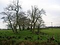
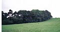
Cankerton, previously Cakertonhole, from near Wattshode.
-
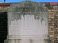
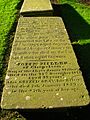
The gravestone of Mary Reid of Chapelton & Stacklawhill.
-
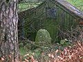
The old gateposts from the demolished Chapelton House lying near the Chapel Hill. The drystone dykes in the background were built with stones from the old house.
-
Archibald Brownlie's headed notepaper of 1895.
-
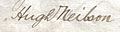
Signature of Hugh Neilson who purchased Chapelton in 1899 from J Archibald Brownlie of Monkcastle, Banker.
-
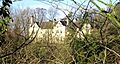
Chapeltoun House
-
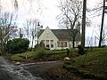
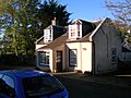
The lodgehouse at Chapeltoun House.
-
A view of the Chapelton ha-ha.
-
The Coach Road through the policies near the Lainshaw ha-ha prior to the creation of the SWAT paths.
-
Chapeltoun Bridge and the River Annick from Chapel Hill.
-
The woods above the River Annick as viewed from East Lambroughton.
-
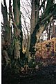
The Coppiced Boundary March beech Tree.
-
A view of the old Glazert ford at Haysmuir, with the Bonshaw woodlands in the background. One rail is left of an old footbridge.
-
A Milestone near Stewarton in East Ayrshire.
-
Crossgates Farm.
-
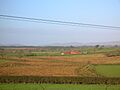
Bloomridge farm from Bogside.
-
A view of Gill Mill farm in 2007.
-
A view of Kirkmuir farm in 2007.
-
Righead Toll overlooking the old Picken's Park in Lainshaw.
-
A view across Canaan Park to Bickethall farm in 2007.
-
Freezeland smallholding.
-
Freezeland smallholding.
-
A view of Bloak Well, now called Salt Well in 2006.
-
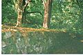
The Chapel Burn near its confluence with the Annick Water.
-
The Wilson family grave at the Laigh Kirk in Stewarton.
-
The Miller family grave at the Laigh Kirk in Stewarton.
-
Part of the disputed Lambroughton March.
-
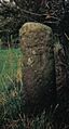
A small standing stone in Firbank Plantation.
-
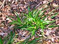
Greater woodrush (Luzula sylvatica)in spring.


