River Garnock facts for kids
Quick facts for kids River Garnock |
|
|---|---|
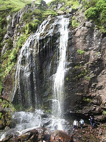
"The Spout"
|
|
| Country | Scotland |
| Region | North Ayrshire |
| Physical characteristics | |
| Main source | Hill of Stake, Ayrshire, Scotland 522 m (1,713 ft) |
| River mouth | Firth of Clyde, Irvine |
| Length | 39 km (24 mi) |
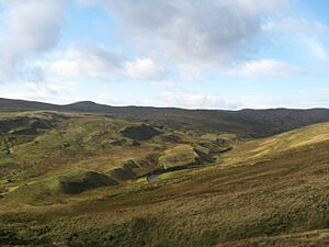
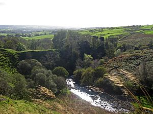
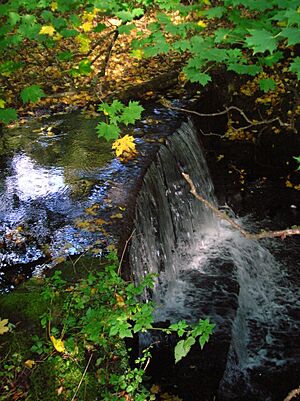
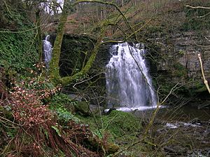
The River Garnock (Scottish Gaelic: Gairneag / Abhainn Ghairneig) is a river in Scotland. It starts high up on the Hill of Stake in the Clyde Muirshiel Regional Park. This is called its source. A short distance from its source, the river forms the Spout of Garnock. This is the highest waterfall in Ayrshire.
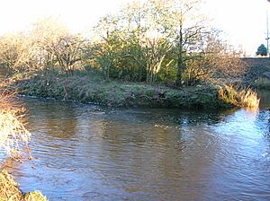
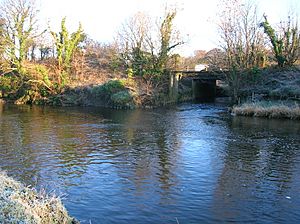
The Garnock flows for about 20 miles (32 km). It passes through towns like Kilbirnie, Glengarnock, Dalry, and Kilwinning. Finally, it joins the River Irvine at Irvine Harbour. This meeting point is called a confluence.
The Garnock has several smaller rivers and streams that flow into it. These are called tributaries. The main ones are the Rye Water, the Caaf Water, and the Lugton Water.
Contents
Garnock Valley: A Scenic Area
The term "Glen Garnock" refers to a specific, short part of the river. Here, the river flows through a steep valley. You can see the old Glengarnock Castle ruins overlooking this section.
"The Garnock Valley" is a much larger area. It covers parts of North Ayrshire. This wider area includes the towns of Beith, Dalry, and Kilbirnie.
Garnock Estuary: A Home for Wildlife
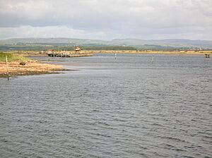
The Garnock River meets the River Irvine at Irvine Harbour. Here, they form a large estuary. An estuary is where a river meets the sea, and fresh water mixes with salt water. This estuary is one of the best examples of its kind in the UK.
This area is very important for wildlife. It is a SSSI. This means it's nationally important for certain bird species. These include eider ducks, red-breasted mergansers, and goldeneye ducks. Thousands of migrating birds also stop here to feed in spring and autumn.
Other animals like otters and water voles live here. Many birds also nest here, such as water rails and sand martins. The estuary is also known as a Wildlife Site.
Interesting Places Along the Garnock
- The Clyde Muirshiel Regional Park is where the Garnock River begins.
- The Spout of Garnock is the highest waterfall in Ayrshire.
- Glengarnock Castle is a ruined castle. It stands on a rocky spot overlooking the river.
- Nether Mill was an old watermill in Kilbirnie. The local football team, Kilbirnie Ladeside, is named after the mill's water channel.
- Dalgarven Mill still uses water from the Garnock. It powers a large waterwheel. The mill is now a museum and a popular place to visit.
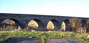
- The Kilwinning Viaduct is an old railway bridge. It is now part of the Sustrans Garnock Valley Cycleway. You can cycle across the river here.
- Eglinton Country Park is built around the old Eglinton Castle Estate. This was once home to the Earls of Eglinton.
- Saint Ninian's Isle was once an island in the river near Kilwinning. It is now part of the riverbank.
- Salmon usually arrive in the Garnock in late July. The best fishing spots are between Kilbirnie and Dalry.
- Garnock Floods is a wildlife reserve. It is managed by the Scottish Wildlife Trust in Kilwinning.
- Ardeer Factory was once the world's largest explosives factory. It is located on a natural peninsula between the Firth of Clyde and the River Garnock.
Rivers and Streams Joining the Garnock
Many smaller streams and rivers flow into the Garnock. Here are some of them:
Pundeavon Burn
The Pundeavon Burn flows from Pundeavon Reservoir. It joins the Garnock near Kilbirnie Cross.
Paduff Burn
The Paduff Burn is a small stream. It is also known as Jock's Burn. It flows through the golf course at Kilbirnie Place Golf Club.
Powgree Burn
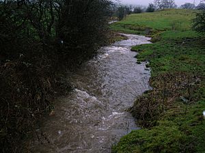
The Powgree Burn starts on Cuff Hill. It runs through Auchengree and Longbar. It then flows under the Glengarnock railway station before joining the Garnock.
Pitcon Burn
The Pitcon Burn has cut a deep gully called Swinlees Glen. This area is a Nature Conservation Site. The burn joins the Garnock near Pitcon House.
Rye Water
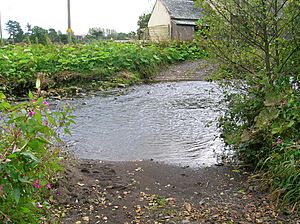
The Rye Water flows from Muirhead Reservoir. It passes through the village of Drakemyre. It joins the Garnock north of Dalry. A ford here is linked to the song "Comin' Thro' the Rye".
Putyan Burn
The Putyan Burn is formed by several smaller streams. It joins the Garnock near Putyan Cottage. It flows past Broadlie House, where an old dam still exists. This dam was part of a system that once provided electricity to the house.
Caaf Water
The Caaf Water flows from Caaf Reservoir. It passes Braidwoods Restaurant. It then enters the Lynn Glen, which has a waterfall. Finally, it joins the Garnock south of Dalry.
Bombo Burn
The Bombo Burn is a small stream, about 5 miles (8.0 km) long. It flows through the beautiful gardens of the Blair Estate. This burn creates many scenic spots. An ancient yew tree, mentioned in the Domesday Book, leans over its banks.
Dusk Water
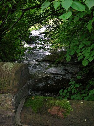
The Dusk Water starts on Cuff Hill near Beith. It flows through Barrmill. It eventually joins the Garnock upstream of Dalgarven.
Along its path, you can find old watermills. There is also Giffen House and Cleeves Cove. Cleeves Cove is a system of caves in the Dusk Glen.
Mills on the Dusk Water
- Coldstream Mill is a grain mill that can still work for demonstrations. It gets its water from a scenic mill dam.
- Giffen Mill (or Barr Mill) is a ruined grain mill in Barrmill.
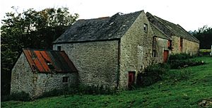
- Blair Mill was a traditional corn mill for the Blair estate. It stopped being used as a mill in the 1950s.
- Waterside Mill, downstream of the Dusk Glen, is now a home.
Lugton Water
The Lugton Water is the largest tributary of the Garnock. It flows for about 14 miles (23 km) from Loch Libo. It passes through Lugton and several parishes. The Lugton joins the Garnock just after flowing through Eglinton Country Park.
The Garnock and the Irvine: Joining the Sea
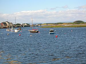
The two main rivers of North Ayrshire, the Irvine and the Garnock, meet at Irvine Harbour. Here, they flow together into the Firth of Clyde.
The silt carried by these rivers has created the Bogside mudflats. Over many years, both nature and people have changed the paths of these rivers.
A Mining Event
In 1833, something unusual happened. The surface of the Garnock River looked rough. It turned out that a part of the riverbed had fallen into coal mines below! The river water started flowing into the mines. People tried to block the hole with clay and straw, but it didn't work.
Miners were safely brought out of the mines. They saw the river dry up for almost a mile downstream. Fish were jumping everywhere! The incoming tide eventually filled the mines with water. The river then returned to its normal level. The huge weight of the water caused air to burst through the ground in many places. Large areas of land bubbled like boiling water. Water and sand shot into the air like fountains. Nearby mining villages were flooded.
Later, in 1852, the Earl of Eglinton bought the land. He dug a short canal to bypass the damaged river section. Once the old riverbed was sealed, the mines could be pumped dry. This led to the creation of the "Eglinton Iron Works."
The Legend of Saint Winning
A legend tells that Saint Winning sent his monks to fish in the Garnock. But they could not catch any fish. So, the saint put a curse on the river, saying it would never have fish. The legend says the river then changed its course to avoid the curse.
It is true that the river has changed its path over time. Old maps, like Blaeu's map from 1654, show that it used to enter the sea at Stevenston. This would have made Ardeer an island back then.
The Earls of Eglinton and Fishing Rights
In the 1770s, official documents show that Alexander Montgomery, 10th Earl of Eglinton was very protective of his fishing rights on the River Garnock. He even banned fishing on the river completely.
|
External links
 | Georgia Louise Harris Brown |
 | Julian Abele |
 | Norma Merrick Sklarek |
 | William Sidney Pittman |


