
Clyde Muirshiel Regional Park facts for kids
Quick facts for kids Clyde Muirshiel Regional Park |
|
|---|---|

Castle Semple Collegiate Church
|
|
| Lua error in Module:Location_map at line 420: attempt to index field 'wikibase' (a nil value). | |
| Location | Inverclyde, North Ayrshire and Renfrewshire |
| Area | 280 km2 (110 sq mi) |
| Governing body | Clyde Muirshiel Park Authority |

The Clyde Muirshiel Regional Park is a large natural area in Scotland. It is located on the south side of the River Clyde estuary. This park is a special place where nature is protected, and people can enjoy outdoor activities.
The park covers about 280 square kilometers (108 square miles). It stretches across parts of Inverclyde, North Ayrshire, and Renfrewshire. You can find it from Greenock in the north, down to the coast near Largs and West Kilbride. Inland, it reaches towards Dalry and Lochwinnoch.
Clyde Muirshiel Regional Park includes several important spots. These are Castle Semple Loch and its old church, the Greenock Cut Centre, Muirshiel Country Park, Barnbrock Farm, and Lunderston Bay. It also has Locherwood, Haylie Brae, and Knockendon. The name Muirshiel comes from the Scots language. It means "moorhut" in English.
Contents
How the Park Started
The land that is now Clyde Muirshiel Regional Park was once a large estate. It was mainly used for hunting grouse. Important people like Lord Howard of Glossop and the Marquess Conyngham owned parts of it. In the late 1930s and early 1940s, some land was sold to the local council and a mining company. The rest was sold to Renfrewshire County Council in 1952.
The idea of making this area a "Regional Park" first came up in 1947. But it took 20 years for the plan to move forward. In 1967, Renfrewshire County Council suggested the Renfrewshire Regional Park. They started a plan to manage about 30,000 acres (12,000 hectares) of land.
- In June 1970, Muirshiel Country Park was created.
- Castle Semple Water Park opened in 1971.
- The Cornalees Bridge Visitor Centre welcomed its first visitors in 1973.
Later, in 1975, Strathclyde Regional Council took over managing the parks. Finally, in 1990, the Clyde Muirshiel Park Authority was formed. This authority still runs the park today. It includes councillors from the three local areas and NatureScot, a group that protects Scotland's nature.
Things to Do and See

The park has many places for visitors to enjoy. There are two Country Parks with visitor centers. You can find them at Castle Semple Loch and Muirshiel. There's also the Greenock Cut Centre at Cornalees Bridge, near Loch Thom. This center helps explain the history of the Greenock Cut.
At Castle Semple, you can find an outdoor activity center. You can also rent boats and bikes there. Barnbrock has a campsite if you want to stay overnight. There are also community woodlands at Locherwoods and Outerwards.

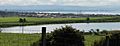
Lunderston Bay has a sandy beach and a nice walk along the coast to Inverkip. Loch Thom and the Greenock Cut offer easy walks with interesting industrial history. The old Collegiate Church and Castle Semple are great for history fans.
Many other spots, like Haylie Brae, have parking. Here, visitors can have picnics, enjoy great views, and watch wildlife. There are also many chances for hillwalking. The highest point in the park is Hill of Stake, which is 522 meters (1,713 feet) high.
Activities in the Park
Clyde Muirshiel offers fun activities all year round. You can join instructor-led sessions for:
- Sailing
- Kayaking
- Canoeing
- Raft building on the shallow Castle Semple Loch
On land, you can try:
- Archery
- Mountain biking
- Hill walking
- Orienteering (finding your way with a map)
- Navigation
- First aid training
Walking Routes
The park has many popular walking paths.
- The Johnshill Loop is about 4 kilometers (2.5 miles) long.
- The Semple Trail is about 12.5 kilometers (7.8 miles) long. Both start from the Castle Semple visitor center.
- The Greenock Cut route is about 11.5 kilometers (7.1 miles) long.
- The shorter Shielhill Glen Nature Trail is about 2.5 kilometers (1.6 miles). Both of these start from the Greenock Cut visitor center.
From the Muirshiel visitor center, you can walk:
- A 2-kilometer (1.2-mile) trail up to Windy Hill.
- A more challenging 10-kilometer (6.2-mile) circular route past the Barytes Mine to Hill of Stake.
From the Greenock Cut visitor center, you can also find:
- A tough 5-kilometer (3.1-mile) walk up Dunrod Hill.
- A 10-kilometer (6.2-mile) walk over Corlick Hill.
Cycling Paths
The Sustrans Lochwinnoch Loop Line is a great cycle track. It runs through the Castle Semple Loch visitor center. This path is about 14 miles (23 kilometers) long. It is part of the Lochs and Glens Route. It follows National Cycle Route 75 from Paisley Canal Railway Station to Johnstone. Then it goes southwest to Kilbarchan, Lochwinnoch, and Kilbirnie. It passes Castle Semple, Barr, and Kilbirnie Lochs. Since it's built on an old railway line, it's mostly flat and safe from traffic.
National Cycle Route 753 also branches off Route 75 in Gourock. It goes south to Lunderston Bay. Here, it passes toilets and picnic areas in the park. It then continues along the coast to Inverkip War Memorial. Small parts of this route are on public roads. Another section of Route 753 runs from Seamill to Ardrossan, near the park's southern edge.
Sports Clubs at the Loch
Castle Semple Loch is home to several sports clubs:
- Castle Semple Sailing Club (started in 1966)
- Castle Semple Rowing Club
- Clyde Windsurfing Club
Historic Places to Explore
The Castle Semple Collegiate Church

This old church was built near where the original Castle Semple once stood. It was a "Collegiate church." This means it was run by a group of priests called canons. They were led by a dean or provost. These churches often got money and land from wealthy people. Here, John, 1st Lord Sempill, provided support in 1504. The church is built in a late Gothic style. It has a rectangular main part, a square tower at the west end, and a three-sided apse at the east end. Today, Historic Scotland looks after this important church.
The Castle Semple Temple


On Kenmure Hill, at the north end of Castle Semple Loch, you'll find a small building called the "Temple." It's a type of decorative building called a folly. This temple is one of the few things left from the old Castle Semple estate. Colonel William MacDowell built the Temple. He also built Castle Semple House, which sadly burned down in 1935. All that remains of this 900-acre (360-hectare) estate are the folly, a walled garden, and two gate arches.
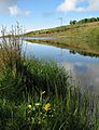
Loch Thom and the Greenock Cut

Long ago, there was a freshwater loch (lake) called Shaws Water high above Greenock. A smart engineer named Robert Thom came up with a plan. He turned this loch into a reservoir, which was later named Loch Thom after him. He also created a special water channel called an aqueduct, known as "The Cut." This whole system officially opened on April 16, 1827. The aqueduct brought a steady supply of good quality water to Greenock. It was used by homes and businesses.
"The Cut" starts at Cornalees, leaving Loch Thom. It has a footpath next to it. It flows west, then turns north, following the shape of Dunrod Hill. It continues until it is directly above Greenock at Overton. The Cut is about 5.5 miles (9 kilometers) long. It collects water from streams it crosses. It also has clever gates that automatically release extra water when needed.
Muirshiel Barytes Mine
Baryte is a type of mineral. It was found in three valleys about 2 kilometers (1.2 miles) north of Hill of Stake. People started digging for baryte in small open pits around the mid-1700s. They also dug horizontal tunnels, called adits, to follow the mineral veins. Between 1859 and 1920, about 17,678 long tons (17,962 metric tons) of baryte were produced. A track was built, running about 4 kilometers (2.5 miles) downhill to a grinding mill on the River Calder. Here, the mineral was cleaned and processed. Houses and stables for the workers were built next to the mill. A bridge over the river connected to a lane leading to Lochwinnoch. The mine stopped production in 1920.
The mine reopened in 1942. New shafts were dug, going down about 64 meters (210 feet). This gave access to better quality baryte. This mineral was sent directly to a processing plant in Glasgow. Production increased from 1,580 long tons (1,605 metric tons) in 1944 to 16,987 long tons (17,259 metric tons) in 1949. At first, there was no electricity. Workers or horses moved wagons of minerals to the surface. The miners came from Lochwinnoch and Kilbirnie.
In 1960, a new company took over. Electricity was added to power machines that lifted the wagons to the surface. The baryte was then loaded onto lorries. In 1962, Rio Tinto Zinc became the operator. A new processing plant was built downhill from the mine. It processed lower quality baryte. At this time, up to 48 people worked at the mine. This included skilled miners, assistants, and maintenance workers. Production reached its highest point in 1964. The mine finally closed on September 5, 1969.
When the country park was created, the Muirshiel Visitor Centre was built near the old mine site. The original mine workings and bridge are now ruins. A new bridge, built in the 1960s, provides access for walkers. Part of the site is used for off-road vehicle driving lessons. At the mine itself, a seismometer (a device that measures ground movement) sends information by radio to the British Geological Survey.
Images for kids
-
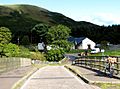
Cornalees Visitors Centre.
-
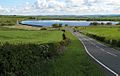
A view of Loch Thom.
-
Rottenburn Bridge.
-
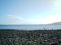
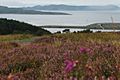
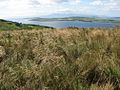
The view south from Lunderston looking towards the Isle of Arran.
-
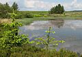
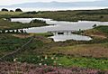
Gryfe Reservoir, Close to Loch Thom.
-
Munnoch Reservoir on the B780 road.
-
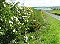
Wildflowers near Munnoch Reservoir on the B780.
-
The view from Fairlie Moor road across to Arran.
-
The view of Arran & Cumbrae from the hills above Largs.
-
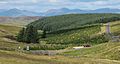
Mill Glen Reservoir on the B780.
-
Busbie Muir Reservoir on the B780.
-
Glenburn Reservoir on the Fairlie Moor road (Fairlie to Dalry), about 1 kilometer (0.6 miles) east from the A78 road.
-
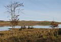
A view of Loch Thom in autumn.
-
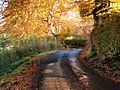
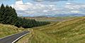
The Brisbane Glen road in autumn.
-
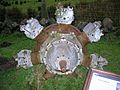
The engine from an Avro Anson which crashed on the north side of Dunrod Hill is now displayed in the Cut Centre car park.
-
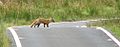
A fox near Loch Thom


