Garafía facts for kids
Quick facts for kids
Garafía
|
|||
|---|---|---|---|
|
|||
 |
|||
| Country | |||
| Autonomous community | |||
| Province | |||
| Island | |||
| Area | |||
| • Total | 103.00 km2 (39.77 sq mi) | ||
| Elevation | 400 m (1,300 ft) | ||
| Population
(2018)
|
|||
| • Total | 1,626 | ||
| • Density | 15.786/km2 (40.887/sq mi) | ||
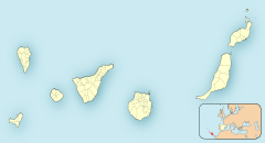
Garafía is a municipality located on the island of La Palma in the Canary Islands, Spain. It's in the northwest part of the island. Garafía is surrounded by two large ravines: Franceses to the north and Izcagua to the south. The Izcagua ravine starts near the Roque de los Muchachos, a famous mountain.
The main town and administrative center of Garafía is called Santo Domingo. Here you'll find the City Council. The local church, Iglesia de Nuestra Señora de La Luz, is very old, dating back to the 1500s. Garafía has a long coastline, stretching about 25.5 kilometers. It covers an area of 103 square kilometers, making it the largest municipality on La Palma. In 2018, about 1,626 people lived here. Santo Domingo, the capital, is located about 400 meters above sea level.
Contents
Climate and Nature
Garafía has different climates depending on how high up you are.
- Coastal areas: These areas are usually mild, but often windy. The strong trade winds make the sea quite choppy.
- Middle altitudes (Medianías): This area is between 400 and 1200 meters above sea level. It's much cooler here, especially at night. The land in this zone is very fertile.
- High peaks: The highest parts, like the Roque de los Muchachos, are very cold. It can even snow here in winter! It's amazing to see the white snow against the dark volcanic rocks.
This varied climate helps many plants grow. You can find beautiful flowers like the violet of Garafía and blue and rose tajinastes blooming along the roads to the mountain tops.
Farming and Local Products
The fertile land in the middle altitudes is great for farming. Farmers grow cereals, fruits, and tubers (like potatoes). There are also large areas of fresh pastures where animals, especially goats, graze. The goat milk is used to make a special artisan cheese. This cheese is famous for its golden color and unique taste, which comes from being carefully smoked by local craftspeople.
Roque de los Muchachos Observatory
Garafía is home to the Roque de los Muchachos, the highest point on La Palma, reaching 2,426 meters above sea level. This mountain is very important because it hosts a major astronomical observatory. It's part of the Canary Island Astrophysics Institute (IAC).
The Roque de los Muchachos is one of the best places in the Northern Hemisphere to observe the stars. This is because of its high location and the clear, stable air currents from the Atlantic Ocean. Many telescopes from different countries are located here, making it a global hub for astronomy.
History and Villages
In the 1960s, Garafía had almost 5,000 residents. However, many people moved away over the years, and today the population is much smaller. This happened partly because it was hard to travel to and from Garafía. Roads were built much later than in other parts of the island.
Because of this isolation, Garafía has kept its natural and rural charm. This makes it a great place for rural tourism. There are many old paths and trails that are perfect for hiking and exploring the beautiful scenery.
Garafía is also special because a large part of its land is protected. Almost one-third of the municipality is made up of natural protected areas, like the Natural Monument Coast Hiscaguán and the Special Guelguén Natural Reserve. This shows how much the local government cares about protecting nature. There are also special laws to protect the sky quality for the astronomical observatories.
The municipality includes several small villages and districts:
- Llano Negro
- Cueva de Agua
- Don Pedro
- Franceses
- Santo Domingo
- Hoya Grande
- Juan Adalid-El Mudo
- Catela
- El Palmar
- Roque del Faro
- El Tablado
- Las Tricias
- El Castillo
- La Mata
Land and Landscape
The higher parts of Garafía are covered with pine forests. Above the tree line, there are open, treeless areas. The central parts, around the villages, have farmland and natural landscapes, including almond trees and vineyards. The coastline is rugged with steep cliffs and deep gorges, but you can still reach the sea at several points.
Village Life
For a long time, the villages in Garafía were very isolated. Until the 1960s, people mostly used donkey paths to get around. Now, good, winding asphalt roads connect the area, making it much easier to visit.
Like many rural areas, Garafía's population has been decreasing. Young people often move away because traditional farming and rural life don't always offer enough income.
Tourism and Activities
Garafía is a fantastic place for outdoor activities. It has a great network of marked walking paths, lush green areas, and amazing views. The steep, forested hillsides are cut through by barrancos (gorges), which add to the dramatic scenery. It's a perfect spot for walking and hiking adventures!
Gallery
See also
 In Spanish: Garafía para niños
 | Selma Burke |
 | Pauline Powell Burns |
 | Frederick J. Brown |
 | Robert Blackburn |


