Garden Home–Whitford, Oregon facts for kids
Quick facts for kids
Garden Home-Whitford, Oregon
|
|
|---|---|

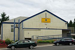
Recreation Center in Garden Home
|
|

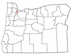
Location of Garden Home-Whitford, Oregon
|
|
| Country | United States |
| State | Oregon |
| County | Washington |
| Area | |
| • Total | 1.55 sq mi (4.02 km2) |
| • Land | 1.55 sq mi (4.01 km2) |
| • Water | 0.00 sq mi (0.01 km2) |
| Elevation | 256 ft (78 m) |
| Population
(2020)
|
|
| • Total | 7,081 |
| • Density | 4,571.34/sq mi (1,765.06/km2) |
| Time zone | UTC-8 (Pacific (PST)) |
| • Summer (DST) | UTC-7 (PDT) |
| FIPS code | 41-27825 |
| GNIS feature ID | 2408277 |
Garden Home-Whitford is a special kind of community in Washington County, Oregon, United States. It's called a census-designated place (CDP). This means it's an area that the government counts for population, but it's not officially a city or town. It includes two neighborhoods: Garden Home and the smaller Whitford area. These places are located in the hills southwest of Portland, close to Beaverton. In 2020, about 7,081 people lived here.
History of Garden Home-Whitford
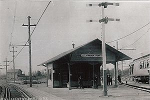
The community of Garden Home got its own post office way back in 1882. It was already a known place when the Oregon Electric Railway was built in the early 1900s. This railway even named one of its train stations "Garden Home."
Whitford was another station on the same railway line. It was located where Allen Road and Scholls Ferry Road (also known as Oregon Route 210) are today. The name "Whitford" was created by combining parts of the names of two investors from New York who helped fund the railway: W.A. White and A.C. Bedford.
Around 1920, the railway stopped running, and the Whitford station closed. Unlike Garden Home, which grew into a suburb of Portland, Whitford is mainly remembered today because of a middle school in the Beaverton School District that carries its name.
Geography
Garden Home-Whitford covers an area of about 1.55 square miles (4.02 square kilometers). According to the United States Census Bureau, all of this area is land.
Population Information
In 2020, the total population of Garden Home-Whitford was 7,081 people.
Back in 2000, there were 6,931 people living in the area. There were 3,048 households, which means groups of people living together in homes. About 26.3% of these households had children under 18 living with them. Many households were married couples living together, while others were single people or single-parent families.
The population included people of all ages. About 21.1% of the people were under 18 years old. About 13.1% were 65 years old or older. The average age of people living in Garden Home-Whitford was 40 years old.
See also
 In Spanish: Garden Home-Whitford para niños


