Garvaghullion facts for kids
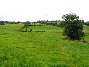
Garvaghullion is a small area of land, known as a townland, located in County Tyrone, Northern Ireland. It is part of a larger historical region called the barony of Omagh West. It also belongs to the civil parish of Longfield East. This townland covers an area of about 640 acres.
Contents
What Does Garvaghullion Mean?
The name Garvaghullion comes from the Irish words Garbhach an Chuilinn. This means "rough place of the holly." It suggests that this area might have been a bit wild and had many holly bushes long ago.
People Who Lived Here
We can look back at history to see how many people lived in Garvaghullion.
- In 1841, there were 204 people living in 38 houses.
- By 1851, the population had changed to 157 people living in 33 houses. This shows a decrease in the number of people and homes during that time.
Discovering Ancient History
Garvaghullion holds a special secret from the past! It has one important Scheduled Historic Monument. This is a very old wooden trackway from the Bronze Age.
- It was found deep inside Garvaghullion Bog, about 9 kilometers (5.6 miles) northwest of Omagh.
- The trackway was buried more than 1.5 meters (about 5 feet) deep in the bog.
What is Garvaghullion Bog?
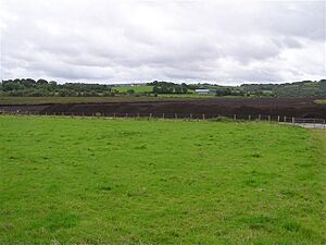
Garvaghullion Bog is a type of wetland called a "raised bog." These bogs are found along the valley of the Fairy Water river.
- In the 1990s, people started taking out "peat" from this bog. Peat is a type of soil made from decayed plants, often used for fuel or gardening.
- By 1997, only a small part of the original bog was left. Even though this remaining part is very important for science, it has not been officially protected.
 | Tommie Smith |
 | Simone Manuel |
 | Shani Davis |
 | Simone Biles |
 | Alice Coachman |


