Gaston, South Carolina facts for kids
Quick facts for kids
Gaston, South Carolina
|
|
|---|---|

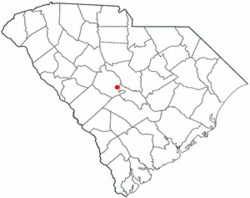
Location of Gaston, South Carolina
|
|
| Country | United States |
| State | South Carolina |
| County | Lexington |
| Area | |
| • Total | 5.32 sq mi (13.76 km2) |
| • Land | 5.32 sq mi (13.76 km2) |
| • Water | 0.00 sq mi (0.00 km2) |
| Elevation | 499 ft (152 m) |
| Population
(2020)
|
|
| • Total | 1,608 |
| • Density | 302.54/sq mi (116.82/km2) |
| Time zone | UTC-5 (Eastern (EST)) |
| • Summer (DST) | UTC-4 (EDT) |
| ZIP code |
29053
|
| Area code(s) | 803, 839 |
| FIPS code | 45-28780 |
| GNIS feature ID | 1231307 |
| Website | www.gastonsc.org |
Gaston is a small town located in Lexington County, South Carolina, in the United States. In 2010, about 1,645 people lived there. It is part of the larger Columbia Metropolitan Statistical Area. This means it is connected to the bigger city of Columbia.
Contents
History of Gaston
Gaston got its name from the Gaston family. They were important in the early days of the town.
Geography and Location
Gaston is found near the banks of Bull Swamp Creek. The town covers an area of about 3.4 square miles (8.8 square kilometers). All of this area is land, with no large bodies of water inside the town limits.
Population Changes
The number of people living in Gaston has changed over the years. Here is a quick look at how the population has grown:
- In 1980, there were 960 people.
- By 1990, the population grew to 984.
- In 2000, it reached 1,304 residents.
- By 2010, the town had 1,645 people.
- In 2020, the population was 1,608.
Who Lives in Gaston? (2020 Census)
The 2020 United States census helps us understand the different groups of people living in Gaston.
| Race | Number of People | Percentage |
|---|---|---|
| White (not Hispanic) | 1,043 | 64.86% |
| Black or African American (not Hispanic) | 228 | 14.18% |
| Native American | 6 | 0.37% |
| Asian | 10 | 0.62% |
| Pacific Islander | 1 | 0.06% |
| Other/Mixed | 100 | 6.22% |
| Hispanic or Latino | 220 | 13.68% |
In 2020, there were 1,608 people living in Gaston. These people lived in 684 households, and 458 of these were families.
Economy of Gaston
The town of Gaston mostly gets its money from business fees. This means that local businesses pay certain amounts to the town.
Education in Gaston
Students in the Gaston area go to schools in two different school districts: Lexington School District 4 and Lexington School District 2.
Schools located right in Gaston include:
- Frances Mack Intermediate
- Sandhills Middle School
Other schools that Gaston students attend are in nearby towns like Swansea, South Carolina and West Columbia. These include:
- Early Childhood Center
- Sandhills Primary
- Sandhills Elementary
- Swansea High Freshmen Academy
- Swansea High School
Some parts of Gaston also attend:
- Airport High School in West Columbia
- Pine Ridge Middle School in Pine Ridge
- RH Fulmer Middle School in West Columbia
- Congaree Elementary School in South Congaree
Gaston also has a public library. It is a part of the Lexington County Library system. This means kids and adults can borrow books and use other resources there.
See also
 In Spanish: Gaston (Carolina del Sur) para niños
 | Calvin Brent |
 | Walter T. Bailey |
 | Martha Cassell Thompson |
 | Alberta Jeannette Cassell |

