Lexington County, South Carolina facts for kids
Quick facts for kids
Lexington County
|
|||
|---|---|---|---|
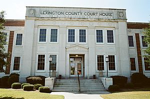
Lexington County Courthouse
|
|||
|
|||
| Motto(s):
"Grow with us"
|
|||
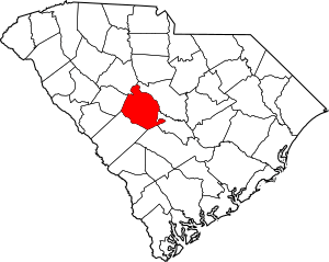
Location within the U.S. state of South Carolina
|
|||
 South Carolina's location within the U.S. |
|||
| Country | |||
| State | |||
| Founded | 1785 | ||
| Named for | Battle of Lexington and Concord | ||
| Seat | Lexington | ||
| Largest community | Lexington | ||
| Area | |||
| • Total | 757.62 sq mi (1,962.2 km2) | ||
| • Land | 699.00 sq mi (1,810.4 km2) | ||
| • Water | 58.62 sq mi (151.8 km2) 7.74% | ||
| Population
(2020)
|
|||
| • Total | 293,991 | ||
| • Estimate
(2023)
|
309,528 |
||
| • Density | 388.045/sq mi (149.8252/km2) | ||
| Time zone | UTC−5 (Eastern) | ||
| • Summer (DST) | UTC−4 (EDT) | ||
| Congressional district | 2nd | ||
Lexington County is a county in the state of South Carolina. A county is like a large area of land with its own local government. In 2020, about 293,991 people lived here. The main town and biggest community is Lexington.
Lexington County was started in 1785. It was named after Lexington, Massachusetts. This was where the Battle of Lexington happened during the American Revolutionary War. Lexington County is the sixth-most populated county in South Carolina. It is also part of the larger Columbia area. You can find it in the middle part of South Carolina, known as the Midlands.
Contents
History
Lexington County was officially created in 1785. It got its name from the Battles of Lexington and Concord. These battles were some of the first fights in the American Revolutionary War.
Geography
Lexington County covers about 757 square miles. Most of this area, about 699 square miles, is land. The rest, about 58 square miles, is water. The biggest body of water is Lake Murray. Other important waterways include the Broad River, the Saluda River, and the Congaree River.
Lexington County has different kinds of landscapes. You can find busy city areas, suburbs with many homes, and quiet countryside areas. The eastern and northeastern parts of the county have the most cities and towns. The land in the county is about 392 feet above sea level.
Climate
Lexington County gets about 47 inches of rain each year. This is more than the average for the whole U.S., which is 38 inches. It usually snows about 1 inch per year. The U.S. average is 28 inches. On average, there are 103 days with some rain or snow.
The county enjoys about 218 sunny days every year. In July, the temperature usually gets up to about 92.3°F. In January, the low temperature is around 33.2°F. The county's "comfort index" is 7.3 out of 10. A higher number means the climate is more comfortable. The U.S. average is 7 out of 10.
State and Local Protected Areas
- Congaree Creek Heritage Preserve
- Lake Murray Dam North Recreational Area
- Peachtree Rock Heritage Preserve
- Saluda Shoals Park
- Shealy's Pond Heritage Preserve
Major Water Bodies
- Congaree River
- Lake Murray
- North Fork Edisto River
- Red Bank Creek
- Saluda River
Neighboring Counties
- Richland County – to the east
- Orangeburg County – to the southeast
- Calhoun County – to the southeast
- Aiken County – to the southwest
- Saluda County – to the west
- Newberry County – to the northwest
Demographics
| Historical population | |||
|---|---|---|---|
| Census | Pop. | %± | |
| 1810 | 6,641 | — | |
| 1820 | 8,083 | 21.7% | |
| 1830 | 9,065 | 12.1% | |
| 1840 | 12,111 | 33.6% | |
| 1850 | 12,930 | 6.8% | |
| 1860 | 15,579 | 20.5% | |
| 1870 | 12,988 | −16.6% | |
| 1880 | 18,564 | 42.9% | |
| 1890 | 22,181 | 19.5% | |
| 1900 | 27,264 | 22.9% | |
| 1910 | 32,040 | 17.5% | |
| 1920 | 35,676 | 11.3% | |
| 1930 | 36,494 | 2.3% | |
| 1940 | 35,994 | −1.4% | |
| 1950 | 44,279 | 23.0% | |
| 1960 | 60,726 | 37.1% | |
| 1970 | 89,012 | 46.6% | |
| 1980 | 140,353 | 57.7% | |
| 1990 | 167,611 | 19.4% | |
| 2000 | 216,014 | 28.9% | |
| 2010 | 262,391 | 21.5% | |
| 2020 | 293,991 | 12.0% | |
| 2023 (est.) | 309,528 | 18.0% | |
| U.S. Decennial Census 1790–1960 1900–1990 1990–2000 2010 2020 |
|||
2020 Census
In 2020, the census counted 293,991 people living in Lexington County. There were 118,193 households and 81,118 families.
| Race | Number of People | Percentage (%) |
|---|---|---|
| White (not Hispanic) | 208,854 | 71.04% |
| Black or African American (not Hispanic) | 42,382 | 14.42% |
| Native American | 894 | 0.3% |
| Asian | 6,644 | 2.26% |
| Pacific Islander | 185 | 0.06% |
| Other/Mixed | 13,235 | 4.5% |
| Hispanic or Latino | 21,797 | 7.41% |
Economy

In 2022, the total value of all goods and services produced in Lexington County was about $16.7 billion. This is called the GDP. It shows how much money the county's economy makes.
Many big companies have distribution centers in Saxe Gotha Industrial Park, near Cayce. These include Amazon, Chick-fil-A, The Home Depot, and Nephron Pharmaceuticals. Near Lexington, there is a Michelin tire factory. Other companies like Shaw Industries, Southeastern Freight Lines, and Flex also have operations here.
Top Employers
These are the top employers in Lexington County as of 2021:
| Rank | Employer | Employees |
|---|---|---|
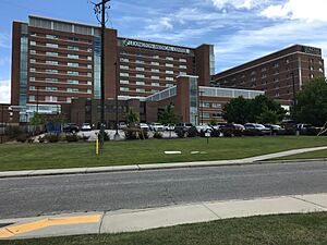
| 1 | Lexington Medical Center | 7,893 |
| 2 | Lexington School District 1 | 3,674 |
| 3 | Amazon | 3,050 |
| 4 | Wal-Mart | 2,603 |
| 5 | State government | 2,308 |
| 6 | Michelin | 2,240 |
| 7 | County of Lexington | 1,855 |
| 8 | Dominion Energy | 1,486 |
| 9 | Lexington School District 2 | 1,274 |
| 10 | Lexington School District Five | 1,136 |
Transportation
Interstates
 I-20 Interstate 20 goes from west to east. It connects Columbia to cities like Atlanta and Augusta. It also serves towns like Pelion, Lexington, and West Columbia.
 I-26 Interstate 26 runs from northwest to southeast. It links the Columbia area to Greenville-Spartanburg and Charleston.
 I-77 Interstate 77 starts in Lexington County. It goes all the way to Cleveland, Ohio. Many people traveling to or from Florida use this highway.
U.S. Routes
 US 1
US 1
 US 1 Conn.
 US 176
 US 178
 US 321
 US 378
State Routes
 SC 6
SC 6


 SC 6 Conn.
 SC 12
SC 12


 SC 12 Conn.
 SC 113
 SC 245
 SC 302
 SC 391
 SC 602
Columbia Metropolitan Airport

The Columbia Metropolitan Airport is the main airport for the Columbia area. In 2018, over 1.1 million passengers used the airport. It also handles a lot of cargo. The airport is a major hub for UPS Airlines, moving millions of pounds of freight. During World War II, the airport was called Lexington County Airport. It was used to train pilots for B-25 Mitchell planes.
Public Transportation
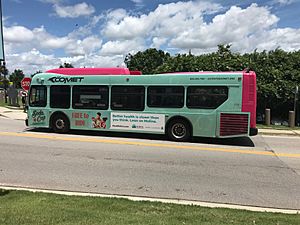
Public transportation in Lexington County is provided by COMET. This is the bus system for the greater Columbia area. In Lexington County, COMET buses run in areas like West Columbia, Cayce, and Irmo. COMET also offers a special service called DART. This service helps passengers with disabilities get around.
Education
Lexington County has five different school districts.
| Public school district name | Enrollment | Teachers | Schools |
|---|---|---|---|
| Lexington County School District One | 27,072 | 1,959 | 31 |
| Lexington County School District Two | 8,582 | 636 | 13 |
| Lexington County School District Three | 2,020 | 160 | 4 |
| Lexington County School District Four | 3,245 | 224 | 6 |
| Lexington & Richland County School District Five | 16,780 | 1,332 | 22 |
| Colleges | Enrollment | Campuses | |
| Midlands Technical College | 15,000 | 3 | |
| Public libraries | Visitors (counted once) | Branches | |
| Lexington County Public Library | 160,336 | 10 | |
Attractions

- Lake Murray
- Riverbanks Zoo
- Riverbanks Botanical Garden
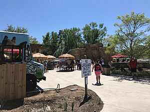
- Riverbanks Waterfall Junction and waterpark
- Lexington County Museum
- Lake Murray Dam
- Lexington County Baseball Stadium
- Cayce-West Columbia Riverwalk
- Fourteen-mile Creek Trail
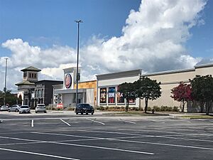
- Columbiana Centre
Communities

Cities
- Cayce (partly in Richland County)
- Columbia (mostly in Richland County)
- West Columbia
Towns
- Batesburg-Leesville
- Chapin (partly in Richland County and Newberry County)
- Gaston
- Gilbert
- Irmo (partly in Richland County)
- Lexington (county seat and largest community)
- Pelion
- Pine Ridge
- South Congaree
- Springdale
- Summit
- Swansea
Census-designated places
- Edmund
- Fairview Crossroads
- Oak Grove
- Red Bank
- Seven Oaks
- White Knoll
Ghost town
Notable Person
- Floyd Spence, a former representative for South Carolina in the U.S. Congress.
See also
 In Spanish: Condado de Lexington para niños
 | Jessica Watkins |
 | Robert Henry Lawrence Jr. |
 | Mae Jemison |
 | Sian Proctor |
 | Guion Bluford |


