Cayce, South Carolina facts for kids
Quick facts for kids
Cayce, South Carolina
|
||
|---|---|---|
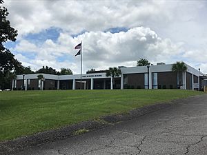
City Hall
|
||
|
||
| Motto(s):
"A new kind of city"
"Time of Life" |
||
| Country | United States | |
| State | South Carolina | |
| Counties | Lexington; Richland | |
| Area | ||
| • Total | 17.74 sq mi (45.95 km2) | |
| • Land | 16.88 sq mi (43.72 km2) | |
| • Water | 0.86 sq mi (2.23 km2) | |
| Elevation | 233 ft (71 m) | |
| Population
(2020)
|
||
| • Total | 13,781 | |
| • Density | 816.36/sq mi (315.21/km2) | |
| Time zone | UTC−5 (Eastern (EST)) | |
| • Summer (DST) | UTC−4 (EDT) | |
| ZIP code |
29033, 29169, 29170, 29171, 29172
|
|
| Area code(s) | 803, 839 | |
| FIPS code | 45-12655 | |
| GNIS feature ID | 1247197 | |
Cayce (/ˈkeɪsi/ KAY-see) is a city in South Carolina, a state in the United States. It sits along the Congaree River. In 2020, about 13,781 people lived there. This makes it the third-largest city in Lexington County.
Most of Cayce is in Lexington County. A smaller part, mostly open land, is in Richland County. Cayce is also part of the larger Columbia area. It is located in the central part of South Carolina, known as the Midlands.
Contents
Exploring Cayce's Past
The area where Cayce is now has been home to Native Americans for at least 12,000 years. Important ancient sites like the Manning Archeological Site, the SAM Site, and the Taylor Site are found here. These sites show how people lived long ago.
Early European Visits
In 1540, a Spanish explorer named Hernando de Soto came to this area. He found a large Native American village near Congaree Creek, where Cayce stands today. Later, in the late 1600s, another explorer named John Lawson visited and wrote about his journey.
Building Forts
During the time when America was still a group of colonies, the English built their first permanent fort in the Midlands here. This was in 1718. A second fort was built on the river in 1748. These forts were called Congaree Fort #1 and Congaree Fort #2. Today, they are part of a historic area called Congarees Site.
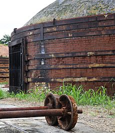
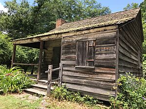
The Guignard Brick Works began operating on the west side of the Congaree River in 1803. This brick-making factory worked for almost 200 years.
A Town's Beginning
The city of Cayce includes an area that was once a town called Granby. Granby used to be an important community and even the county seat. But it was later abandoned. Cayce officially became a town in 1914. It was named after William J. Cayce, a local businessman.
In 2007, Cayce added a large area of land in Richland County. This area was mostly a floodplain, which means it could flood easily. The city had plans to build there, but they later decided it wasn't a good idea because of the flooding risk.
Cayce's Location and Land
Cayce is located in eastern Lexington County and western Richland County. The main part of the city is on the west side of the Congaree River. The Congaree River separates Cayce from Columbia, the state capital.
Cayce also shares borders with other towns. To the north is West Columbia. To the northwest is Springdale. And to the southwest is Pine Ridge.
The city covers about 17.6 square miles (45.5 km2) of land and water. Most of this area, about 16.8 square miles (43.5 km2), is land. The rest, about 0.77 square miles (2.0 km2), is water.
Fun Things to Do in Cayce
Cayce has many trails for hiking and biking. Most of its public attractions are free to visit, except for the Cayce Historical Museum.
- The Cayce Riverwalk is a paved trail about 12-mile (19 km) long. It runs along the Congaree River. The Riverwalk has different sections and places to enter. It also has signs that tell about the area's history. Sometimes, parts of the park might flood if the river gets too high.
- The 12,000-year-old park is built on land that the city says has looked much the same for thousands of years.
- The Timmerman Trail is a 3.5-mile (5.6 km) trail for hiking and biking through the woods. It is kept up by Dominion Energy, a large power company.
- The Congaree Creek Heritage Preserve has a 2.7-mile (4.3 km) hiking trail. It goes through the woods along Congaree Creek.
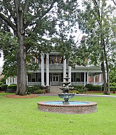
- The Cayce Historical Museum is located at the city's main complex. It has old items from Native American times, the colonial period, and the Revolutionary and Civil Wars.
- The Guignard Brick Works were started by the Guignard family in 1801. This historic site has four old brick kilns, an old brick office, and other parts of the brick factory.
Cayce's Economy
Cayce is home to Dominion Energy South Carolina. This company is part of Dominion Energy, a large energy provider. Dominion Energy provides power to millions of customers in many states.
Getting Around Cayce
Public Transportation
Bus System
Cayce has a public bus system called the COMET. It is also known as the Central Midlands Regional Transit Authority. The COMET has several bus routes in Cayce and serves the wider Columbia area.
Columbia Metropolitan Airport
The Columbia Metropolitan Airport (IATA:CAE) is the main airport for the Columbia area. It is just west of Cayce. In 2018, over a million passengers used the airport. It is also a major hub for UPS Airlines, handling a lot of cargo. During World War II, the airport was used to train pilots.
Roads and Railways
 I-26 runs through the western part of Cayce. It connects the Columbia area to other big cities in South Carolina, like Greenville and Charleston.
 I-77 starts in Cayce at I-26. It goes all the way north to Cleveland, Ohio. Many travelers use it to go to or from Florida.
 US-321 passes through the western and northern parts of Cayce. It goes east into downtown Columbia and south towards Savannah, Georgia.
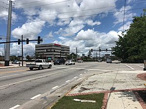
 SC-2 goes through the center of Cayce on State Street and Frink Street.
- A railroad line owned by CSX Transportation also runs through Cayce.
Learning in Cayce
Cayce is served by Lexington County School District Two.
Public Schools
| Type | School | Enrollment | Within city limits |
|---|---|---|---|
| Elementary | Cayce Elementary School | 1,058 | Yes |
| Middle | Cyril B. Busbee Creative Arts Academy | 418 | Yes |
| Middle | R. H. Fulmer Middle School | 684 | Yes |
| High | Airport High School | 1,348 | Yes |
| High | Brookland-Cayce High School | 964 | Yes |
| College | Midlands Technical College, Airport campus | 15,000 | No |
The Cayce-West Columbia branch of the Lexington County Public Library serves the people of Cayce and West Columbia.
Cayce's Population
| Historical population | |||
|---|---|---|---|
| Census | Pop. | %± | |
| 1920 | 746 | — | |
| 1930 | 1,267 | 69.8% | |
| 1940 | 1,476 | 16.5% | |
| 1950 | 3,294 | 123.2% | |
| 1960 | 8,517 | 158.6% | |
| 1970 | 9,967 | 17.0% | |
| 1980 | 11,701 | 17.4% | |
| 1990 | 11,163 | −4.6% | |
| 2000 | 12,150 | 8.8% | |
| 2010 | 12,528 | 3.1% | |
| 2020 | 13,781 | 10.0% | |
| U.S. Decennial Census | |||
Who Lives in Cayce?
| Race | Number of people | Percentage |
|---|---|---|
| White (not Hispanic) | 8,664 | 62.87% |
| Black or African American (not Hispanic) | 3,062 | 22.22% |
| Native American | 34 | 0.25% |
| Asian | 502 | 3.64% |
| Pacific Islander | 1 | 0.01% |
| Other/Mixed | 627 | 4.55% |
| Hispanic or Latino | 891 | 6.47% |
In 2020, there were 13,781 people living in Cayce. These people lived in 6,017 households, which are groups of people living together. There were also 2,794 families.
See also
 In Spanish: Cayce (Carolina del Sur) para niños
 | William L. Dawson |
 | W. E. B. Du Bois |
 | Harry Belafonte |


