West Columbia, South Carolina facts for kids
Quick facts for kids
West Columbia, South Carolina
|
||
|---|---|---|
 |
||
|
||
| Motto(s):
"Bridging Past, Present, And Future"
|
||
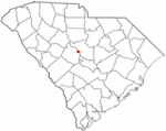
Location in Lexington County, South Carolina
|
||
| Country | United States | |
| State | South Carolina | |
| County | Lexington | |
| Government | ||
| • Type | City Council, City Administrator | |
| Area | ||
| • Total | 9.47 sq mi (24.53 km2) | |
| • Land | 9.30 sq mi (24.08 km2) | |
| • Water | 0.17 sq mi (0.45 km2) | |
| Elevation | 282 ft (86 m) | |
| Population
(2020)
|
||
| • Total | 17,416 | |
| • Density | 1,873.49/sq mi (723.38/km2) | |
| Time zone | UTC−5 (EST) | |
| • Summer (DST) | UTC−4 (EDT) | |
| Area code(s) | 803, 839 | |
| FIPS code | 45-75850 | |
| GNIS feature ID | 1251380 | |
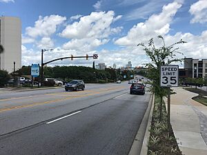
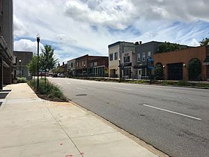
West Columbia, once known as Brookland, is a city in Lexington County, South Carolina, United States. It is a place where many people live and travel to work in nearby cities.
In 2010, about 14,988 people lived here. By 2019, the number grew to an estimated 17,998 people. West Columbia is located across the Congaree River from Columbia, which is the state capital. It is also close to downtown Columbia, including the South Carolina State House. To the south, West Columbia borders its neighboring city, Cayce.
Contents
History of West Columbia
West Columbia officially became a town in 1894. It was first named "Brookland." However, the U.S. Postal Service called it "New Brookland" because there was already another town named Brookland.
In 1936, the town's name was changed to "West Columbia." This new name helped show that the city was very close to Columbia, the state capital. Even today, you can find many businesses, churches, and a high school that still use the old names, Brookland and New Brookland.
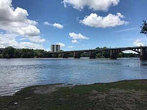
Several important places in West Columbia are listed on the National Register of Historic Places. These include the Gervais Street Bridge, the Mount Hebron Temperance Hall, the New Brookland Historic District, and the Saluda Factory Historic District. These places help tell the story of the city's past.
Geography of West Columbia
West Columbia is located to the south and west of two rivers: the Saluda River and the Congaree River.
The United States Census Bureau reports that the city covers a total area of about 6.3 square miles (16.3 square kilometers). Most of this area, about 6.1 square miles (15.7 square kilometers), is land. The remaining 0.2 square miles (0.5 square kilometers) is water, making up about 3.18% of the city's total area.
Population Information
| Historical population | |||
|---|---|---|---|
| Census | Pop. | %± | |
| 1900 | 1,089 | — | |
| 1910 | 900 | −17.4% | |
| 1920 | 1,793 | 99.2% | |
| 1930 | 1,722 | −4.0% | |
| 1940 | 1,744 | 1.3% | |
| 1950 | 1,543 | −11.5% | |
| 1960 | 6,410 | 315.4% | |
| 1970 | 7,838 | 22.3% | |
| 1980 | 10,409 | 32.8% | |
| 1990 | 10,588 | 1.7% | |
| 2000 | 13,064 | 23.4% | |
| 2010 | 14,988 | 14.7% | |
| 2020 | 17,416 | 16.2% | |
| U.S. Decennial Census | |||
As of the 2020 United States census, West Columbia had a population of 17,416 people. There were 8,315 households and 3,764 families living in the city.
Education in West Columbia
West Columbia has a public library where people can borrow books and use other resources. It is a part of the Lexington County Public Library system.
Notable People
West Columbia has been home to several well-known individuals:
- Duce Staley: A former professional football player who also became a football coach.
- Hal Jeffcoat: A former professional baseball player.
- Troy Lesesne: A professional soccer coach.
See also
 In Spanish: West Columbia (Carolina del Sur) para niños
 | Victor J. Glover |
 | Yvonne Cagle |
 | Jeanette Epps |
 | Bernard A. Harris Jr. |


