Richland County, South Carolina facts for kids
Quick facts for kids
Richland County
|
|||||
|---|---|---|---|---|---|
|
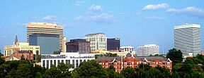
Skyline of Columbia
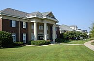
Richland County Justice Center
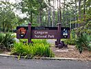
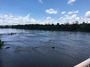
Gervais Street Bridge over the Congaree River
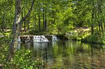
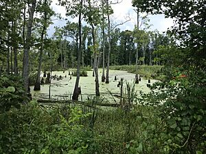
Sesquicentennial State Park
|
|||||
|
|||||
| Motto(s):
"Uniquely Urban...Uniquely Rural"
|
|||||
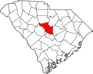
Location within the U.S. state of South Carolina
|
|||||
 South Carolina's location within the U.S. |
|||||
| Country | |||||
| State | |||||
| Founded | March 12, 1785 | ||||
| Named for | The county's "rich land" | ||||
| Seat | Columbia | ||||
| Largest community | Columbia | ||||
| Area | |||||
| • Total | 771.96 sq mi (1,999.4 km2) | ||||
| • Land | 757.28 sq mi (1,961.3 km2) | ||||
| • Water | 14.68 sq mi (38.0 km2) 1.90% | ||||
| Population
(2020)
|
|||||
| • Total | 416,147 | ||||
| • Estimate
(2023)
|
425,138 |
||||
| • Density | 549.53/sq mi (212.17/km2) | ||||
| Time zone | UTC−5 (Eastern) | ||||
| • Summer (DST) | UTC−4 (EDT) | ||||
| Congressional districts | 2nd, 6th | ||||
Richland County is a place in South Carolina, a state in the United States. In 2020, about 416,147 people lived here. This makes it the second-most populated county in South Carolina. Only Greenville County has more people.
The main city and county seat is Columbia. This city is also the capital of South Carolina. Richland County was created on March 12, 1785. It is part of the larger Columbia, SC Metropolitan Statistical Area. In 2020, the exact middle point of South Carolina's population was found in Columbia, within Richland County. The county is also home to the geographic center of the state, located southeast of Columbia.
Contents
History of Richland County
Richland County likely got its name because of its "rich land." The county was first formed in 1785. It was part of a much larger area called the Camden District. A small part of Richland County was later given to Kershaw County in 1791.
Columbia is the county seat and largest city. It is also the state capital. In 1786, state leaders decided to move the capital. They wanted it to be in a more central spot. A location in Richland County was chosen. This area is in the middle of the state. A new town was then planned out. Richland County's borders were officially set on December 18, 1799.
Cotton from nearby farms was sent through Columbia. Later, it was made into cloth there. During the Civil War, General William T. Sherman captured Columbia. His troops burned the town and parts of the county on February 17, 1865.
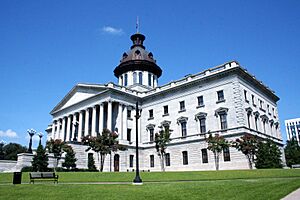
The U. S. Army returned in a friendly way in 1917. This is when Fort Jackson was built. Today, Fort Jackson is the largest training center for new soldiers in the U.S. Army. The South Carolina State House building is located in downtown Columbia.
Geography and Nature
Richland County covers about 772 square miles. About 757 square miles are land. The remaining 14.68 square miles, or 1.90%, is water. Richland County is located right in the middle of South Carolina.
Protected Natural Areas
- Congaree National Park is a special place.
- Harbison State Forest is a large forest area.
- Nipper Creek Heritage Preserve protects important natural sites.
- Riverbanks Zoo and Garden is a popular spot for animals and plants.
- Sesquicentennial State Park offers outdoor fun.
- Wateree Heritage Preserve/Wildlife Management Area helps protect nature.
Major Rivers and Lakes
- Broad River
- Congaree River
- Lake Murray
- Little River
- Saluda River
- Wateree River
Neighboring Counties
Richland County shares borders with these other counties:
- Kershaw County – to the northeast
- Fairfield County – to the north
- Sumter County – to the east
- Lexington County – to the west
- Calhoun County – to the south
- Newberry County – to the northwest
People and Population
In 2020, 416,147 people lived in Richland County. There were 153,484 households. About 90,802 families lived in the county.
The population has grown a lot over the years:
- In 1790, there were 3,930 people.
- By 1950, the population reached 142,565.
- In 2020, it was 416,147.
Economy and Jobs
Richland County has a strong economy. In 2022, the total value of goods and services produced was about $32 billion.
Top Employers
Many people work for large organizations in Richland County. Here are some of the biggest employers from 2019:
- Prisma Health (a healthcare system) – 16,000 employees
- Blue Cross Blue Shield (an insurance company) – 10,000 employees
- University of South Carolina – 7,000 employees
- South Carolina Department of Corrections – 5,000 employees
- Richland County School District One – 5,000 employees
- South Carolina Department of Transportation – 5,000 employees
- South Carolina Department of Mental Health – 5,000 employees
- South Carolina Department of Social Services – 5,000 employees
- Richland County School District Two – 4,000 employees
- South Carolina Department of Health and Environmental Control – 4,000 employees
Getting Around: Transportation
Richland County has many ways to travel, including major highways, airports, and public buses.
Interstate Highways
 I-20 (Interstate 20) goes from west to east. It connects Columbia to cities like Atlanta and Augusta in the west. To the east, it goes towards Florence.
 I-26 (Interstate 26) runs from northwest to southeast. It links Columbia to other big areas in South Carolina. These include Greenville–Spartanburg and Charleston.
 I-77 (Interstate 77) starts near Columbia. It goes all the way to Cleveland, Ohio. Many people use it when traveling to or from Florida.
 I-126 (Interstate 126) is a shorter highway. It branches off I-26 and leads into downtown Columbia. It also provides access to Riverbanks Zoo.
U.S. Routes and State Routes
Many other important roads cross Richland County, including:
 US 1
US 1 US 21
US 21 US 76
US 76 US 176
 US 321
 US 378
 US 601
 SC 6
SC 6 SC 12
SC 12 SC 48
SC 48 SC 277
Airports
The Jim Hamilton–L.B. Owens Airport is a smaller airport. It is mostly used for private planes. The main airport for the area is the Columbia Metropolitan Airport. This airport is in nearby Lexington County. In 2018, over 1.1 million passengers used this airport.
Bus Systems
The COMET is the public bus system in Richland County. It serves the greater Columbia area. About 2.8 million passengers use the bus system each year. The COMET also offers a special service called Dial-a-ride transit (DART). This helps passengers with disabilities.
The University of South Carolina also has its own bus system. The COMET helps maintain it. This university system serves another 1 million passengers each year.
Railway
Columbia has an Amtrak train station. Over 30,000 passengers use it each year. The Silver Star train line stops here. Richland County also has a facility for CSX Transportation. This company moves over one million train carloads of goods each year.
Learning and Education
Richland County has many schools and colleges.
Public Schools
The county is served by several public school districts:
- Richland School District 1: Serves central and southern parts of the county.
- Richland School District 2: Serves northeastern parts of the county.
- Lexington & Richland County School District Five: Serves northwestern parts of the county.
- Fort Jackson: The schools on the Fort Jackson base are run by the Department of Defense Education Activity for younger students. District 2 serves older students from the base.
Colleges and Universities
Richland County is home to several colleges and universities:
- University of South Carolina: A large public university.
- Midlands Technical College: Offers two-year degrees and training.
- Benedict College: A Historically Black College and University (HBCU).
- Columbia International University: A private Christian university.
- Columbia College: A private college.
- Allen University: Another HBCU.
Public Library
The Richland Library System has 11 branches. It has about 3.3 million books and other items borrowed each year. Over 364,000 people visit the libraries annually.
Healthcare Services
Richland County has several hospitals and medical centers to care for its residents:
- Medical University of South Carolina: Has two locations, Downtown and Northeast.
- Prisma Health Baptist: Has three locations: Taylor and Marion Streets, Parkridge, and Richland.
- William Jennings Bryan Dorn Veterans Affairs Medical Center: Provides care for veterans.
- Moncrief Army Community Hospital: Serves military personnel.
- Lexington Medical Center: Has a Northeast location.
Fun Places to Visit
Richland County offers many attractions for families and visitors:
- Congaree National Park: A beautiful park with old-growth forests.
- Fort Jackson National Cemetery: A place of honor.
- Harbison State Forest: Great for hiking and nature.
- Lake Murray: Popular for boating and fishing.
- Palmetto Trail: A long trail for walking and biking.
- Richland Library: More than just books, they have events and programs.
- Riverbanks Zoo: Home to many animals from around the world.
- Sesquicentennial State Park: Offers camping, fishing, and trails.
- South Carolina State Fair: A big annual event with rides and shows.
- South Carolina State Museum: Learn about the state's history, art, and science.
Communities in Richland County
Richland County has several cities, towns, and other communities.
Cities
- Cayce (mostly in Lexington County)
- Columbia (the state capital and county seat)
- Forest Acres
Towns
- Arcadia Lakes
- Blythewood (partly in Fairfield County)
- Eastover
- Elgin (mostly in Kershaw County)
- Irmo (mostly in Lexington County)
Census-Designated Places (CDPs)
CDPs are areas that are like towns but are not officially incorporated.
- Arthurtown
- Capitol View
- Dentsville
- Gadsden
- Hopkins
- Lake Murray of Richland
- Olympia
- St. Andrews
- Woodfield
Unincorporated Communities
These are smaller communities that are not officially part of a city or town.
- Bookman
- Horrell Hill
- Pontiac
- Wateree
Neighborhoods
- Boyden Arbor
- Cedar Creek
- Eau Claire
- Fairwold Acres
- Killian
- Kingville
- Leesburg
- Lykes
- Mountain Brook
- Riverside
- Spring Hill
- State Park
- Wateree
- Windsor Estates
Regions
- Dutch Fork
- Fort Jackson
- Intown/downtown
- Lower Richland
- Northeast Richland
- Upper Richland
|
See also
 In Spanish: Condado de Richland (Carolina del Sur) para niños
 | Dorothy Vaughan |
 | Charles Henry Turner |
 | Hildrus Poindexter |
 | Henry Cecil McBay |


