Eastover, South Carolina facts for kids
Quick facts for kids
Eastover, South Carolina
|
|
|---|---|

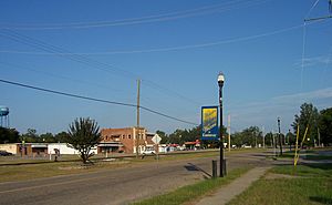
Main Street
|
|

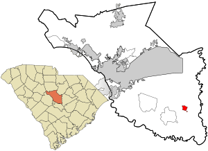
Location in Richland County and the state of South Carolina.
|
|
| Country | United States |
| State | South Carolina |
| County | Richland |
| Area | |
| • Total | 1.21 sq mi (3.15 km2) |
| • Land | 1.21 sq mi (3.15 km2) |
| • Water | 0.00 sq mi (0.00 km2) |
| Elevation | 190 ft (60 m) |
| Population
(2020)
|
|
| • Total | 614 |
| • Density | 505.77/sq mi (195.23/km2) |
| Time zone | UTC-5 (EST) |
| • Summer (DST) | UTC-4 (EDT) |
| ZIP code |
29044
|
| Area code(s) | 803, 839 |
| FIPS code | 45-22390 |
| GNIS feature ID | 1222202 |
| Website | http://www.eastoversc.com |
Eastover is a small town located in Richland County, South Carolina, in the United States. It's a part of the larger Columbia metropolitan area. In 2020, about 614 people lived here.
Contents
History of Eastover
Eastover has many important historical buildings and places. These sites are listed on the National Register of Historic Places. This means they are recognized as special places that are worth preserving.
Some of these historic spots include:
- The J.A. Byrd Mercantile Store
- The Farmers and Merchants Bank Building
- Good Hope Baptist Church
- Goodwill Plantation
- Kensington Plantation House
- St. Phillip School
- Saint Thomas' Protestant Episcopal Church
- Claudius Scott Cottage
- And the Siloam School
These places help tell the story of Eastover's past.
Geography and Location
Eastover is found at a specific point on the map: 33.877553 degrees North and -80.694592 degrees West. This helps pinpoint its exact location.
The town covers a total area of about 3.1 square kilometers (or 1.2 square miles). All of this area is land, with no large bodies of water within the town limits.
Population and People
The number of people living in Eastover has changed over the years. Here's how the population has grown and shrunk:
| Historical population | |||
|---|---|---|---|
| Census | Pop. | %± | |
| 1910 | 237 | — | |
| 1920 | 326 | 37.6% | |
| 1930 | 393 | 20.6% | |
| 1940 | 473 | 20.4% | |
| 1950 | 564 | 19.2% | |
| 1960 | 713 | 26.4% | |
| 1970 | 817 | 14.6% | |
| 1980 | 899 | 10.0% | |
| 1990 | 1,044 | 16.1% | |
| 2000 | 830 | −20.5% | |
| 2010 | 813 | −2.0% | |
| 2020 | 614 | −24.5% | |
| U.S. Decennial Census | |||
Who Lives in Eastover?
The 2020 United States census counted 614 people living in Eastover. These people made up 271 households and 153 families.
Here's a look at the different groups of people living in Eastover in 2020:
| Race | Number of People | Percentage |
|---|---|---|
| White (not Hispanic) | 18 | 2.93% |
| Black or African American (not Hispanic) | 563 | 91.69% |
| Asian | 4 | 0.65% |
| Other/Mixed | 19 | 3.09% |
| Hispanic or Latino | 10 | 1.63% |
Education in Eastover
Students in Eastover attend public schools managed by Richland County School District One.
- Webber Elementary School is located right in Eastover.
- After elementary school, students typically go to Southeast Middle School.
- For high school, students attend Lower Richland High School.
Interesting Places to Visit
Eastover is home to a few notable sites:
- McEntire Joint National Guard Base: This is a military base where the South Carolina Air National Guard has its main offices.
- Wateree Station: This is a large power plant operated by South Carolina Electric & Gas Company. It generates 700 megawatts of electricity using coal.
- Congaree National Park: South Carolina's only national park is just twelve miles southwest of Eastover. Eastover is the closest town to this beautiful park, known for its old-growth forests.
Famous People from Eastover
Some notable individuals have come from Eastover:
See also
 In Spanish: Eastover (Carolina del Sur) para niños
 | Frances Mary Albrier |
 | Whitney Young |
 | Muhammad Ali |

