
Calhoun County, South Carolina facts for kids
Quick facts for kids
Calhoun County
|
|||
|---|---|---|---|

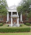
Calhoun County Courthouse and Confederate Monument
|
|||
|
|||
| Motto(s):
"In the Heart of South Carolina"
|
|||

Location within the U.S. state of South Carolina
|
|||
 South Carolina's location within the U.S. |
|||
| Country | |||
| State | |||
| Founded | 1908 | ||
| Named for | John C. Calhoun | ||
| Seat | St. Matthews | ||
| Largest community | St. Matthews | ||
| Area | |||
| • Total | 392.48 sq mi (1,016.5 km2) | ||
| • Land | 381.15 sq mi (987.2 km2) | ||
| • Water | 11.33 sq mi (29.3 km2) 2.89% | ||
| Population
(2020)
|
|||
| • Total | 14,119 | ||
| • Estimate
(2023)
|
14,186 | ||
| • Density | 37.04/sq mi (14.30/km2) | ||
| Time zone | UTC−5 (Eastern) | ||
| • Summer (DST) | UTC−4 (EDT) | ||
| Congressional district | 6th | ||

Calhoun County is a county located in the state of South Carolina. It's a place where about 14,000 people live. The main town, or county seat, is St. Matthews.
Calhoun County is one of the smallest counties in South Carolina. It was created in 1908 from parts of other counties. The county is named after John C. Calhoun, a very important person from South Carolina who was once the U.S. Vice-President.
This county is part of the larger Columbia, SC Metropolitan Area. It's known for its rural areas and has a mix of different communities.
Contents
History of Calhoun County
Calhoun County has a long history. The Congaree Tribe lived here many years ago. Maps from as early as 1715 show them in this region. You can still find old arrowheads and other items near lakes and rivers today.
During the American Revolutionary War, an important event called the Siege of Fort Motte happened here. You can still visit the Fort Motte Battle Site.
In 2011, a very large pile of old vehicle tires was found in Calhoun County. It was so big that some people said you could see it from space!
Geography and Nature
Calhoun County covers about 392 square miles. Most of this area is land, with a small part being water. It's the second-smallest county in South Carolina by land size.
The county is home to beautiful natural spots. These include Lake Marion and the Congaree Bluffs. You can explore the Congaree Bluffs at the Congaree Bluffs Heritage Preserve.
Calhoun County is also very close to Congaree National Park. This park is famous for being a large swamp with many old trees. It has amazing biodiversity, meaning many different kinds of plants and animals live there. Even though the park is not inside Calhoun County, the environment is very similar. The Congaree River forms the northern border of the county.
Protected Natural Areas
- Congaree Bluffs Heritage Preserve
Main Rivers and Lakes
- Big Beaver Creek
- Congaree River
- Four Hole Swamp
- Lake Marion
- Little Limestone Creek
Neighboring Counties
Calhoun County shares borders with these counties:
- Richland County (to the north)
- Sumter County (to the northeast)
- Clarendon County (to the east)
- Orangeburg County (to the south)
- Lexington County (to the northwest)
Major Roads
Several important highways pass through Calhoun County:
 I-26
I-26 US 21
US 21 US 176
 US 601
 SC 6
SC 6 SC 33
SC 33 SC 172
 SC 267
 SC 419
These roads are very important, especially during hurricanes. Sometimes, Interstate 26 (I-26) has special "lane reversals" to help people evacuate safely.
People of Calhoun County (Demographics)
| Historical population | |||
|---|---|---|---|
| Census | Pop. | %± | |
| 1910 | 16,634 | — | |
| 1920 | 18,384 | 10.5% | |
| 1930 | 16,707 | −9.1% | |
| 1940 | 16,229 | −2.9% | |
| 1950 | 14,753 | −9.1% | |
| 1960 | 12,256 | −16.9% | |
| 1970 | 10,780 | −12.0% | |
| 1980 | 12,206 | 13.2% | |
| 1990 | 12,753 | 4.5% | |
| 2000 | 15,185 | 19.1% | |
| 2010 | 15,175 | −0.1% | |
| 2020 | 14,119 | −7.0% | |
| 2023 (est.) | 14,186 | −6.5% | |
| U.S. Decennial Census 1790–1960 1900–1990 1990–2000 2010 2020 |
|||
In 2020, about 14,119 people lived in Calhoun County. The population has changed over the years, sometimes growing and sometimes shrinking.
Who Lives Here?
| Race | Num. | Perc. |
|---|---|---|
| White (non-Hispanic) | 7,783 | 55.12% |
| Black or African American (non-Hispanic) | 5,361 | 37.97% |
| Native American | 62 | 0.44% |
| Asian | 27 | 0.19% |
| Pacific Islander | 6 | 0.04% |
| Other/Mixed | 393 | 2.78% |
| Hispanic or Latino | 487 | 3.45% |
Most people in Calhoun County are White or Black/African American. There are also smaller groups of Native American, Asian, and Pacific Islander people. Some people identify as being of two or more races, or as Hispanic/Latino.
In 2017, the average age of people in Calhoun County was about 46 years old. Most people own their homes, and the average commute to work is about 27 minutes.
Economy and Jobs
Even though Calhoun County is mostly rural, it has several important factories and businesses. For example, Devro, a company from the UK, makes sausage casings here. Starbucks also has a coffee roasting facility in the county.
Other companies like DAK Americas, Zeus Industrial Products, and Thermo King Columbia, Inc. also have factories. Country Clear, Inc. bottles water in the same area.
The county has a special area called the Calhoun County I-26 Industrial Park. This park is designed to attract new businesses to the area.
In 2022, the total value of all goods and services produced in the county (called GDP) was about $790 million. The unemployment rate in Calhoun County usually stays low, between 2.7% and 4.3%. Some of the biggest employers in the county include Devro and Starbucks.
Towns and Communities
Towns
- Cameron
- St. Matthews (This is the county seat and the largest community.)
Unincorporated Communities
These are smaller communities that are not officially towns:
- Creston
- Fort Motte
- Lone Star
- Sandy Run
Images for kids
-
Calhoun County Courthouse and Confederate Monument
See also
 In Spanish: Condado de Calhoun (Carolina del Sur) para niños
