Lake Murray (South Carolina) facts for kids
Quick facts for kids Lake Murray |
|
|---|---|
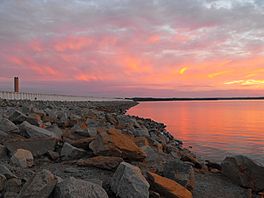
Lake Murray from the dam
|
|
| Location | Lexington / Newberry / Saluda / Richland counties, South Carolina, United States |
| Coordinates | 34°03′57″N 81°19′44″W / 34.065795°N 81.328968°W |
| Type | Reservoir |
| Primary inflows | Saluda River |
| Primary outflows | Saluda River |
| Basin countries | United States |
| Max. length | 41 mi (66 km) |
| Max. width | 14 mi (23 km) |
| Surface area | 50,000 acres (200 km2) |
| Max. depth | 189.6 ft (57.8 m) |
| Shore length1 | 650 mi (1,050 km) |
| Surface elevation | 360 ft (110 m) |
| 1 Shore length is not a well-defined measure. | |
Lake Murray is a huge reservoir (a man-made lake) in South Carolina, United States. It covers about 50,000 acres and has roughly 650 miles of shoreline. This amazing lake was created in the late 1920s. Its main purpose was to generate hydroelectricity, which is power made from moving water.
The Saluda River feeds Lake Murray. This river starts near the North Carolina border. The lake is named after William S. Murray, the chief engineer of the project. The dam that holds back the water, called the Saluda Dam (or Dreher Shoals Dam), was a marvel of engineering when it was finished in 1930. It was the largest earthen dam in the world at that time. The dam is about 1.5 miles long and 220 feet high. Lake Murray itself is 41 miles long and 14 miles wide at its widest point. When it was completed, it was the world's largest man-made lake!
Besides making electricity, Lake Murray is a popular spot for fun activities. People love to go fishing and boating here. Dreher Island State Recreation Area is also located on the lake. It offers many ways to enjoy the water and nature.
History of Lake Murray
Early Life Around the Saluda River
The Saluda River got its name from the Saluda Indian tribe. This tribe once lived along the riverbanks. Later, the Cherokee tribe moved into the area.
In the 1750s, German and Swiss families settled in the lower Saluda River valley. They formed communities like the Dutch Fork. By 1760, many families lived there. These German-speaking settlers kept their culture strong for many years. You can still see their family names in the area today.
During the American Revolutionary War, most people in the Dutch Fork supported the American side. The Saluda River was an important boundary. Ferries were used to move soldiers and supplies across the river. Some German soldiers, called Hessians, came to fight for the British. Many of them didn't want to fight and found new homes in German settlements like the Dutch Fork.
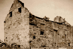
Life returned to normal after the war. But then came the American Civil War. Many local men joined volunteer groups to fight. By 1928, about 5,000 people lived in the Saluda River valley. There were churches, schools, and many graveyards in the area.
Building a Powerhouse: Hydroelectric Power
People had thought about using the Saluda River for power for a long time. As more electricity was needed in the Southern United States, building dams on big rivers became important.
In 1923, an engineer named William S. Murray saw the huge potential of the Saluda River. He imagined a massive project to create electricity. Murray planned a system of three dams. One would be on the Saluda River, which would become Lake Murray. This dam would keep water flowing to other dams downstream. His vision was much bigger than anyone had thought possible.
Getting the Land Ready
On July 8, 1927, the plan to build the dam and power plant was approved. The company quickly started buying the land needed for the lake. The lake and its edges would cover about 65,000 acres. To get this land, they had to buy about 100,000 acres in total.
Buying the land was a big job. They needed to purchase 1,100 pieces of land where about 5,000 people lived. Many properties had been passed down through families without official paperwork. This made the process even harder.
The project also meant moving three churches, six schools, and 193 graveyards. Over 2,300 graves were carefully moved. Most landowners worked with the company. Many moved to areas near the new lake and continued their lives.
Clearing the Way for the Lake
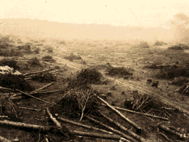
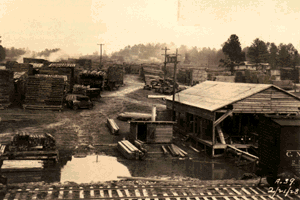
Work to clear the land for the lake began in April 1927. All the trees and plants up to the future high-water mark were removed. By the summer of 1928, 2,000 men were working. They used 37 sawmills to cut down trees. Much of the wood needed to build the dam came from this clearing work.
Camps were built for the thousands of workers. A small village was also created for the dam's future operators. A new railroad track was built to bring in building materials and equipment. This huge effort showed how important the project was.
Lake Murray in the 1940s
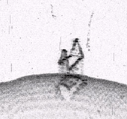
During the 1940s, several B-25 Mitchell bombers crashed into Lake Murray. These planes were flying from nearby Columbia for training during World War II. Some planes were recovered, but three remained lost for decades.
In September 2005, a B-25C Mitchell bomber that crashed in 1943 was finally brought up from the lake. A group called the Lake Murray B-25 Rescue Project led this effort. The plane's parts were moved to the Southern Museum of Flight in Birmingham, Alabama. There, it was preserved and put on display. This particular bomber had a rare machine-gun turret on its underside.
Geography of Lake Murray
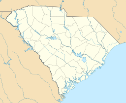
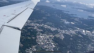
Lake Murray is in central South Carolina. It touches Lexington, Richland, Newberry, and Saluda counties. It's close to the town of Lexington, which is near Columbia, the state capital.
The lake has a unique, irregular shape with many coves. It also has several small islands. Some of these include the Jim Spence Islands, Shull Island, and the islands of Dreher Island State Park. One special island is Bomb Island, also known as Lunch Island. It's one of the biggest nesting spots for Purple Martins in the entire country!
Fun Things to Do at Lake Murray
Lake Murray is a fantastic place for outdoor activities. Boating, fishing, and swimming are very popular here.
Fishing at Lake Murray
Fishing is one of the most popular activities on Lake Murray. The lake is home to many different kinds of fish. Some popular ones to catch include Largemouth Bass, Striped Bass, Blue Catfish, and Crappie. There are several boat landings around the lake where you can launch your boat.
To fish in South Carolina, you need a valid fishing license. You can easily get one through the South Carolina Department of Natural Resources website.
Public Parks and Recreation
Lake Murray has several public parks. Dreher Island State Park is a great place to visit. It's located on three islands in the northwest part of the lake and offers many lake-related activities.
Near the Saluda Dam, north of Lexington, there's a walkway that goes across the dam. There are also recreational areas on both sides, including a public beach on the southern side.
Events and Gatherings
Lake Murray hosts exciting events every year. Spence Island, on the Lexington side, has concerts like Drift Jam in early June and Reggaetronic in mid-July. There are also amazing fireworks on the 4th of July. Many summer camps related to the lake are held here too.
See also
- List of lakes in South Carolina
- Lake Murray Country
 | William M. Jackson |
 | Juan E. Gilbert |
 | Neil deGrasse Tyson |


