
Saluda County, South Carolina facts for kids
Quick facts for kids
Saluda County
|
||
|---|---|---|
.jpg)
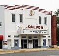
Saluda Theatre
|
||
|
||

Location within the U.S. state of South Carolina
|
||
 South Carolina's location within the U.S. |
||
| Country | ||
| State | ||
| Founded | 1895 | |
| Named for | Saluda River | |
| Seat | Saluda | |
| Largest community | Saluda | |
| Area | ||
| • Total | 461.64 sq mi (1,195.6 km2) | |
| • Land | 452.72 sq mi (1,172.5 km2) | |
| • Water | 8.92 sq mi (23.1 km2) 1.93% | |
| Population
(2020)
|
||
| • Total | 18,862 | |
| • Estimate
(2023)
|
19,123 | |
| • Density | 41.66/sq mi (16.09/km2) | |
| Time zone | UTC−5 (Eastern) | |
| • Summer (DST) | UTC−4 (EDT) | |
| Congressional district | 3rd | |

Saluda County is a county located in the state of South Carolina. In 2020, about 18,862 people lived here. The main town and center of the county is Saluda. This county was created from parts of Edgefield County.
Saluda County is also part of the larger Columbia, SC Metropolitan Statistical Area.
Contents
History of Saluda County
Saluda County was started in 1895. It was formed from parts of Edgefield County. The county got its name from the nearby Saluda River. The biggest town and the place where the county government is located is Saluda.
Geography of Saluda County
The U.S. Census Bureau says that Saluda County covers a total area of about 461.64 square miles. Most of this (452.72 square miles) is land, and a small part (8.92 square miles) is water. Saluda County is mostly in the area drained by the Saluda River. A small western part of the county is in the Savannah River area.
Protected Areas
- Sumter National Forest (part of it is in Saluda County)
Major Water Bodies
- Halfway Swamp Creek
- Lake Murray
- Saluda River
Neighboring Counties
Saluda County shares borders with these counties:
- Newberry County (to the north)
- Lexington County (to the east)
- Aiken County (to the south)
- Edgefield County (to the southwest)
- Greenwood County (to the northwest)
- McCormick County (to the west)
Main Roads
These are some of the important highways that go through Saluda County:
 US 1
US 1 US 178


US 178 Conn. US 378
 SC 23
SC 23 SC 39
SC 39 SC 121
 SC 193
 SC 194
 SC 391
 SC 395
 SC 702
Important Places
- Saluda County Airport
Population and People
| Historical population | |||
|---|---|---|---|
| Census | Pop. | %± | |
| 1900 | 18,966 | — | |
| 1910 | 20,943 | 10.4% | |
| 1920 | 22,088 | 5.5% | |
| 1930 | 18,148 | −17.8% | |
| 1940 | 17,192 | −5.3% | |
| 1950 | 15,924 | −7.4% | |
| 1960 | 14,554 | −8.6% | |
| 1970 | 14,528 | −0.2% | |
| 1980 | 16,150 | 11.2% | |
| 1990 | 16,357 | 1.3% | |
| 2000 | 19,181 | 17.3% | |
| 2010 | 19,875 | 3.6% | |
| 2020 | 18,862 | −5.1% | |
| 2023 (est.) | 19,123 | −3.8% | |
| U.S. Decennial Census 1790–1960 1900–1990 1990–2000 2010 2020 |
|||
2020 Census Information
The 2020 census counted 18,862 people living in Saluda County. There were 7,094 households and 5,132 families.
Here's a look at the different groups of people living in Saluda County in 2020:
| Race | Number of People | Percentage (%) |
|---|---|---|
| White (not Hispanic) | 11,264 | 59.72% |
| Black or African American (not Hispanic) | 4,028 | 21.36% |
| Native American | 44 | 0.23% |
| Asian | 35 | 0.19% |
| Other/Mixed | 479 | 2.54% |
| Hispanic or Latino | 3,012 | 15.97% |
2010 Census Information
In 2010, there were 19,875 people in the county. The population density was about 43.9 people per square mile.
- About 61.1% of the people were white.
- About 26.3% were Black or African American.
- About 14.4% of the population were of Hispanic or Latino background.
The average age of people in Saluda County was 39.6 years. The average income for a household was $40,508. About 15.1% of the people lived below the poverty line, which means they had less money than needed for basic living.
Economy
In 2022, the total value of all goods and services produced in Saluda County was about $572.2 million. This is known as the GDP.
As of April 2024, one of the biggest employers in the county is Food Lion.
Here's a look at jobs and wages in Saluda County in late 2023:
| Industry (Type of Business) | Number of Jobs | Percentage of Total Jobs (%) | Average Yearly Pay ($) |
|---|---|---|---|
| Hotels and Restaurants | 208 | 4.6 | 14,872 |
| Office Support and Waste Services | 42 | 0.9 | 37,076 |
| Farming, Forests, Fishing, and Hunting | 443 | 9.9 | 53,040 |
| Arts, Entertainment, and Fun | 62 | 1.4 | 26,208 |
| Building and Construction | 136 | 3.0 | 44,980 |
| Money and Insurance | 48 | 1.1 | 58,448 |
| Health Care and Social Help | 591 | 13.2 | 39,780 |
| Manufacturing (Making Goods) | 1,921 | 42.9 | 49,868 |
| Other Services (not Government) | 68 | 1.5 | 47,060 |
| Science and Technical Services | 107 | 2.4 | 47,892 |
| Public Administration (Government) | 336 | 7.5 | 44,044 |
| Real Estate and Rentals | 24 | 0.5 | 38,948 |
| Retail (Stores) | 295 | 6.6 | 28,652 |
| Transportation and Storage | 67 | 1.5 | 54,912 |
| Utilities (Power, Water, etc.) | 33 | 0.7 | 69,680 |
| Wholesale Trade | 96 | 2.1 | 52,572 |
| Total | 4,477 | 100.0% | 45,016 |
Communities in Saluda County
Towns
- Batesburg-Leesville (most of it is in Lexington County)
- Monetta (most of it is in Aiken County)
- Ridge Spring
- Saluda (This is the county seat and the biggest town.)
- Ward
Unincorporated Communities
These are places that are not officially towns:
- Mount Willing
Education in Saluda County
Schools in Saluda County are part of these school districts:
- Saluda County School District
- Aiken County School District
- Lexington School District 3
Famous Person from Saluda County
- William B. Travis: He was a Texas lieutenant colonel who led the defense during the Battle of the Alamo.
Images for kids
-
Saluda Theatre
-

Saluda County Seal
See also
 In Spanish: Condado de Saluda para niños
