Savannah River facts for kids
Quick facts for kids Savannah River |
|
|---|---|

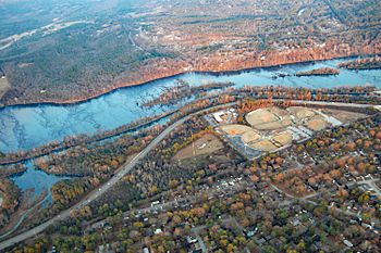
Savannah River at Augusta, with the Augusta Canal running alongside
|
|

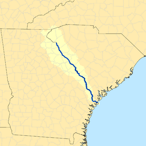
Map of the Savannah River watershed
|
|
| Other name(s) | Tugaloo River |
| Country | United States |
| State | North Carolina, South Carolina, Georgia |
| Cities | Savannah, Augusta |
| Physical characteristics | |
| Main source | Lake Hartwell 655 ft (200 m) 34°26′37″N 82°51′22″W / 34.44361°N 82.85611°W |
| River mouth | Atlantic Ocean Tybee Roads 0 ft (0 m) 32°2′16″N 80°51′0″W / 32.03778°N 80.85000°W |
| Length | 301 mi (484 km) |
| Depth |
|
| Basin features | |
| Basin size | 9,850 sq mi (25,500 km2) |
| Tributaries |
|
The Savannah River is a very important river in the southeastern United States. It forms most of the natural border between the states of South Carolina and Georgia. The area where the Savannah River collects its water, called its drainage basin, reaches into North Carolina. This area is bordered by the Continental Divide, which separates water flowing to the Atlantic from water flowing elsewhere.
The Savannah River starts where the Tugaloo River and the Seneca River meet. Today, this meeting point is covered by Lake Hartwell, a large lake made by people. From Lake Hartwell to the Atlantic Ocean, the Savannah River is about 313 miles (504 km) long.
Two big cities are found along the Savannah River: Savannah and Augusta, both in Georgia. These cities were important centers for early English settlements during the time of the Thirteen Colonies.
How the River Flows to the Ocean
Near the city of Savannah, the river's water level changes with the ocean's tides. After Savannah, the river gets wider and turns into an estuary. An estuary is where a river meets the sea, and fresh water mixes with salt water.
Finally, the Savannah River flows into the Atlantic Ocean. The place where the river's estuary meets the ocean is known as "Tybee Roads." The Intracoastal Waterway, a path for boats along the coast, also goes through a part of the Savannah River near Savannah.
Images for kids
-
Talmadge Memorial Bridge over the Savannah River in Savannah
See also
 In Spanish: Río Savannah para niños
 | DeHart Hubbard |
 | Wilma Rudolph |
 | Jesse Owens |
 | Jackie Joyner-Kersee |
 | Major Taylor |


