Georgetown, Luzerne County, Pennsylvania facts for kids
Quick facts for kids
Georgetown, Pennsylvania
|
|
|---|---|

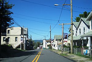
Northbound Northampton Street
|
|
| Country | United States |
| State | Pennsylvania |
| County | Luzerne |
| Township | Wilkes-Barre |
| Area | |
| • Total | 0.7 sq mi (1.9 km2) |
| • Land | 0.7 sq mi (1.9 km2) |
| • Water | 0 sq mi (0 km2) |
| Population
(2010)
|
|
| • Total | 1,640 |
| • Density | 2,240/sq mi (863/km2) |
| Time zone | UTC-5 (Eastern (EST)) |
| • Summer (DST) | UTC-4 (EDT) |
| ZIP code |
18702
|
| Area code(s) | 570 |
Georgetown is a community in Wilkes-Barre Township, Luzerne County, Pennsylvania, United States. It is right next to the city of Wilkes-Barre. Georgetown is known as a census-designated place (CDP). This means it is an area that the U.S. Census Bureau defines for gathering statistics. In 2010, about 1,640 people lived in Georgetown.
Contents
Georgetown's Location and Size
Georgetown is found at these coordinates: 41°13′35″N 75°52′19″W. It is a relatively small area.
Land Area of Georgetown
According to the United States Census Bureau, Georgetown covers a total area of 1.9 square kilometers (about 0.73 square miles). All of this area is land. There are no large bodies of water within the CDP.
Roads and Nearby Cities
Georgetown takes up most of the southwestern part of Wilkes-Barre Township. A major highway, I-81, runs through the community. PA 309 also passes through Georgetown.
You can find Exit 165 of I-81 at the southwestern edge of the CDP. The city of Wilkes-Barre is located to the northwest of Georgetown.
Population of Georgetown
The population of Georgetown was last officially counted in 2010. At that time, 1,640 people called Georgetown home. This number helps us understand the size of the community.
What is a Census-Designated Place?
A census-designated place, or CDP, is a special kind of area. It is identified by the U.S. Census Bureau. CDPs are like towns or communities that don't have their own separate local government. They are created just for statistical purposes. This helps the government collect and share information about populations in specific areas.
See also

- In Spanish: Georgetown (condado de Luzerne) para niños
 | Audre Lorde |
 | John Berry Meachum |
 | Ferdinand Lee Barnett |


