Georgetown, Illinois facts for kids
Quick facts for kids
Georgetown, Illinois
|
||
|---|---|---|
|
City
|
||
 |
||
|
||

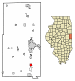
Location of Georgetown in Vermilion County, Illinois.
|
||
| Country | United States | |
| State | Illinois | |
| County | Vermilion County | |
| Township | Georgetown Township | |
| Founded | 1826 | |
| Area | ||
| • Total | 1.62 sq mi (4.19 km2) | |
| • Land | 1.62 sq mi (4.19 km2) | |
| • Water | 0.00 sq mi (0.00 km2) 0% | |
| Elevation | 653 ft (199 m) | |
| Population
(2020)
|
||
| • Total | 3,143 | |
| • Density | 1,944.93/sq mi (750.98/km2) | |
| Time zone | UTC-6 (CST) | |
| • Summer (DST) | UTC-5 (CDT) | |
| ZIP code |
61846
|
|
| Area code(s) | 217 | |
| FIPS code | 17-28963 | |
| GNIS ID | 2394882 | |
| Website | https://georgetownil.net/ | |
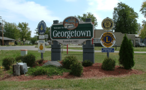
Georgetown is a city in Vermilion County, Illinois, United States. It is located in the eastern part of Illinois. In 2020, about 3,143 people lived there. Georgetown is part of the larger Danville, Illinois area.
Contents
History of Georgetown
Georgetown was officially started in 1826. A man named James Haworth planned the town. However, the very first home was built earlier, in 1820, by Henry Johnson.
People think the town might have been named after George Beckwith. This is because a nearby town, Danville, was named after Dan Beckwith. Another idea is that it was named after James Haworth's son, George. The first post office opened in Georgetown in 1828.
Transportation improved over time. A railroad connecting Paris and Danville was built in 1871. After 1900, an "Interurban" train began carrying passengers. This train traveled between Georgetown and Danville.
Geographic Location
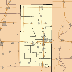
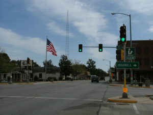
Georgetown is found in Illinois. It is about 13 miles (21 km) south of Danville. Danville is the main city of Vermilion County. Georgetown is located on Illinois Route 1 and U.S. Route 150.
According to information from 2010, Georgetown covers a total area of about 0.14 square miles (0.36 square kilometers). All of this area is land.
Population Changes
The number of people living in Georgetown has changed over the years.
| Historical population | |||
|---|---|---|---|
| Census | Pop. | %± | |
| 1880 | 741 | — | |
| 1890 | 662 | −10.7% | |
| 1900 | 988 | 49.2% | |
| 1910 | 2,307 | 133.5% | |
| 1920 | 3,061 | 32.7% | |
| 1930 | 3,407 | 11.3% | |
| 1940 | 3,235 | −5.0% | |
| 1950 | 3,294 | 1.8% | |
| 1960 | 3,544 | 7.6% | |
| 1970 | 3,984 | 12.4% | |
| 1980 | 4,220 | 5.9% | |
| 1990 | 3,678 | −12.8% | |
| 2000 | 3,628 | −1.4% | |
| 2010 | 3,474 | −4.2% | |
| 2020 | 3,143 | −9.5% | |
| U.S. Decennial Census | |||
In 2000, there were 3,628 people living in Georgetown. About 34.4% of homes had children under 18. Many homes were made up of married couples. Some homes had a female head of household without a husband. About 28.6% of all homes were single individuals.
The population included people of different ages. About 27.9% were under 18 years old. About 16.0% were 65 years or older. The average age in the city was 36 years.
Education in Georgetown
Georgetown has several schools for students.
- Georgetown Ridge Farm High School is located in Georgetown.
- Mary Miller Junior High is also in Georgetown.
- Pine Crest Elementary serves younger students in the city.
- Notre Dame De La Salette Boys Academy is a special boarding school. It is for boys and follows traditional Catholic teachings.
Transportation Options
Getting around Georgetown and to nearby areas is possible with public transport. Danville Mass Transit offers bus service. Route 9 connects Georgetown to downtown Danville. This bus route also goes to other places.
See also
 In Spanish: Georgetown (condado de Vermilion, Illinois) para niños


